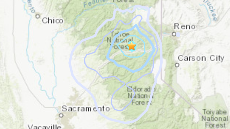
TRUCKEE, Calif. — Some Northern Californians might have felt some shaking this morning. That's because a 3.6 magnitude earthquake hit northwest of Truckee just before 1:30 a.m. on Wednesday, June 23.
According to the United States Geological Survey (USGS), the earthquake had an epicenter near Buzzard Roost in the Tahoe National Forest, which was about 12 miles northwest of Cisco Grove, six miles north of Soda Springs and 30 miles south of Sierraville.
The USGS also says the earthquake was about 72 miles northeast of Roseville, but there have not been any reports of people feeling any shaking in the area.
A map of where the earthquake was likely felt can be found HERE.
ALL ABOUT EARTHQUAKE PREP:
- What you need to know about ShakeAlert, the earthquake warning system | Earthquake Ready or Not
- What can happen to our power grids after an earthquake? | Earthquake Ready or Not
- Why a disaster kit will help you survive the next big one | Earthquake Ready or Not
- What you need to know about the San Andreas fault | Earthquake Ready or Not
- The science of forecasting earthquakes | Earthquake Ready or Not
- How vulnerable is California to tsunamis? | Earthquake Ready or Not
WATCH MORE: Earthquakes come without warning and if you aren’t prepared by the time the big one hits, you will be too late. The 2019 earthquake near Ridgecrest, California, shined a spotlight on the need to be prepared with a disaster kit and a plan. A little work now could help you survive the next quake.


