
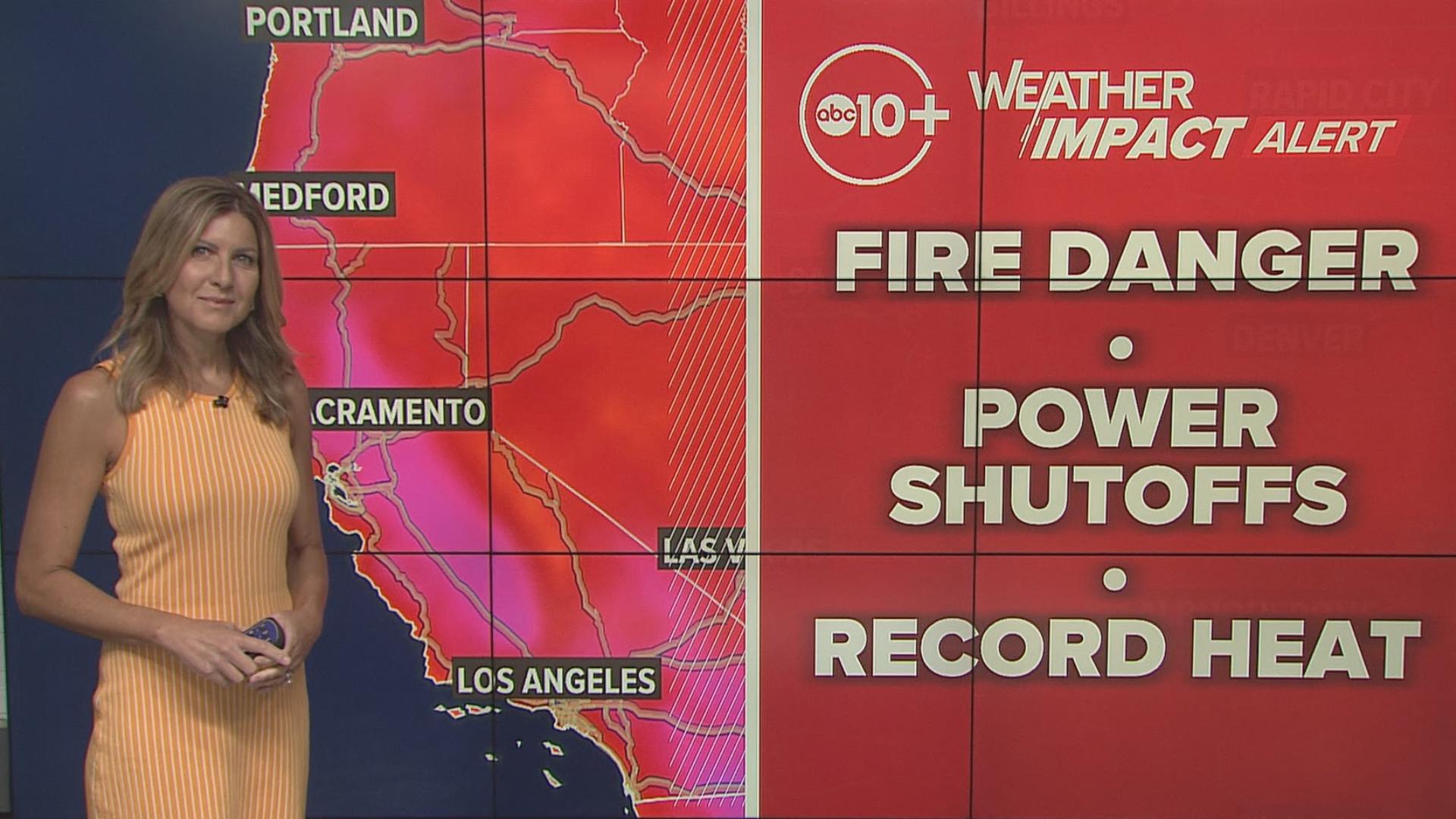
SACRAMENTO, Calif. — A hot weekend gets even hotter during the workweek. High pressure will sit overhead Monday, Tuesday and Wednesday, making for a very summer-like start to October.
Valley high temps on Monday will be in the middle to upper 90s, but Tuesday and Wednesday will see highs near or above the century mark for much of the valley. These temperatures are 10 to 15 degrees above average for this time of year.

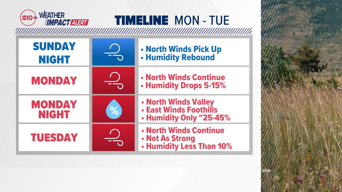
In addition to the abnormally warm temperatures, northerly winds are forecast Monday and Tuesday for the Sacramento Valley, and that means high fire danger.
Northerly wind gusts of up to 30 mph will be possible. Winds begin to pick up overnight Sunday into Monday, with the strongest winds likely in the first half of the day. However, northerly winds will continue with varying intensity through Tuesday.
Overnight Monday into Tuesday, we'll also be looking at easterly downsloping winds in the Sierra foothills which could lead to periods of elevated fire danger.
North winds are dry winds, and humidity across Northern California will take a tumble starting Monday. By Monday afternoon, relative humidity across the valley will be in the 10-20% range. The lack of a Delta Breeze and continued northerly winds overnight Monday into Tuesday means poor overnight recovery. Relative humidity values will only come back to about 40% at best.

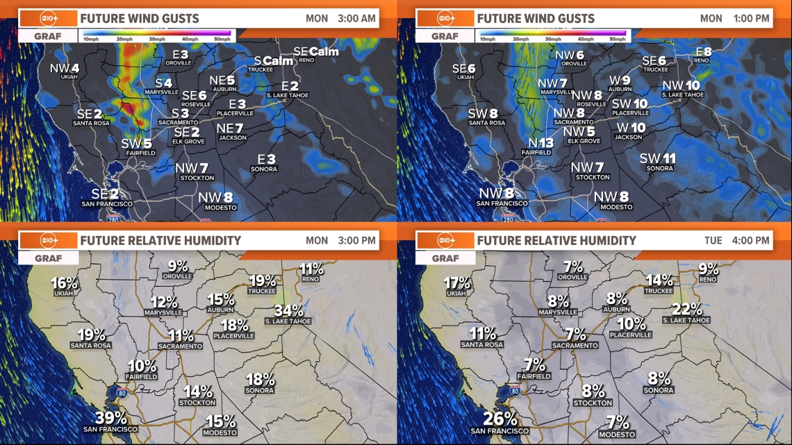
By Tuesday afternoon, even as the winds start to wane, humidity will be at its lowest point with widespread single digit relative humidity values in the valley, foothills and Delta. This means continued high to critical fire danger in the valley through Tuesday.
Afternoon temps will be near 100°, exacerbating the fire danger.
Because of the fire danger, public safety power shutoffs (PSPS) are possible.
PG&E is alerting of possible PSPS for Monday and Tuesday for parts of Northern California including the Sacramento Valley, North Coast, Delta and Bay Area.
The strongest north winds will be along and west of Interstate 5 in the Sacramento Valley and extending down into the Delta.

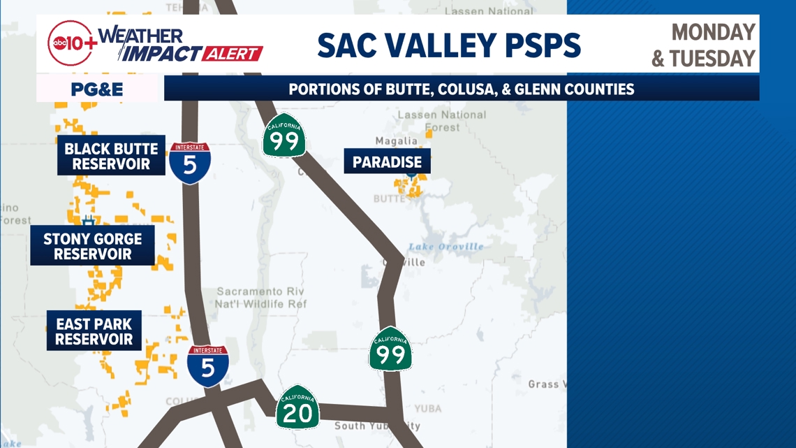
The map above is not encompassing. More PSPS outages are expected closer to Redding and Shasta, in Humboldt and Trinity counties, as well as the North Bay and East Bay. The most up-to-date map from PG&E's can be found at their website HERE.
This is a good reminder that fire season is not over. We can and have seen large and destructive wildfires in Northern California in the fall season. Keep that go-bag packed and make sure YOU'RE ready. Any fires that start could get established and grow quickly.


