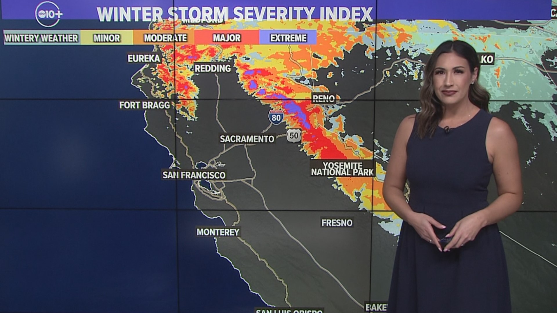
SACRAMENTO, Calif — The most impactful storm of the winter in the Sierra is on the way.
A very cold system, ushered in by the polar branch of the jet stream, will drop into Northern California on Thursday from the Gulf of Alaska.
This system has all the makings of an extreme event, including nearly constant snowfall in the Sierra beginning Thursday and lasting through the weekend. It's due to a robust, stalled out trough of low pressure that will deliver strong onshore flow into the region and a process known as orographic uplift, which will help boost precipitation totals. Orographic uplift occurs when air is forced to rise over mountainous terrain, increasing precipitation amounts.
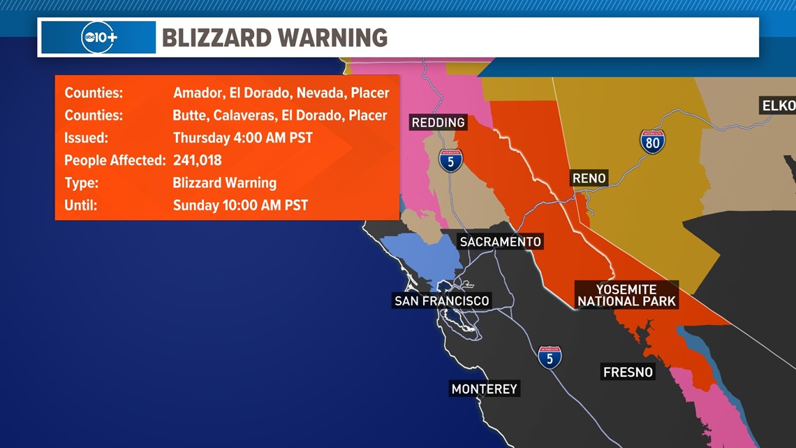
A Blizzard Warning is in effect for the Sierra beginning at 4 a.m. Thursday through 10 a.m. Sunday.
This is only the eighth Blizzard Warning issued by the Sacramento National Weather service office since 2008.

Snow is expected to begin in the northern Sierra around 10 a.m., pushing south throughout the day. Snow levels initially will be in the 5,000-6,000 foot range but will steadily drop. Nearly nonstop snowfall is expected from Thursday afternoon to Sunday morning with the heaviest occurring on Friday afternoon through Saturday morning.
Friday is being categorized as an extreme impact day due to snow rates of 2-4" and gusts upwards of 60 mph. Moderate to heavy rain will be falling in areas below the snow line which is expected to be in the 2,000-4,000 foot range on Friday. Saturday will be another extreme impact day as the snow continues to pile up in the Sierra.
By Sunday morning, the snow will be slowing down, but snow showers are expected through Monday.
This system will be much more impactful in the Sierra than the valley. Travel across the Sierra will be extremely difficult if not impossible and is highly discouraged beginning Thursday afternoon due to whiteout conditions.
In total, locations above 5,000 feet are expected to receive 5 to 10-plus feet of snow and 1-4 feet are expected above 3,000 feet. Light accumulations are expected as low as 2,000 feet.
In the valley, 0.5-1.5" of rain is expected along with periods of strong winds of 35-45 mph. Rain is expected to arrive in the valley before noon north of Interstate 80, but to the south, the rain will begin to pick up in the afternoon.
The heaviest rain will also be during the Friday night through early Saturday morning timeframe. Rain totals will be higher in the eastern valley toward the foothills.
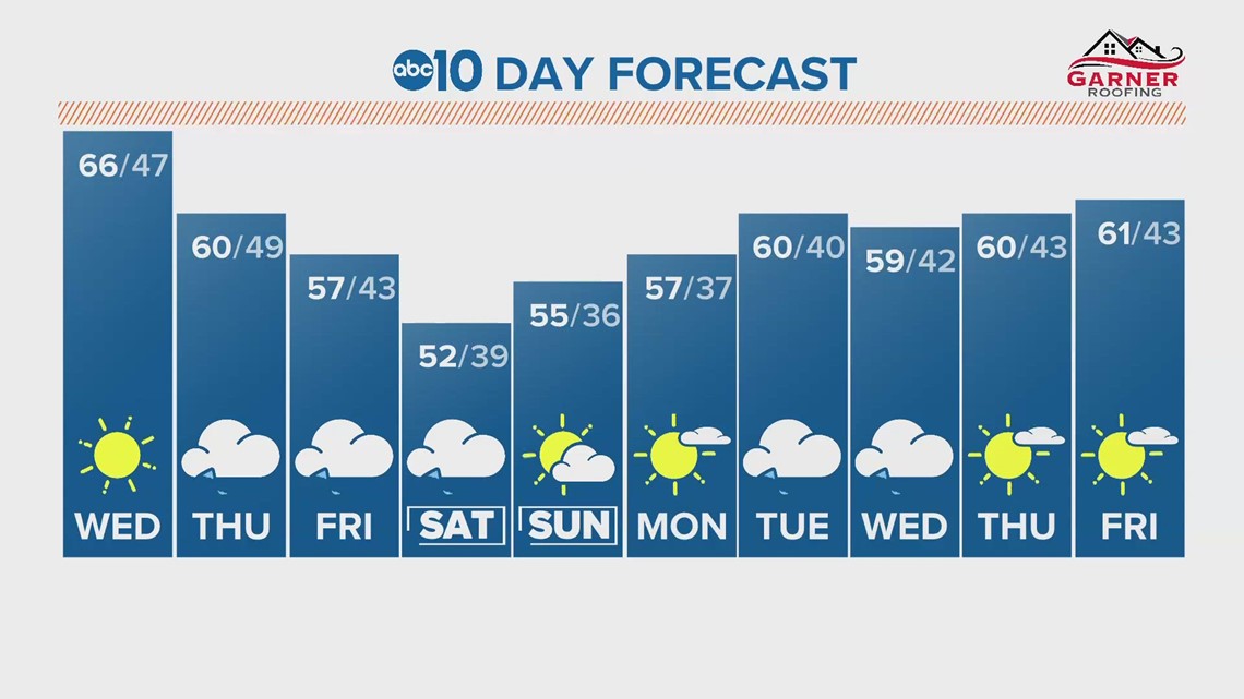
Temperatures will take a deep dive from Wednesday to Thursday and will continue to drop through the weekend. By Saturday, temperatures will be in the low 50s in the valley and 20s in the Sierra.

WATCH ALSO:

