
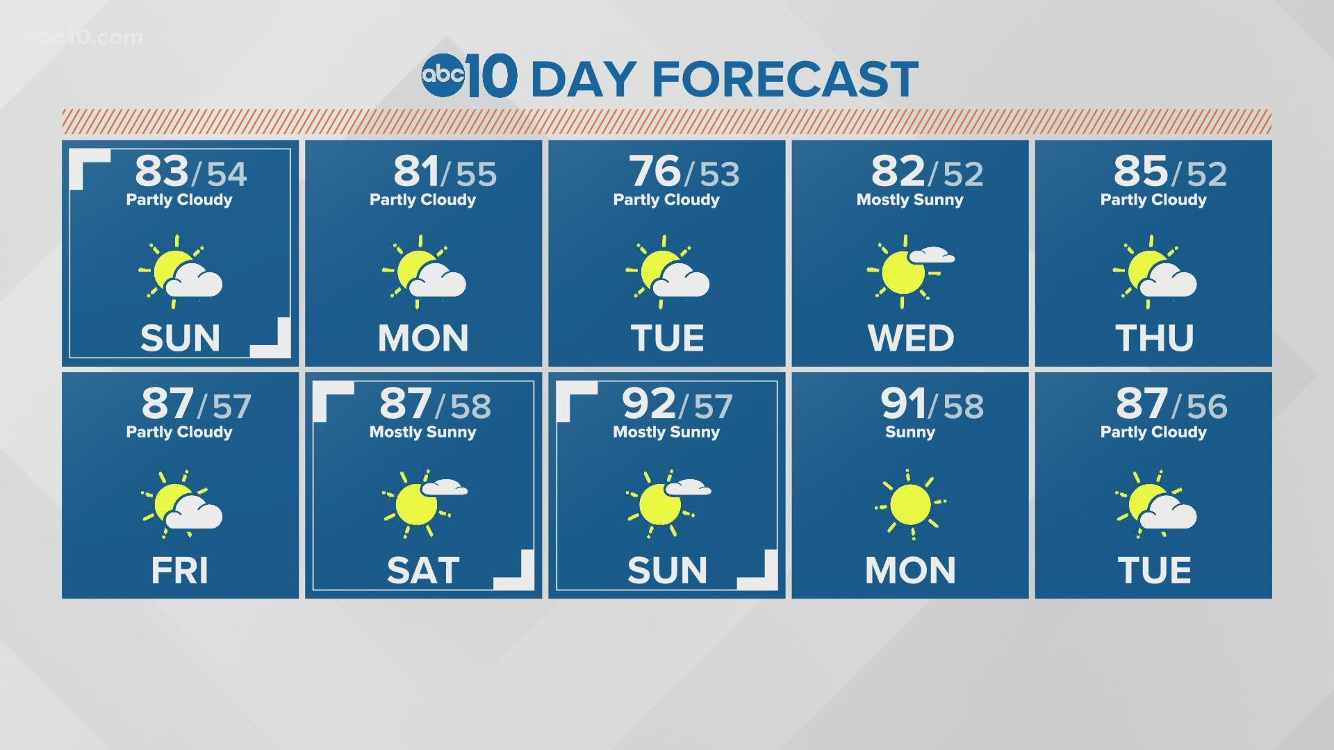
CALIFORNIA, USA — Many people are enjoying the cooler weather after some hot early days in fall.
Sunday most areas will see highs in the low 80s with some breezy conditions.
Monday will see a front push-through that is mostly dry. Wind will start to pick up Monday morning for the high Sierra to the Eastside. Currently, there is a Fire Weather Watch for this area from the Sierra Crest and east side into Nevada. This is issued ahead of a Red Flag Morning. It begins Monday morning to 10 p.m. on Monday evening.

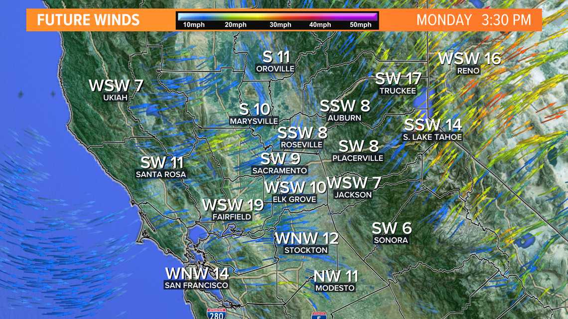
Monday afternoon wind will gust from 35-40mph over the crest of the Sierra and remain dry and windy on the East side including the Tahoe Basin
Most of the early moments of this cold front will be dry. This increases the fire risk until later in the evening and very early Tuesday some rain is possible.


Rain chances remain mostly North of I-80 in the higher terrain of the Coastal Range and Sierra. Rain totals should be light.


