SACRAMENTO, Calif — Daily record high temperatures are possible this week as the first heat wave of the season arrives in Northern California.
A strong ridge of high pressure will move over the West Coast by Tuesday, replacing the influence of low pressure Monday. Cloud cover and winds blowing in from the coast will change to sunny skies and winds blowing from the north Tuesday.
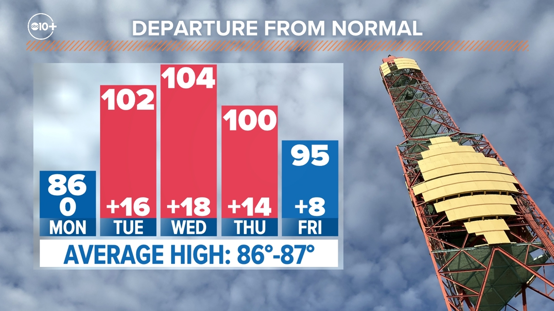
High temperatures Monday will be right around average for this time of year. The average high in Sacramento on June 3 is 86 degrees and the high temperature is forecast to be just that.
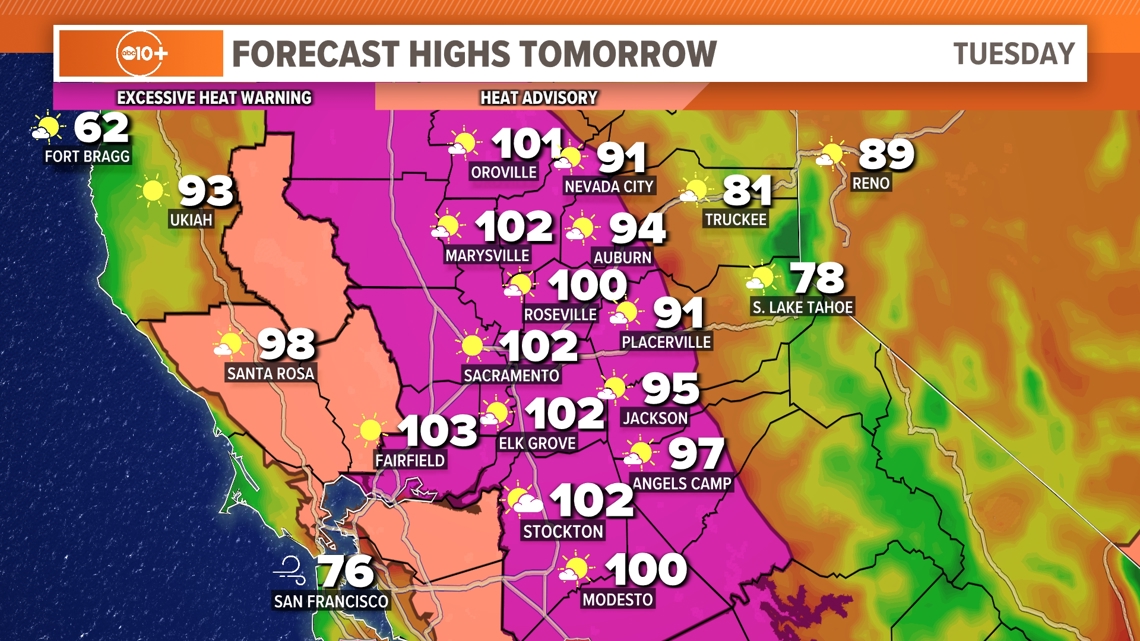
Temperatures across Northern California Tuesday will be 10-20 degrees warmer than Monday. It will also be windy Tuesday thanks to the pattern change and as a result fire risk will be elevated.


Wednesday is forecast to be the hottest day of the week and year so far.
Temperatures this hot aren’t rare this time of year, but the first heat wave of the year is still particularly dangerous, especially considering the single day jump in high temperatures from Monday to Tuesday. The warm overnight lows will also raise the risk of heat illness.


Based on data from 1990-2023, downtown Sacramento averages 23 100+ degree days a year, so it is safe to say there is plenty more heat of this caliber on the way in the coming weeks and months.
An Excessive Heat Warning is in effect beginning Tuesday and lasting through Thursday.
NWS Sacramento lists the following impacts and precautions for staying safe in the heat:
- Major risk of heat stress or illnesses, especially anyone without effective cooling or hydration
- Stay hydrated
- Avoid being outdoors in the sun 10 a.m. to 6 p.m.
- Stay in a cool place especially during the heat of the day
- Use caution around area waterways which are running fast and cold due to snowmelt

