SACRAMENTO, California —
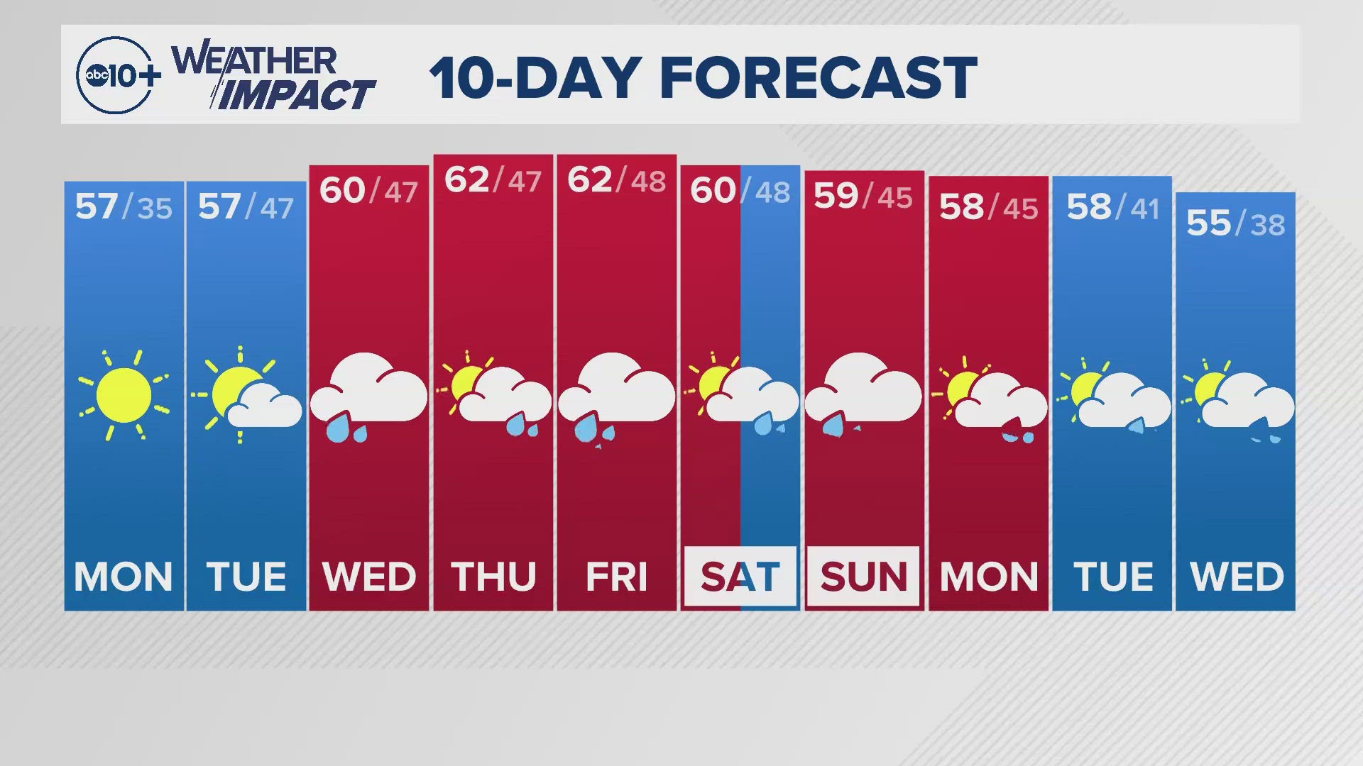
Northern California’s mild weather in the past week will continue through this weekend thanks to low pressure along the entirety of the West Coast.
Before the weekend arrives, Northern California will have to contend with poor air quality thanks to north winds blowing smoke into the region, along with a Red Flag Warning thanks to those north winds and low humidities.
Although it will still appear a bit hazy Friday, a shift in the wind will help to improve air quality by this weekend and air quality index values will be returned to “good” levels, according to Yolo-Solano Air Quality Management District.
Temperatures will continue to be below average through this weekend and beyond. Forecast highs in the Central Valley will be around 80 through Sunday before the pattern shift kicks off Monday, bringing even cooler temperatures. Sierra temperatures will only be in the 50s and 60s, depending on elevation.

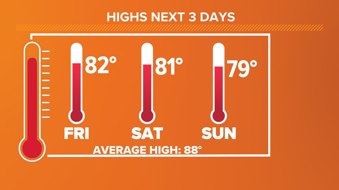
For some context on how nice this stretch of weather is, the first weekend of fall last year featured high temperatures in the mid to upper 90s and the average high in Sacramento for this time of year is 88.
Low temperatures will also be on the cool side this weekend, dipping into the lower 50s across the valley and into the upper 20s and 30s in the Sierra.
This weekend will be dry across Northern California, even in the Sierra where thunderstorms have been popping all week. However, the same can’t be said for early next week, as the first atmospheric river event is aimed toward the Northern California coast.
There is still much uncertainty in the strength, position and timing of the first atmospheric event of the year for Northern California. The storm will bring heavy rain to far Northern California, especially where the fires have been burning.

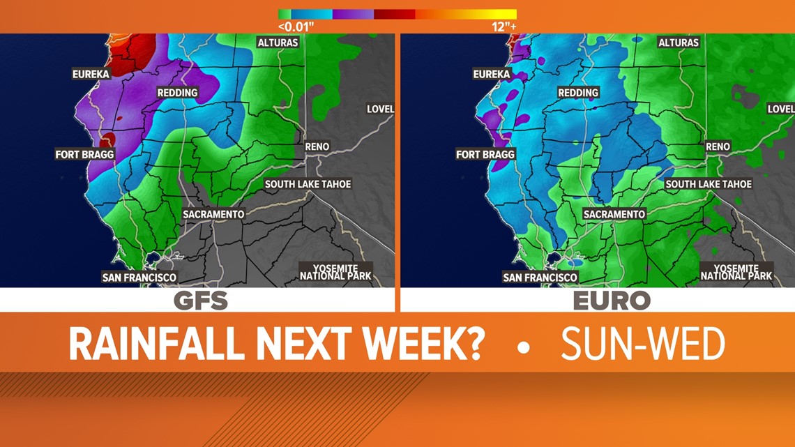
In the Central Valley, cloud cover will start to build in by Sunday afternoon ahead of the initial band of rain associated with the system.
Little to no rain is expected in the greater Sacramento area and south, although the European model favors around 0.25” of rain in the Sacramento area. Still, expect the brunt of the storm to hit areas north of Sacramento, with totals increasing the closer you get to the Oregon border.
In Southern Oregon, the storm is currently forecast to be a category 5 atmospheric river event and even though it will weaken as it heads south, it will still bring beneficial rain to much of Northern California.
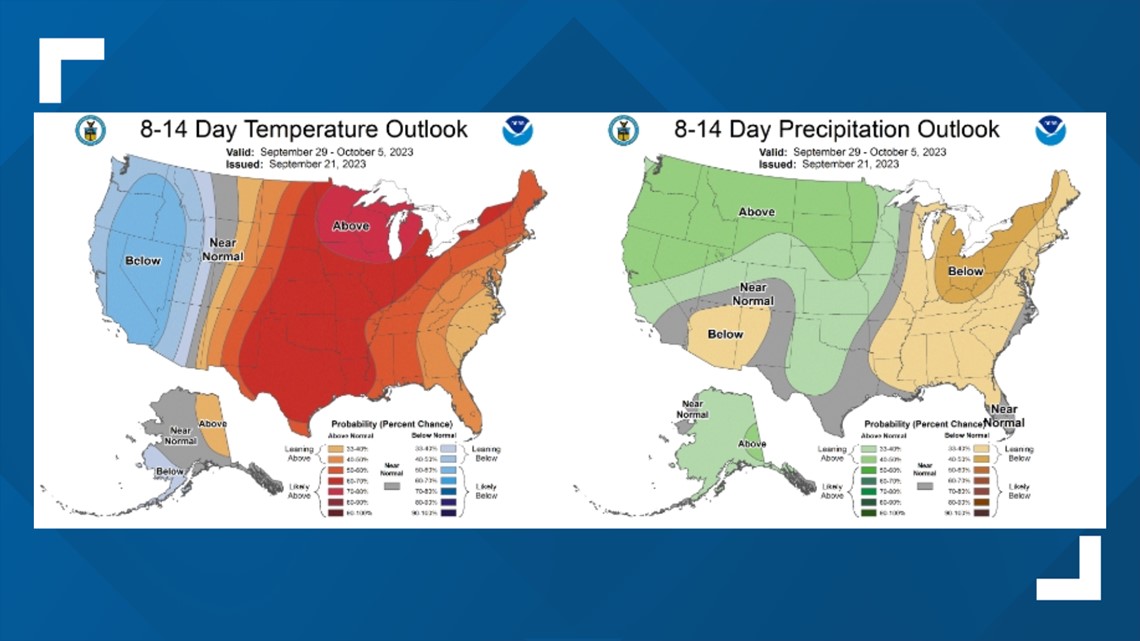
Cooler than average and potentially wet weather is favored for the next two weeks, according to the Climate Prediction Center.

WATCH ALSO: What are the purple rocks on I-5 in Sacramento?