SACRAMENTO, Calif. — A big blast of cold air brought Sierra snow and a big drop in temperatures Monday night and into Tuesday morning. On Sunday night, winds helped keep overnight lows from getting too cold by not allowing too much warm air to escape into the night sky.
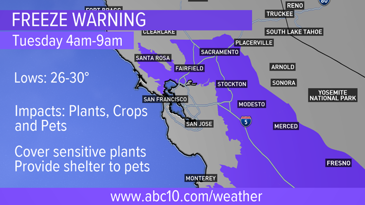
Those winds are expected to decrease slightly overnight Monday into Tuesday leading to very cold temperatures from 4 a.m. to 9 a.m. forcing a freeze warning to go into effect.
The warning includes the southern Sacramento Valley, San Joaquin Valley and parts of the San Francisco Bay Area.
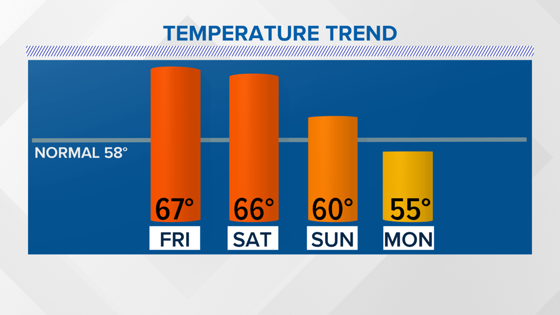
Below are high temperatures for Sacramento Executive Airport reporting station over the last four days.

READ MORE:
Lows are expected to fall into the 20s and low 30s for several hours. This could harm sensitive plants and crops. It's also best to provide shelter to pets with this cold weather.
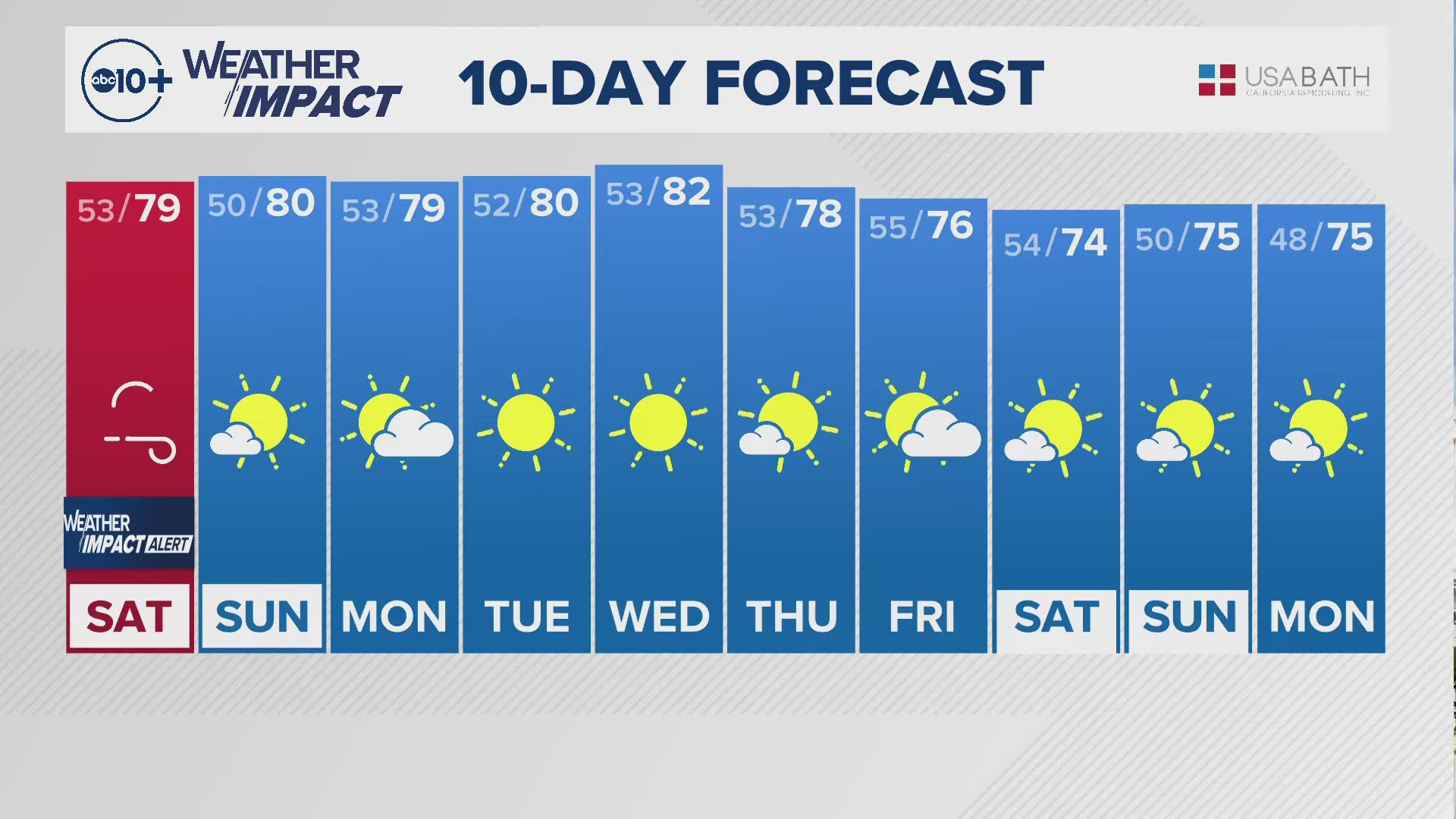
Slightly warmer weather is ahead for Wednesday morning but lows will still be near freezing.
A warming trend will begin by the middle of the week with highs back to the mid 60s and lows near 40 degrees by Friday.
Follow the conversation on Facebook with Monica Woods.
RAIN OR SHINE? GET THE LATEST FORECAST IN YOUR NEIGHBORHOOD BY DOWNLOADING THE ABC10 APP:


►Get the forecast in your email! Sign up now for ABC10's Daily Blend Newsletter