SACRAMENTO, Calif. — The last week of January proved to be a stormy one.
Heavy Valley rain, Sierra snow, and a lot of destruction was seen across Northern California. As we move into the first week of February, another storm system is on our heels, but not quite as impactful.
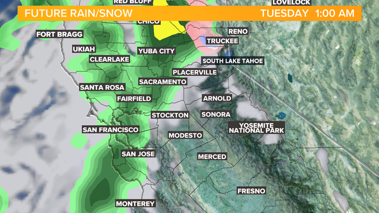
The week kicked off with sunshine and a few clouds before rain arrives closer to midnight, that's when the fun begins.
As the storm rolled in overnight, Tuesday morning was soggy. The major difference between last week and this week's storm is this week’s storm does not include an atmospheric river, which provided almost limitless moisture to the storm as it passes through. This brought in the multiple feet of snow for the Sierra and inches of rain to the Valley.
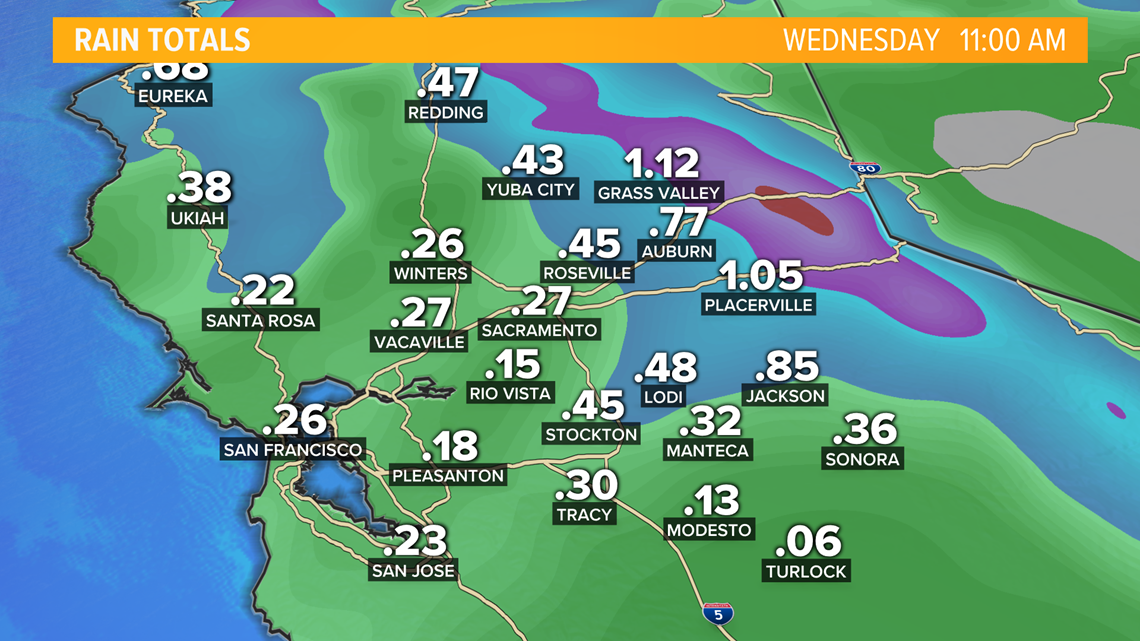
This week, the low pressure in the Pacific Northwest will pull a cold front through Northern California which is expected to bring inch of rain in the Valley and as much as two inches of rain into the Foothills.


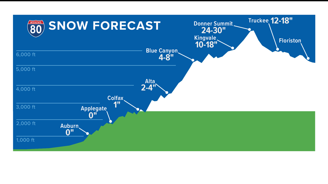
Due to warmer air with Tuesday’s storm system, the snow level is expected to be much higher, with up to two feet of snow possible above 6,000 feet in elevation.


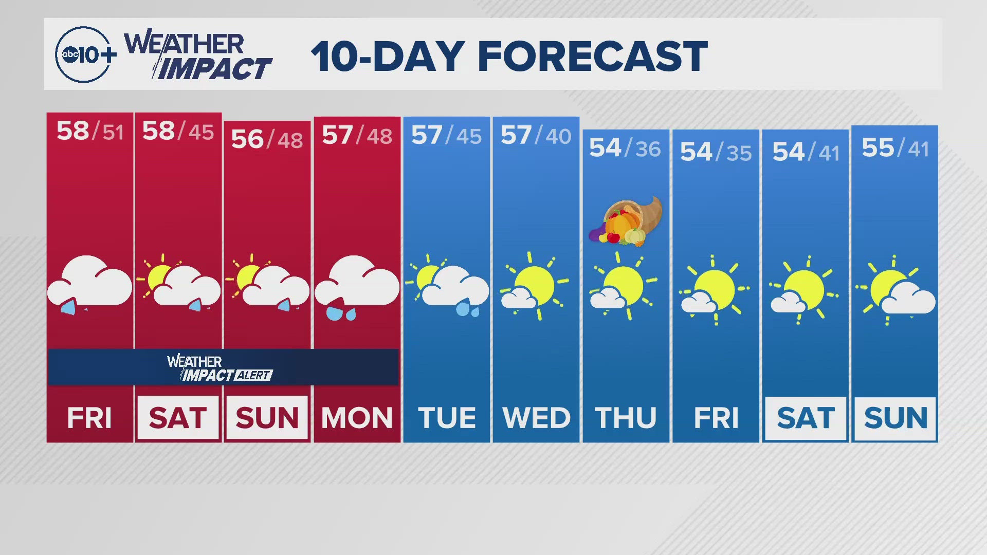
A Winter Storm Warning begins at 7 p.m. Monday, and lasts until 6 a.m. Wednesday. After Tuesday, more sunshine and above average temperatures are expected for the following week.


