SACRAMENTO, Calif. — The storm train rolls on as a potentially dangerous flood situation could develop in the coming days. Another atmospheric river fueled cyclone is barreling towards California and this one is supplied by an abundance of moisture.
Instability in the atmosphere also means a few thunderstorms will be possible through Sunday, along with some isolated showers as well. Sunday will be mainly dry, however, making it a good preparation day ahead of what is expected to be the most impactful of the recent storms.
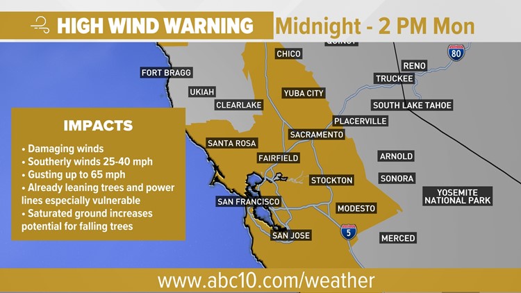
Another wind event will accompany the rain as the storm moves onshore following the 60 mph gusts that knocked out power to more than 300,000 households in the Sacramento area Saturday night. While gusts likely won't be on the same magnitude as Saturday night, which was enhanced thanks to a collection of unique meteorological scenarios, they will still range from 45-65 mph.
Expect winds to peak overnight between the hours of 2-6 a.m. The National Weather Service issued a high wind warning starting at midnight and running through 2 p.m. Monday.
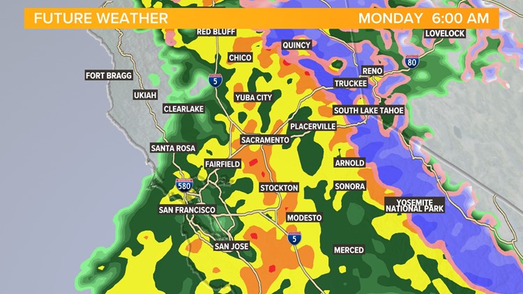
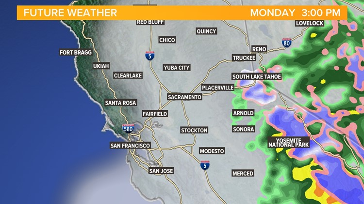
The rain will begin in Sacramento at around 10 p.m. Sunday and will likely continue, uninterrupted, through noon Monday. Monday afternoon, apart from a few isolated showers, is expected to supply a break on the rain before more moves in overnight and into Tuesday.
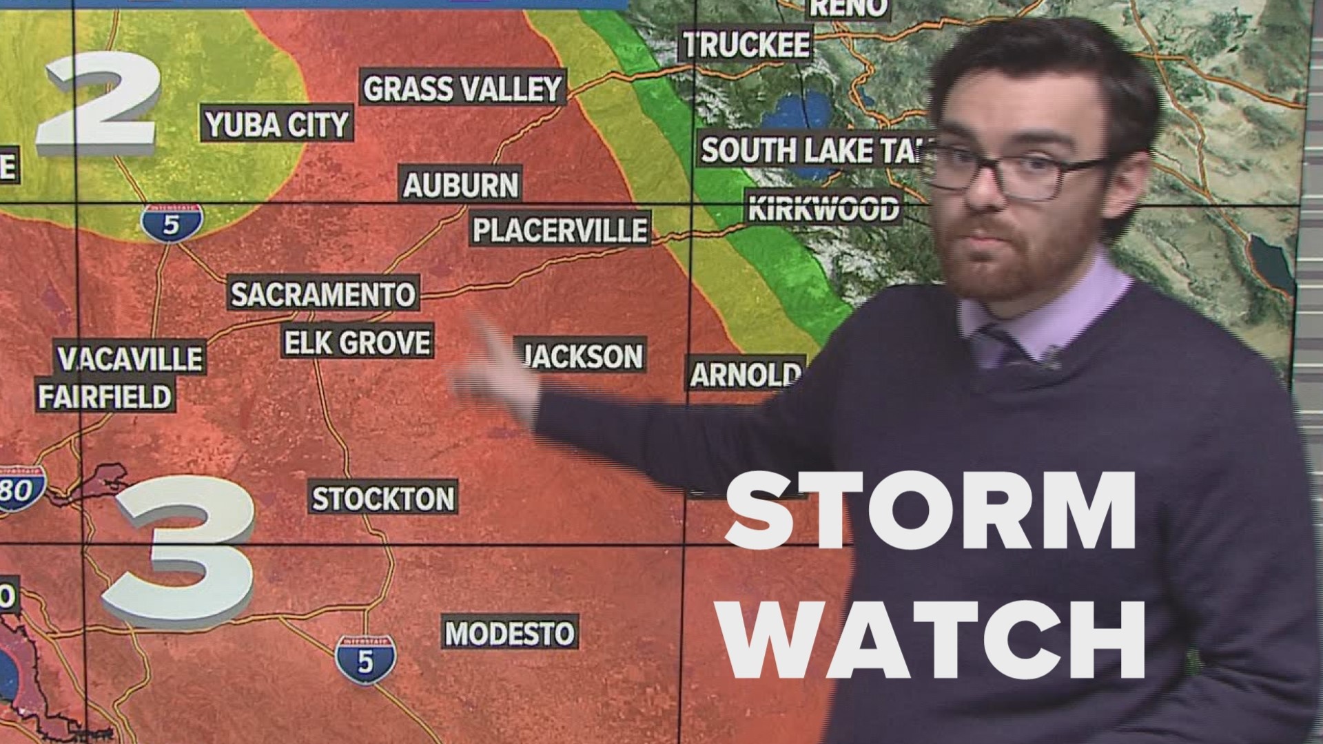
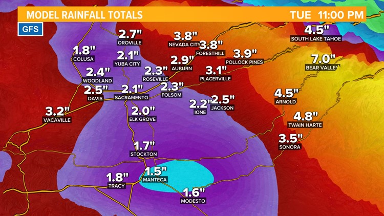
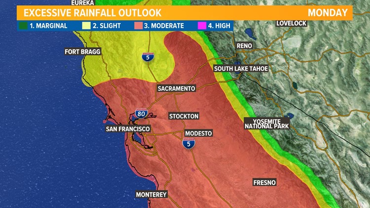
The heaviest rain will fall early Monday morning. While model data has cut back on precipitation totals in the last day, still expect this to be a high impact event regionwide. The valley is expected to see anywhere from 2-5" of rain by Tuesday night.
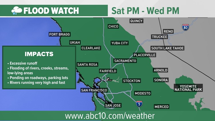
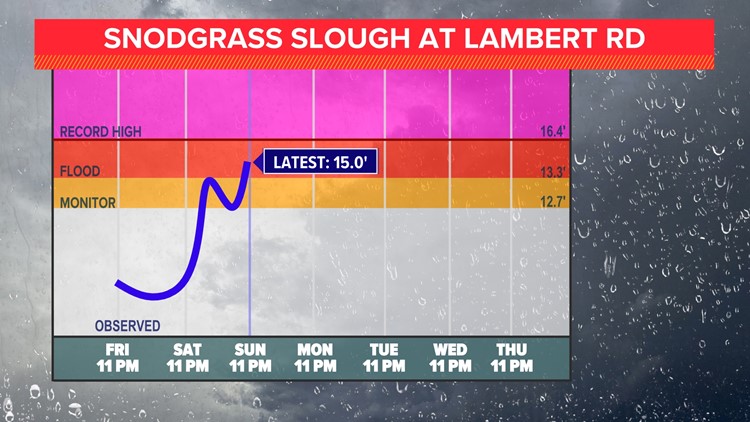
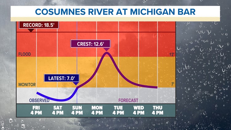
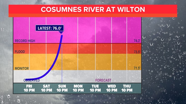
Due to strong dynamics associated with the storm, along with excessive atmospheric moisture, this storm could overperform and result in widespread flooding. It is important to stay vigilant, especially if you find yourself in a flood prone area. Many rivers in the area will reach flood stage and even record levels in some cases.
As for the higher elevations, snow levels will begin around 5,000 feet before warmer air raises levels to above 7,000 feet. Rain falling on the snow due to the high snow levels will further stress the rivers in the region. In total, 3-6 feet of snow are expected with locally higher amounts for the higher peaks.
A break in storms is expected Wednesday and Thursday before more systems roll in next weekend.
Storm gallery 1/8
WATCH MORE ON ABC10 | Northern California storm watch: More wind and rain is on the way Sunday and Monday

