SACRAMENTO, Calif —
The Sierra Nevada snowpack is in much better shape now than it was before two major atmospheric river events slammed into the state.
In the last six days, most Sierra ski resorts received 2.5 feet of snow. Mammoth Mountain in the Central Sierra received a whopping 78" of snow and the Central Sierra Snow Lab received 56", pushing the season total to 161".
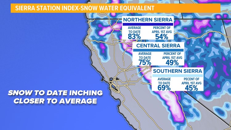
The statewide snowpack — after the feet of snow that fell in the past week — is now at 75% of average to date. Breaking it down further, the Northern Sierra is at 83% of average to date, the Central Sierra is at 75% and the Southern Sierra is at 69%.


Last month the statewide snowpack was only at 33% of average, but the state still has a long way to go to reach the April 1 average, which is used because that is when the snowpack typically peaks. The statewide percent of the April 1 average is only at 49%.
The wet weather has also pushed many valley locations above average in terms of rainfall. Sacramento Executive Airport has received 10.83” since October 1, sitting higher than the typical amount of 10.35” Sacramento typically sees by February 6.
Because of the incredibly wet winter last year, the state’s reservoirs remain above average. Lake Shasta, Lake Oroville and Folsom Lake are all 125-130% of historical average as of February 5.
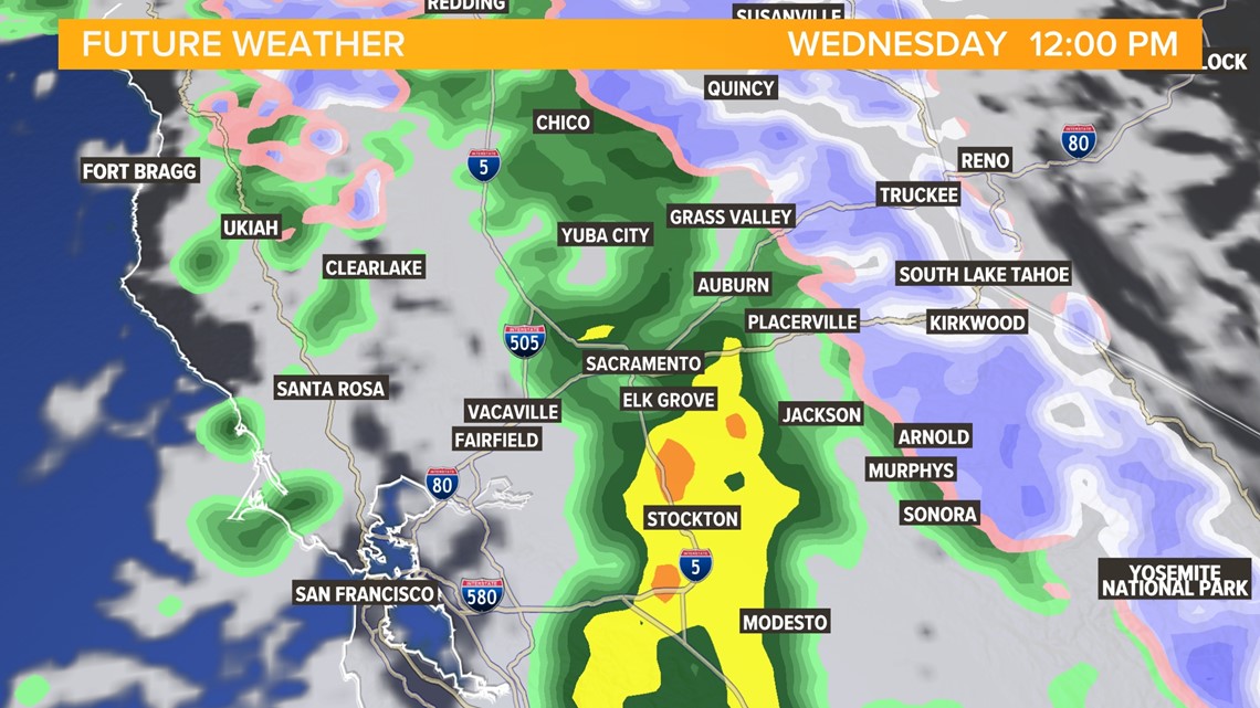
Another system Wednesday will add to the growing snowpack. The storm will drop down into Northern California from the north so it will be a colder storm and snow levels will be as low as 3,500 to 4,000 feet. Around 4-8" of accumulation is forecast above 4,500 feet.


