SACRAMENTO, Calif — Triple digit temperatures are set to return to Northern California by Tuesday after a relative break in the heat over the weekend.
High temperatures were 20 degrees cooler Saturday compared to Wednesday last week, with the high only reaching 82 degrees at Sacramento Executive Airport.
Temperatures rose into the upper 80s and low 90s Sunday and a warming trend will continue through the first half of the week.
High pressure will again build into California and by Tuesday the ridge will be over Northern California while a cutoff low is spinning off the coast of Southern California.
The cutoff low will help push moisture into the region but the only impact in Northern California with this will be afternoon thunderstorms in the Sierra south of Highway 50.
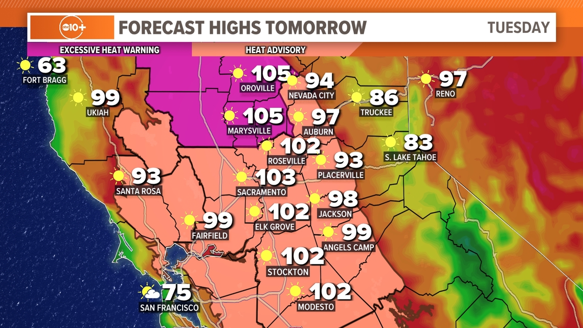
Temperatures Tuesday will rise into the low to mid 100s in the valley, 90s in the foothills and 80s in the Sierra. The hot daytime temperatures will be paired with warm overnight temperatures, dipping only into the 60s and 70s in the valley and foothills.


An Excessive Heat Warning is in effect for areas north of Interstate 80 from Tuesday morning through Wednesday evening. South of Interstate 80, a Heat Advisory is in effect due to slightly cooler temperatures in comparison. Temperatures in parts of the central and northern Sacramento Valley could reach 106 degrees Tuesday.
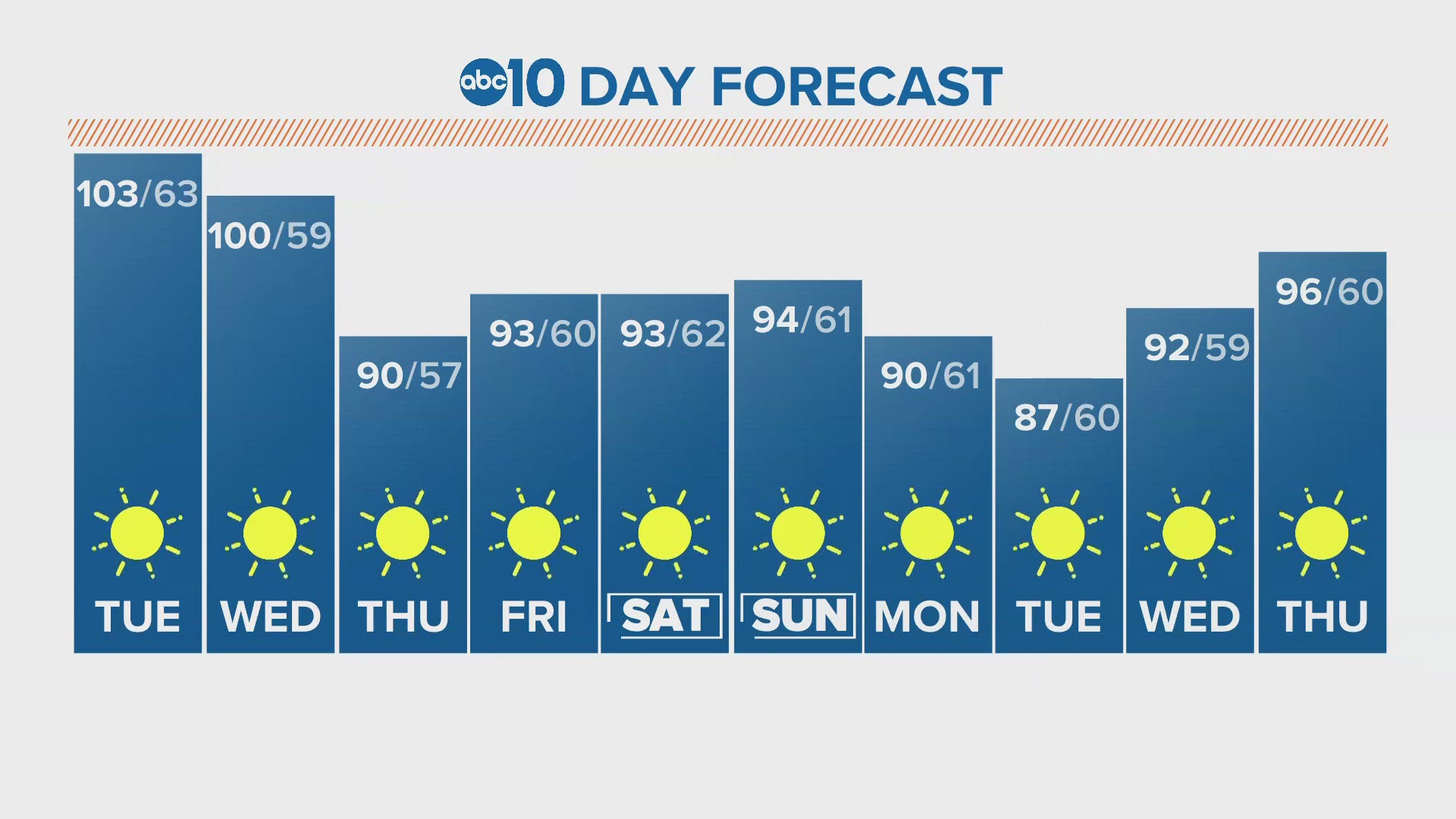
Wednesday will be hot as well, but it will be the start of a cooling trend and temperatures will be much cooler come Thursday. A strong delta breeze Wednesday night will usher in cooler temperatures so it will be a good night to have the windows open.
Northern California will return closer to average for this time of year in terms of temperature by Thursday. The average high in Sacramento is 88-89 degrees in the middle of June.
Temperatures will rebound into the mid 90s Friday and won’t change much day-to-day once the weekend arrives.


