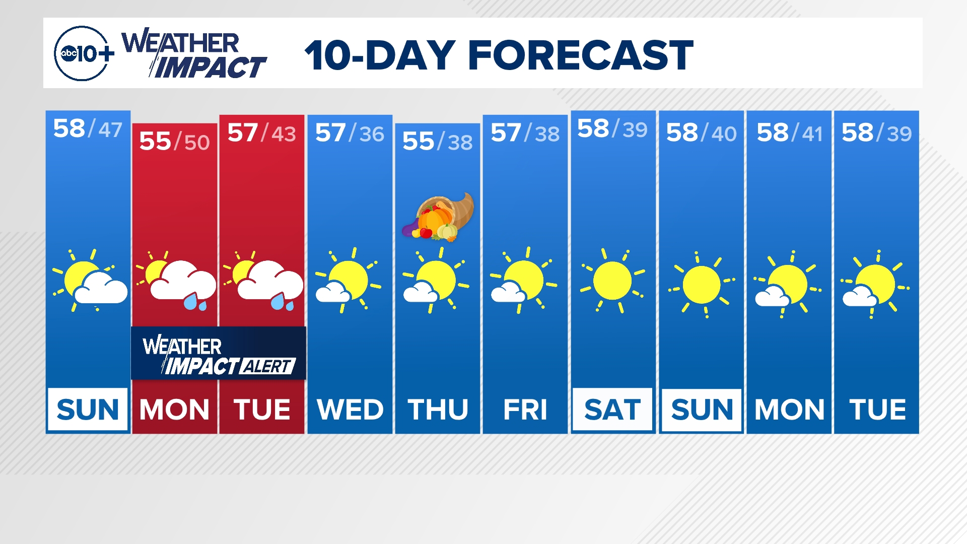
CALIFORNIA, USA — A low-pressure system off the coast of Northern California arrived Sunday night and was slow to move onshore. The stalling of the system helped to bring in higher storm totals from the bay area to the Valley and through Southern California Monday.
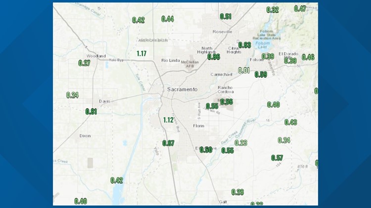
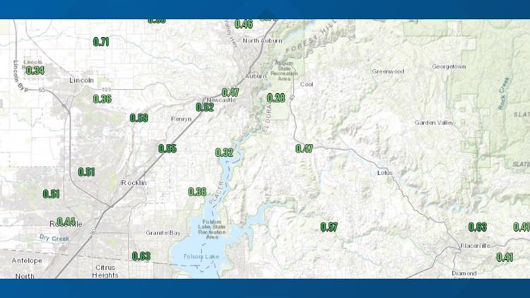
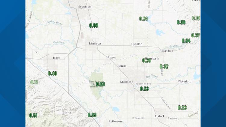
Totals ranged mostly from .25”-.75” with some areas seeing as much as .80”-1.25” of rain within a 36 hour period from Sunday to Monday.
Graphics | Across California, multiple areas observed weather activity
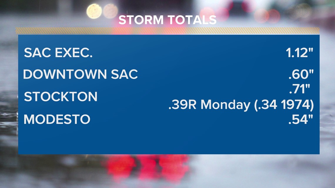
Around Sacramento, the executive airport is 1.12” of rain. Downtown saw .60”. Stockton broke a one day record for March 28th with .39” breaking the previous record of .34” in 1974. Modesto brought in .54” of rain.

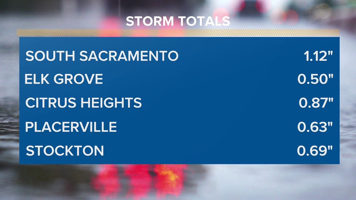
Some other notable rain totals included Citrus Heights with .87”, South Sacramento with 1.12”, Placerville with .63”, and Elk Grove with .50” of rain.

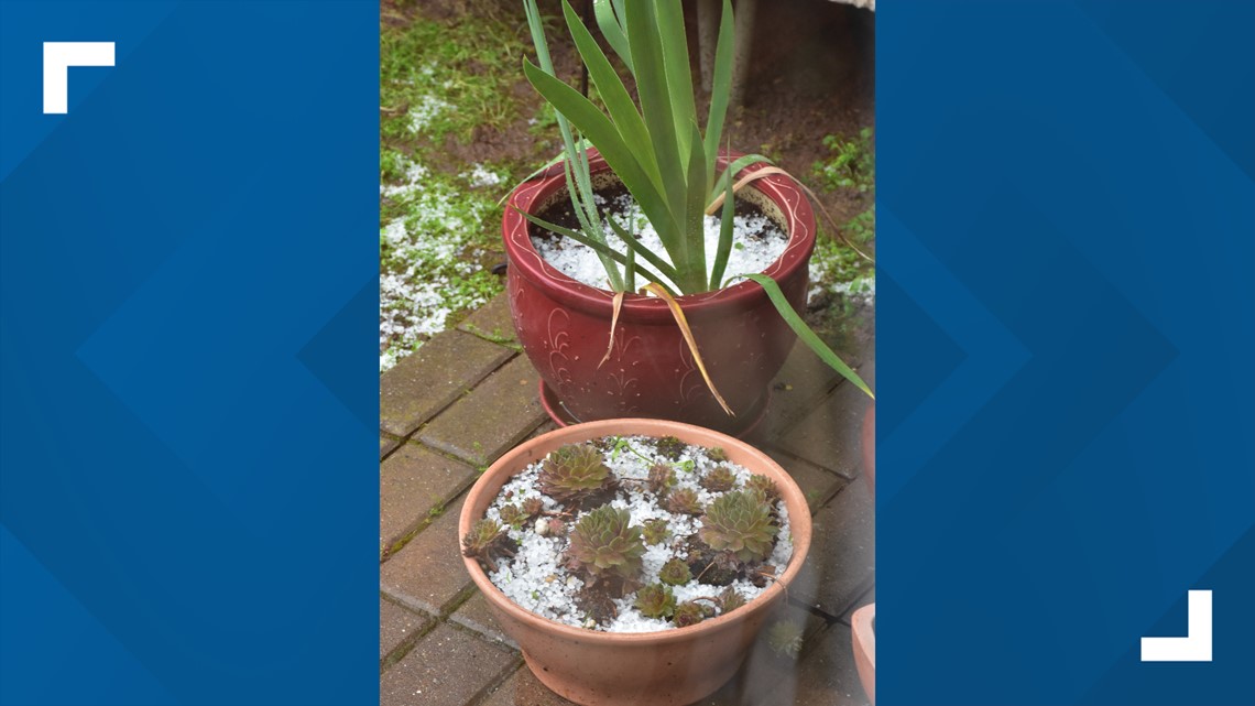
While the scattered showers rolled through Northern California neighborhoods, so did some thunderstorm action Monday evening. Photos came in from Citrus Heights showing small pellets of hail.

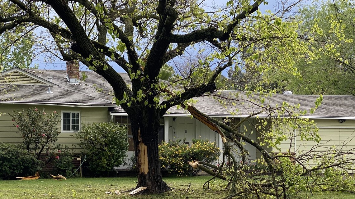
One viewer sent in a photo showing the destruction of his tree in Sacramento, and said the tree in his front yard was hit by lightning.

