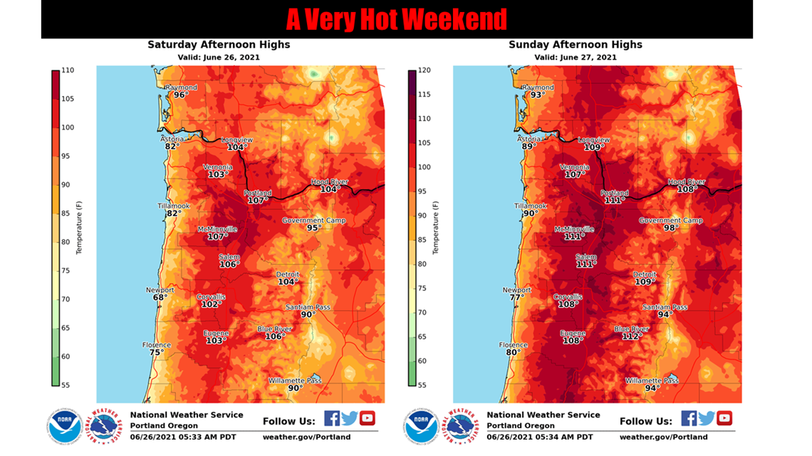
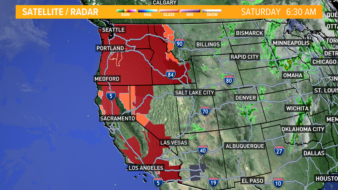
YUBA CITY, Calif. — The Pacific Northwest sweltered Friday as a historic heatwave hit Washington and Oregon, with temperatures in many areas expected to top out 25 to 30 degrees above normal in the coming days.
High pressure settling over Washington and Oregon isn’t expected to budge much for the next few days, causing temperatures to rise as high as 111°F in Portland Metropolitan areas.
A low-pressure system sitting over the pacific under the high-pressure system creates a Rex Block. This weather pattern can cause extreme heat and drought conditions over an area of high pressure; meanwhile, the low can cause unstable weather and possible flooding.

This low-pressure system currently over the Pacific is ushering in cooler air and breezy weather through the Delta. Otherwise, no wet weather is expected.
An Excessive Heat Warning has been issued for five days for areas north of Sacramento to the Pacific Northwest and into Idaho. Areas north of Sacramento expect temperatures from 105-112°F.

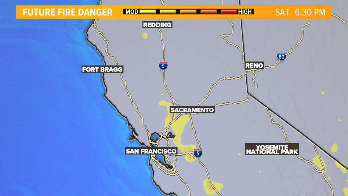
Fire danger around the coastal range will pick up in the afternoon/evening hours as the Delta Breeze moves through. Winds in the valley are expected to be around 10-15 mph, with winds through the Delta 20-15 mph. That's not to say other areas won't see a fire risk. The coastal range areas are at greater risk due to the winds being able to move any fire that may break out more rapidly.

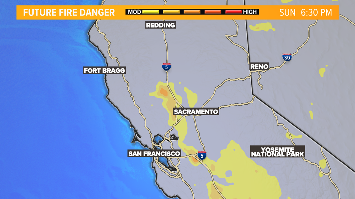
Sunday will bring greater concerns for fire breakouts. Winds are expected to remain mostly the same in the valley 10-15 mph, but the Delta could see winds 25-35 mph. The flow of winds will also spread further south into the San Joaquin Valley.

WATCH ALSO FROM ABC10: California $5B available for rental assistance, but where is the money? | Dollars and Sense


