SACRAMENTO, Calif —
Summer is in full swing for California. Temperatures skyrocketed this weekend under the influence of a high pressure system centered over the desert southwest.
As the ridge of high pressure begins to shift east, the clockwise rotation of the wind will pull in some tropical moisture to the region. Evidence of this can be seen with the presence of wispy cirrus clouds dotting the sky.
Not only could the high clouds potentially limit the high temperature, but there also exists a risk of dry lightning across Northern California.
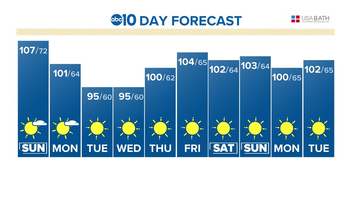
Monday will mark the start of a limited cooling trend as the center of high pressure pushes east toward Texas.
Still, triple-digit temperatures are forecast for Monday. Tuesday is when temperatures will likely dip below 100 for the first time since Wednesday in Sacramento.
Areas further away from the Delta and its cooling influence will likely stay above 100 through the extended forecast.
Wednesday will be similar to Tuesday in terms of temperature, in the mid to upper 90s.
The evenings will also be marked by a return of the evening delta breeze. Temperatures will once again ramp up Thursday as another shot of high pressure moves over the state.


The new ridge of high pressure will push temperatures past the century mark once again on Thursday and high temperatures will stay above 100 through the weekend.
July has been off to a hot start following the relatively cool June. In fact, the average high has been 95.5 degrees, about 10 degrees warmer than the average high in June (85.8).
The average temperature for this time of year is 95 degrees and temperatures will remain well above that mark for the extended forecast.

