SACRAMENTO, Calif. — Freezing temperatures dominated thermometers across Northern California Tuesday morning.
While no records were officially broken, many locations got close. Sacramento Executive Airport reached a brisk 28 degrees Tuesday morning.
The record of 27 set on Jan. 31, 1951, still stands, although the wind chill hit 24 degrees thanks to a 6 mph north wind.
Temperatures at Mather Airport dipped even lower, achieving a low temperature of 25 degrees and a wind chill of 19 degrees.
A lack of cloud cover and light winds allowed temperatures to fall quickly overnight. Areas experiencing wind through the overnight hours didn't experience the same temperature drop as wind-sheltered locations. This is due to the process known as radiational cooling in which heat from the Earth escapes the atmosphere and allows for rapid overnight cooling.
High pressure, light winds, dry air, and clear skies all amplify the effects of radiational cooling. Winds were light enough to allow for strong radiational cooling, but the presence of a few light wind gusts allowed for wind chill values to make the already frigid temperatures feel even colder.
Meanwhile, temperatures in the mountains dipped well below zero in some areas. Truckee Airport reached -11 degrees and Bridgeport, which sits in the eastern Sierra, dropped all the way down to -25.
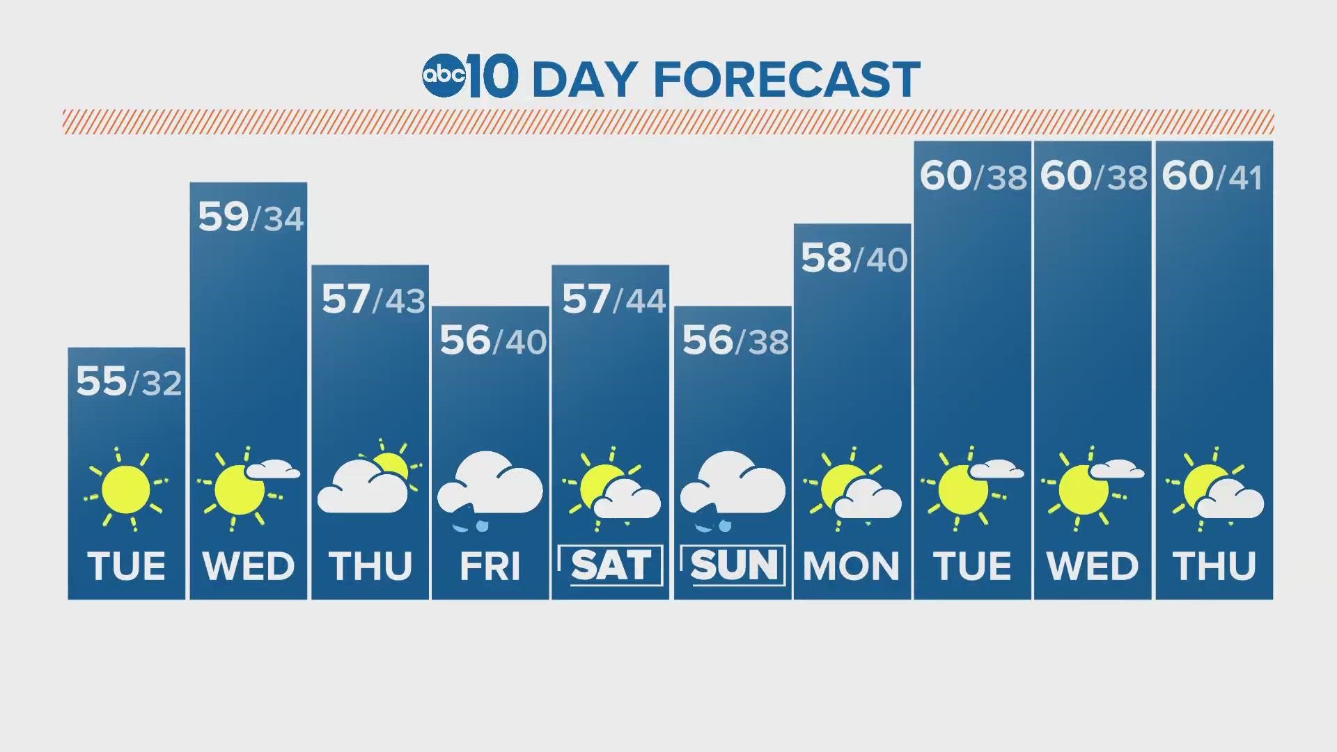
Cold temperatures are expected again Wednesday and Thursday morning. Sacramento is expected to reach at least 32 degrees again Wednesday morning and rural areas in the San Joaquin Valley could dip into the 20s again.
A pattern change is expected later in the week. Low pressure will take the place of high pressure beginning Thursday and precipitation chances will subsequently raise.
There are slim rain and snow chances Thursday and Friday before a more promising system moves in Saturday and Sunday.
WATCH ALSO | California Drought: Updated water levels, drought improvement close out historic January


