SACRAMENTO, Calif —
A cold winter-like system arrived Friday over Northern California, disrupting an extended stretch of abnormally warm weather.
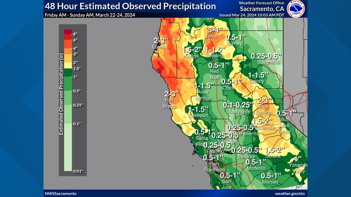
Rain totals from this system varied greatly from location to location due to thunderstorms producing heavy rain in some spots Saturday afternoon. Since Friday, one -tenth of an inch to 1" fell in the valley with totals increasing toward the east.
A few lingering foothill and Sierra snow showers will produce additional inches of snowfall, but it will be a mainly dry day for most of the region as the system exits to the east.
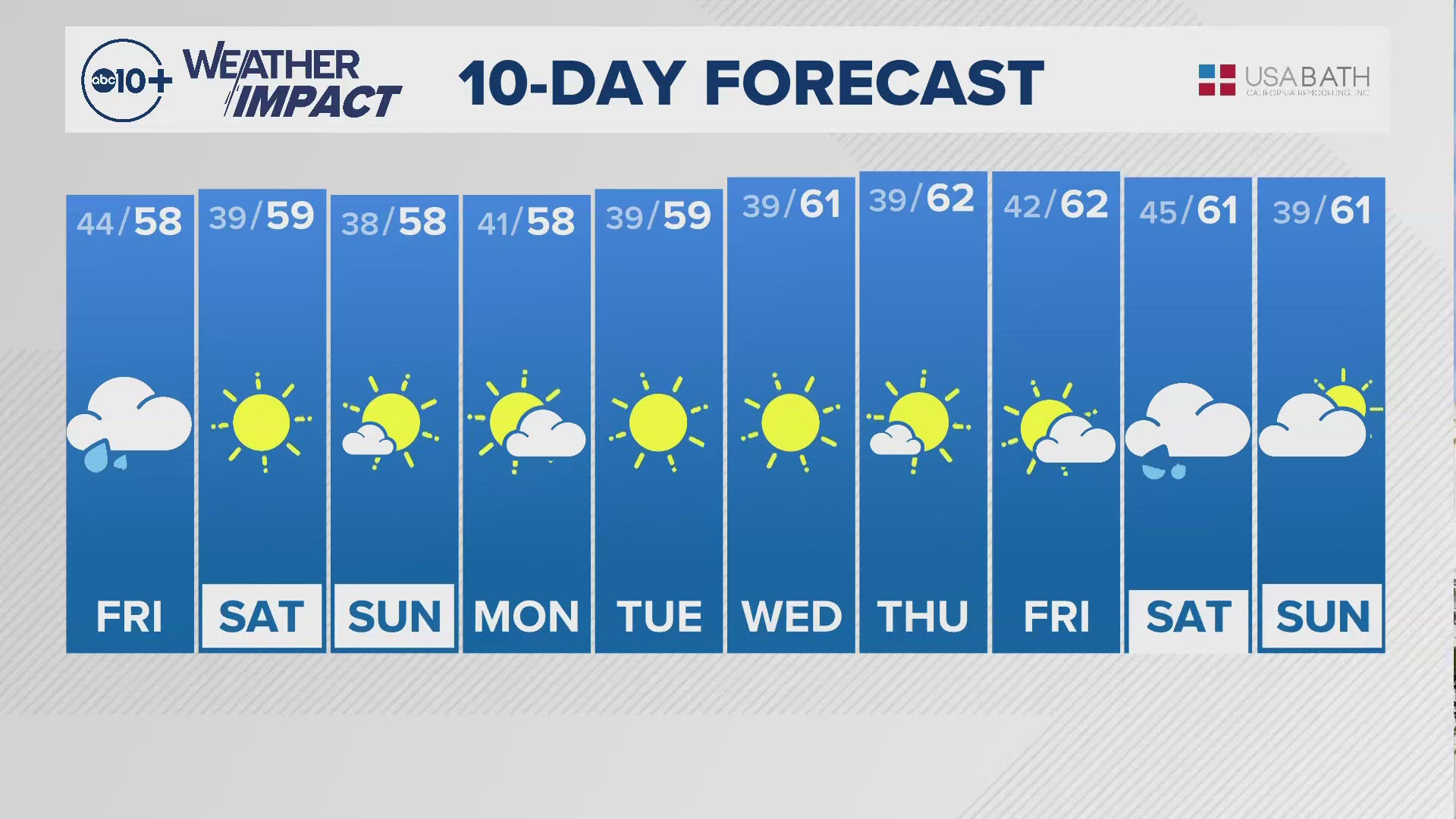
Monday and Tuesday will be dry before another system moves in Wednesday.
Here’s a list of rainfall amounts from foothill and valley locations:
Sacramento Executive: 0.30”
Downtown Sacramento: 0.36”
Stockton: 0.46”
Modesto: 0.75”
El Dorado Hills: 1.03”
Auburn: 1.09"
Placerville: 2.04"
Orangevale: 0.70”
Marysville: 0.20"
Vacaville: 0.52"
Fairfield: 0.28"


Sacramento shows average rainfall totals this winter. Sacramento Executive Airport has received 15.07” of rain since Oct. 1, 2023, the start of the water year. It generally receives 15.26” by March 24.
By March 24, 2023, Sacramento had over 20” of rain.
Snow totals since Friday:
Kirkwood: 26”
Sierra at Tahoe: 26”
Sugar Bowl: 24”
Sierra Snow Lab: 20.3”
Dodge Ridge: 16"
Palisades Tahoe: 27"
The Sierra Snow Lab is at 105% of average to date following the latest storm system. The lab has received 317” of snow this season so far, which equates to nearly 26.5 feet.
WATCH ALSO:


