SACRAMENTO, Calif. — California continues to slip out of drought thanks to the wild amounts of snow and rain that have fallen this winter.
According to the latest drought monitor, the Sierra is virtually free of drought. With more on the way and with some of those storms potentially being warm atmospheric river events, flooding has become the concern rather than drought - yet another example of climate whiplash.
Less than half of the state is still in drought, compared to almost 85% just last week.
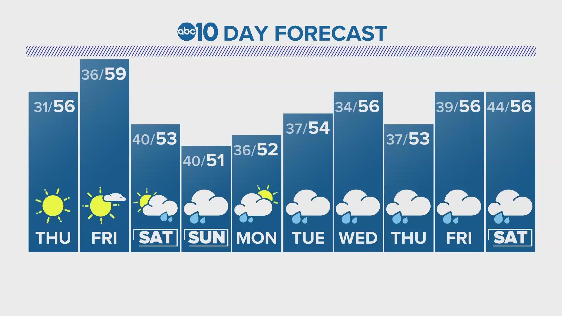
Thursday and Friday will be dry but another storm is waiting behind it with heavy snow expected again in the Sierra.
This will be another cold system originating from the Gulf of Alaska. A Winter Storm Watch has been issued ahead of the event and travel will be difficult across the Sierra this weekend.
Snow levels will be low again, with areas above 1,000 feet expected to get a fresh coating of 0.5-1.5 feet and areas above 2,500 feet can expect anywhere from 2-5 feet on Saturday and Sunday.
Light to moderate rain will fall in the valley. Current estimates show 0.25-1" of rain falling in the valley with rainfall totals generally increasing as you head closer to the Sierra foothills.
Saturday afternoon through Sunday morning will be the period with the heaviest precipitation and therefore will be the most treacherous time to traverse the Sierra due to whiteout conditions.
This system will bring a new batch of unstable storms, so thunderstorms will be a possibility.
The precipitation will likely continue until Tuesday but there is still uncertainty in the forecast for early next week. There is agreement that Wednesday will be the next dry day in Northern California.
WATCH ALSO:


