SACRAMENTO, Calif —
The month of December was warm and wet across Northern California.
The average temperature in Sacramento this month was 3.9 degrees above average but a series of warm storms, particularly in the second half of the month, have resulted in Sacramento Executive Airport receiving 4.69” of rain in December, well above the average of 3.32”.
The warm nature of the storms in December has resulted in minimal snow falling in the Sierra, and the statewide snowpack is only at 28% of average.
New Year’s Day will be on the warmer side and highs will reach into the upper 50s and lower 60s across the valley. Temperatures will also be on the warmer side compared to average in the Sierra and highs will be in the 30s and 40s.
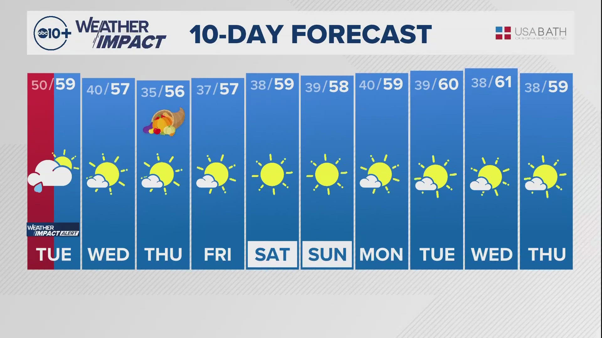
Some colder air will filter in by Tuesday and highs will be back in the mid 50s. The average high in Sacramento in early January is 55 degrees.
The cooler temperatures on Tuesday is part of a larger pattern change that will unfold this week with a series of colder storms expected to drop into the state from the north. The first of two systems is expected to drop down from the north with a cold front pushing through after midnight Tuesday.
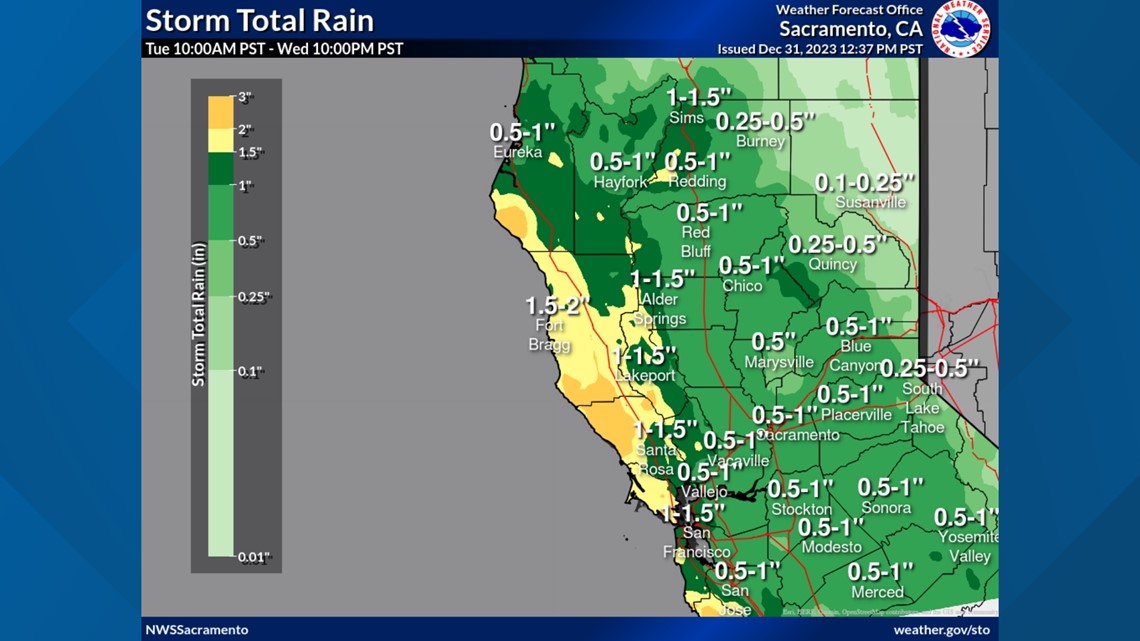
Current data shows half an inch to an inch of rain possible in the valley as the storm moves in after midnight on Tuesday, lasting through Wednesday.


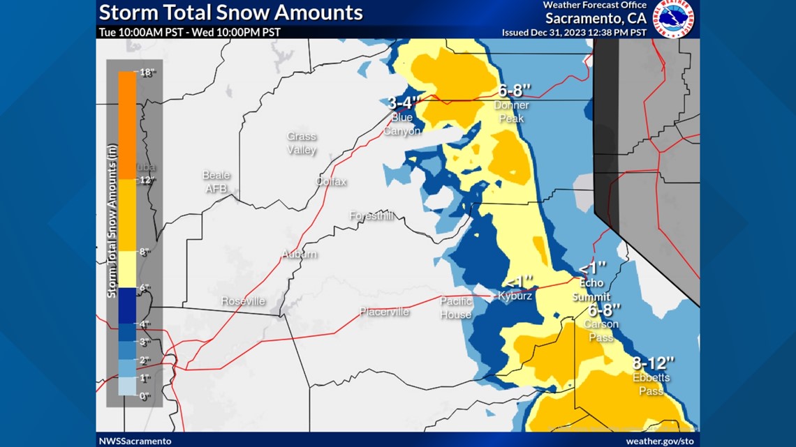
Due to this being a colder storm, snow levels will be around 4,500-5,500 feet. 3-8" of snow is expected above 5,000 feet but totals could approach a foot across the highest elevations.


By Thursday, high pressure will be back over the state but temperatures will remain on the chilly side.
Another cold storm system is forecast to push through Northern California this weekend. Although the details are still murky, this storm is currently expected to be more of a snow maker than the first storm this week.
Cooler and wetter than normal conditions are expected to persist through at least the middle of the month, according to the Climate Prediction Center.
WATCH ALSO:


