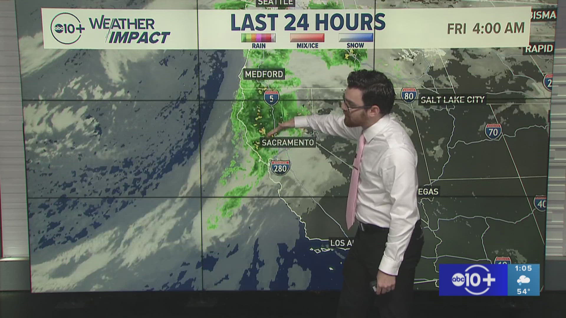
SACRAMENTO, Calif. — Following the record heat wave that shattered all-time high temperatures, California residents and firefighters have welcomed the arrival of cooler temperatures.
The cooler temperatures, increased relative humidity and even a few raindrops have aided firefighters in the fight against the Mosquito Fire.
While the weather conditions Monday were optimal for fighting the flames, fire activity increased on Tuesday as the Mosquito Fire pushed toward Foresthill. A weak, dry cold front is promoting stronger onshore flow, blowing smoke to the east and supplying more oxygen to the fire.
RELATED: Sacramento Weather Forecast
Fire crews are still contending with record dry vegetation levels, which will make any fire fight difficult no matter the weather conditions.
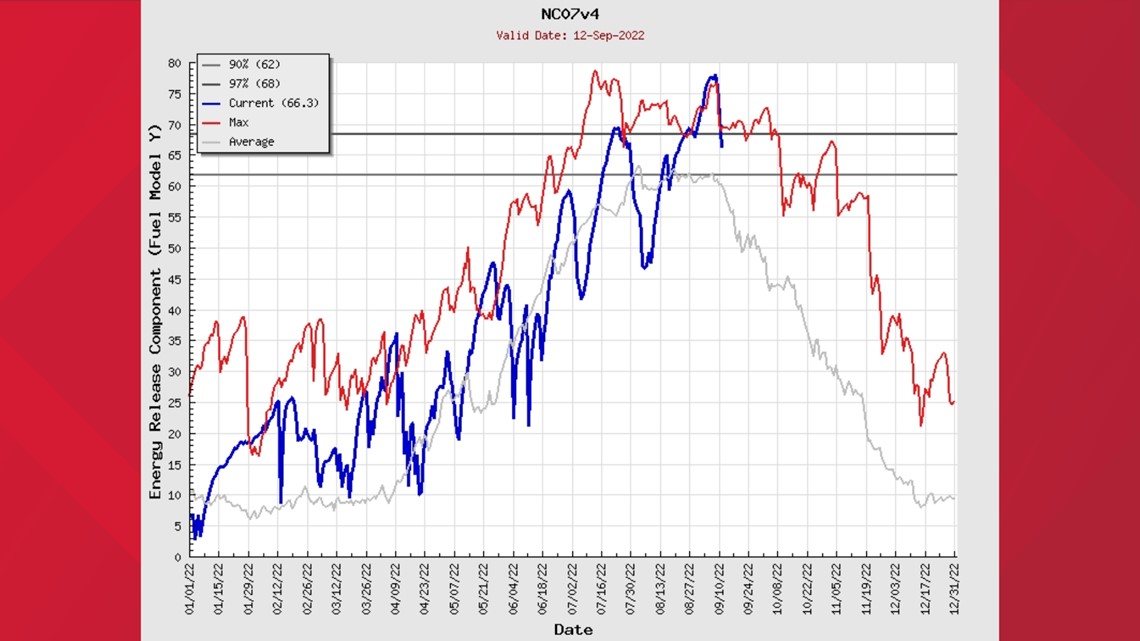
The already dry vegetation grew even more parched due to last week's record heat. Fuel vegetation graphs show that fuels are near, or above, record levels in the region the fire is burning.

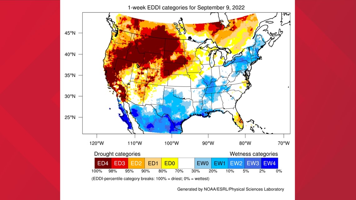
Another measure of fire danger is the Evaporative Demand Drought Index (EDDI). The EDDI measures "the thirst of the atmosphere" and how likely a region is to experience high fire risk, according to NOAA. The map below shows just how "thirsty" and ready to burn California and the rest of the west is.

Winds could still be gusty at times as the system pushes out of the region, but winds are expected to die down the following days before the weather changes again this weekend.
A low pressure system originating from the Gulf of Alaska is expected to drop down into the region this weekend, bringing much cooler temperatures, rain in the valley and foothills, and snow over the highest elevations.
As the storm moves down the coast, windy conditions are expected Saturday into Sunday morning before the rain arrives. This could be dangerous in terms of the Mosquito Fire, which is mapped at 64,159 acres and 20% containment as of Thursday, according to Cal Fire. Gusty winds in the vicinity of the fire are expected, which will supply the flames with fresh oxygen that could cause another flareup before the rain arrives.
The storm currently has a 70%-90% chance of the Sacramento area seeing at least 0.25" of rain through Tuesday night, with around a 30%-55% chance of seeing more than an inch, according to the National Weather Service.
The Mosquito Fire area could see similar totals as well. This will be beneficial to controlling the fire, of course, but the National Weather Service warned that this will only slow down fire season rather than put an end to it.
Showers are possible through Tuesday, and some unstable air could promote isolated thunderstorm activity Monday and Tuesday. Snow levels aren't expected to drop below 7,500 feet, and snow will be minimal so travel over the Sierra shouldn't be impacted.


