SACRAMENTO, Calif. — Cooler air is expected to move into Northern California after a mild and dry second half of November.
Temperatures this weekend are expected to sit in the lower 60s before the cooler air moves in on Monday. A weak system will move in Monday, bringing along with it very little moisture. The main effects will be light mountain snow and the beginning of a stretch of below-average temperatures that will stick around through early December.
Another system later next week could bring the first measurable rain and snow to the region since the early November storm that dropped up to 5 feet of snow in the mountains.
The latest model runs show a fairly robust precipitation event starting on Thursday with precipitation chances lasting through Sunday. The storm could drop a few feet of fresh snow in the mountains and possibly over an inch of rain to most of the valley.
Temperatures are going to decrease throughout the week and highs will likely be in the lower 50s across the valley.
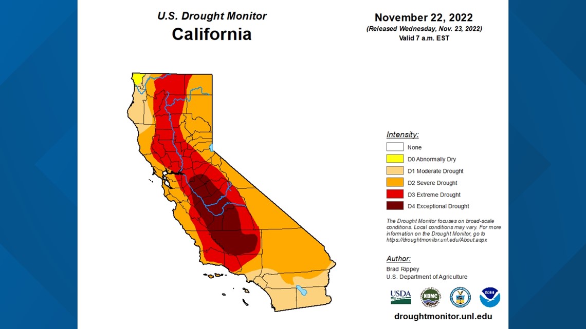
The Climate Prediction Center has cooler and potentially wetter weather sticking around for the next two weeks. The drought monitor update this week shows no changes and the upcoming storms aren't going to be drought busters.


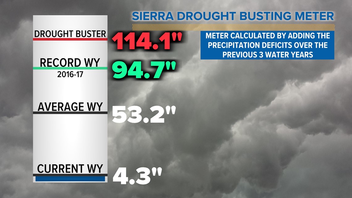
Precipitation data in the Sierra Nevada over the past three years shows a deficit of 60.9 inches of water equivalent, while the yearly average is 53.2 inches for the collection of eight stations scattered across the northern Sierra.
This means that to catch up from the past three years and potentially break out of the drought, the Sierra would need to see over double the average precipitation as a normal year.


