SACRAMENTO, Calif. — Northern California is in the midst of a dangerously wet period with no sign of storm activity slowing down.
A potent atmospheric river plowed into the state this past weekend, drenching the state and causing floods, power outages, and dangerous road conditions due to the flooding, debris, and heavy snow rates in the Sierra.
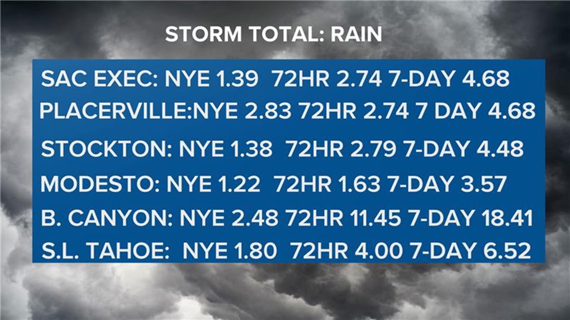
Staggering precipitation totals were seen across Northern California. The last 7 days dropped 18.41" of liquid equivalent precipitation along Interstate 80 near Blue Canyon. Sacramento Executive Airport received 4.68" over the past week and ended the month with 7.79" of rain, more than doubling the December average of 3.43".


The storm, a strong atmospheric river, drew moisture from the tropical Pacific and temperatures were generally pretty warm, keeping snow levels very high. This resulted in massive runoff pushing rivers to maximum capacity and beyond in the case of the Cosumnes River.
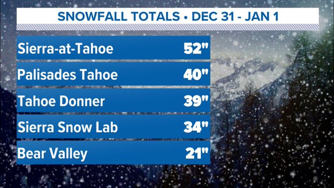
Once cooler temperatures were ushered in, snow levels dropped drastically and produced record breaking snowfall in the Sierra. Palisades Tahoe broke their 12-hour snowfall record while the Central Sierra Snow Lab received 7.5" of snow in a single hour.
In total, the Sierra over-achieved in terms of snowfall due to snow levels dropping quicker than expected. Sierra at Tahoe received 52" of snow once the rain turned to snow.


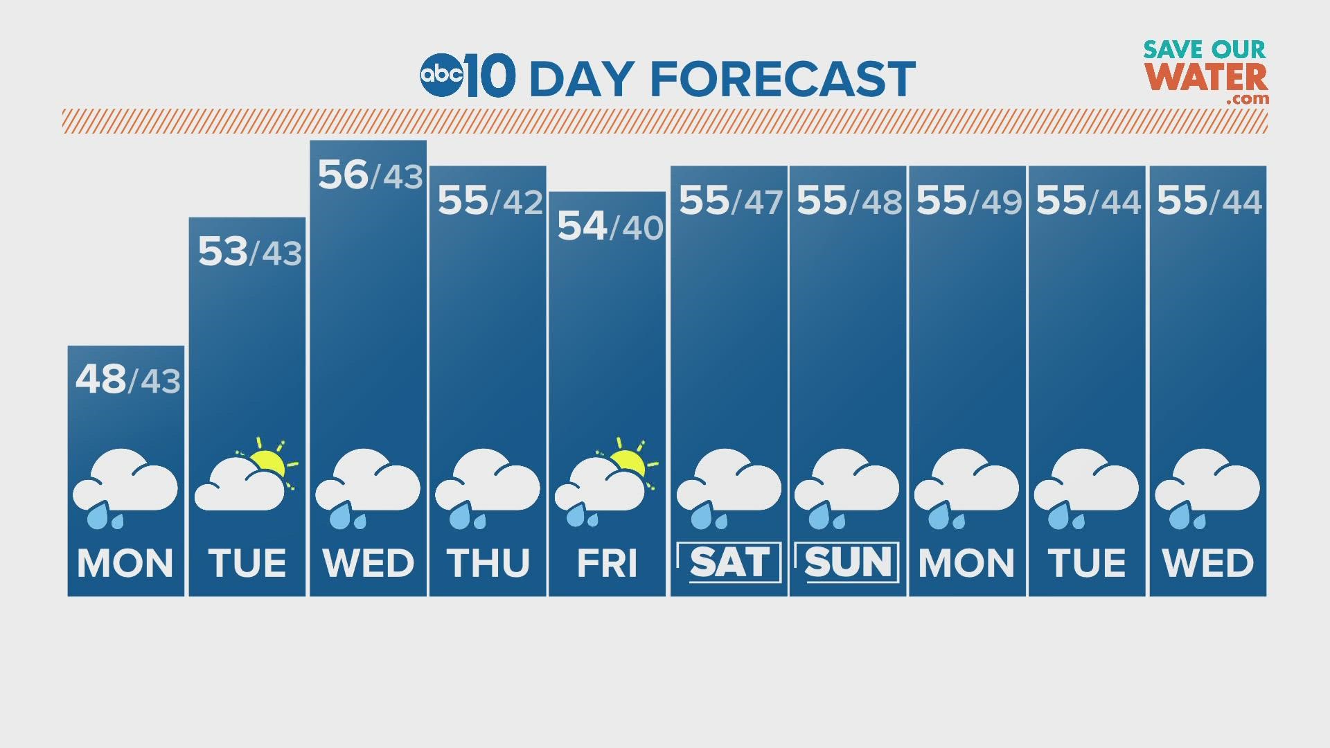
Expect much, much more of this in the coming weeks. Flooding concerns will remain high as the atmosphere will continue to direct storm after storm to Northern California for the extended forecast.


