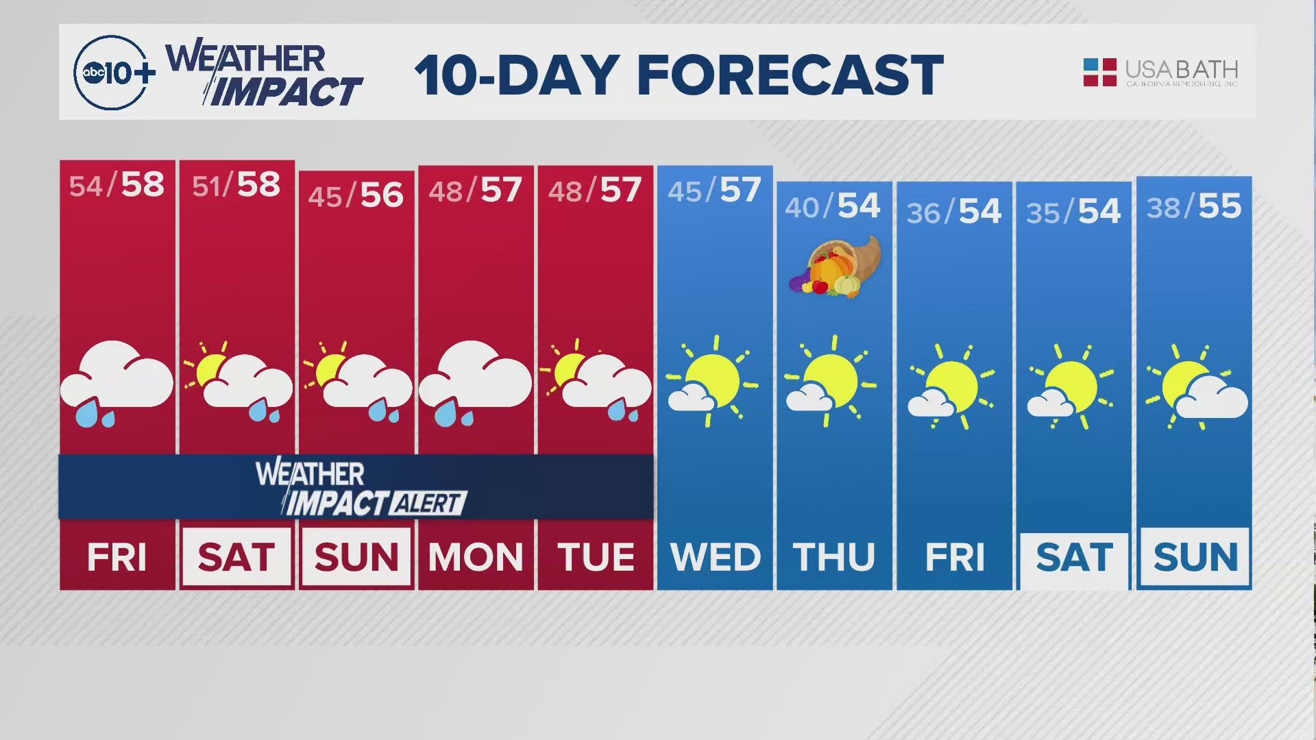
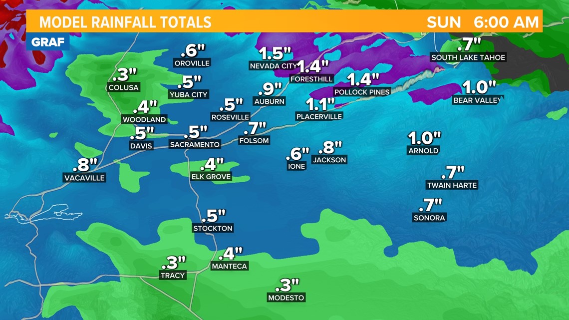
SACRAMENTO, Calif. — Our pattern of active weather in Northern California continues Saturday. Another winter storm is inbound that will bring up to half an inch of valley rainfall and up to two feet of snow in the Sierra. Here's the timeline:
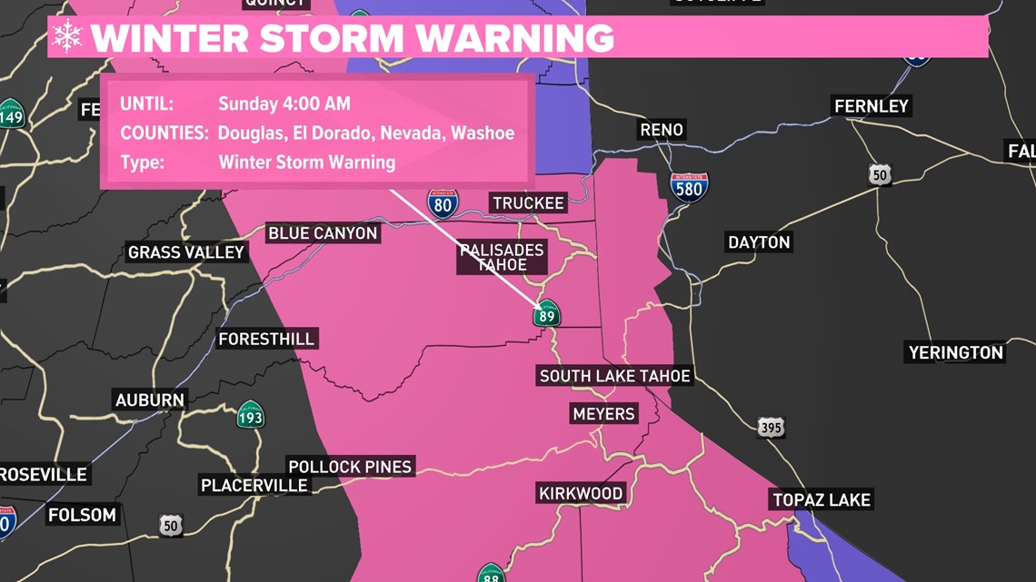
A Winter Storm Warning is now in effect and continues until early Sunday morning.

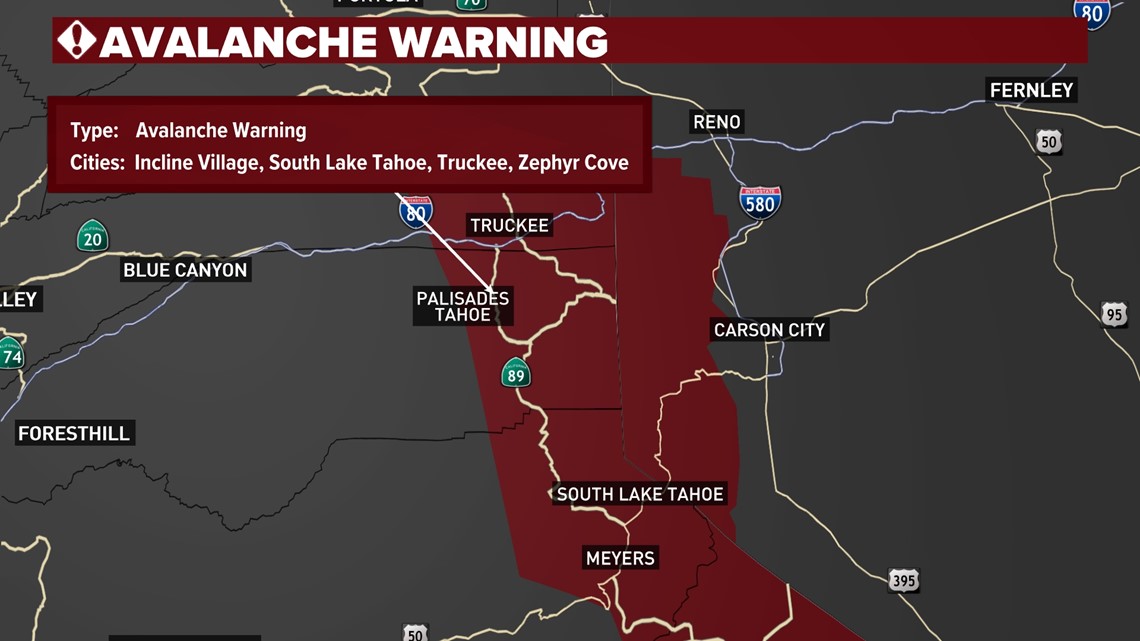
Additionally, an Avalanche Warning is in effect for the Sierra. The Sierra Avalanche Center is forecasting high avalanche danger today. New snow accumulation and strong winds will further destabilize already weak slabs. Natural avalanches are likely; human-triggered avalanches are very likely. Travel in avalanche terrain is not recommended due to very dangerous avalanche conditions and the possibility for large avalanches.

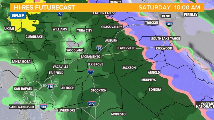
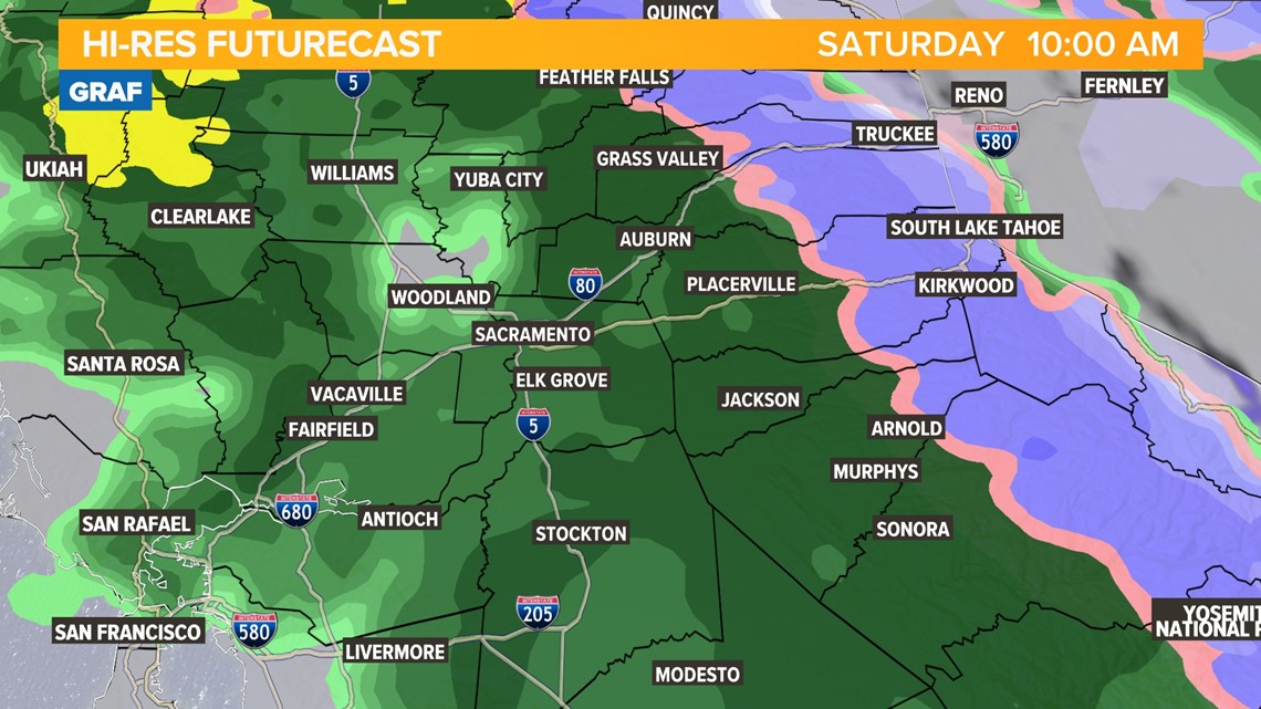
SATURDAY MORNING
After sunrise, valley showers become heavier and even more widespread. Most valley locations will receive rain for most of Saturday morning, with rainfall totals by this time of at least a couple of tenths.
Snow becomes much heavier in the Sierra as well. If chain controls were not needed during the overnight hours, they will be needed by the mid-morning. Snowfall rates of about an inch per hour are possible by the late morning. Snow levels climb slightly towards 4,000-4,500 ft.
Winds will be picking up during the morning hours, too. Valley wind gusts of 15-25 mph are possible, with gusts upwards of 30 mph in the Sierra, stronger across the ridgetops. This will lead to reduced visibility in the Sierra due to blowing snow.

SATURDAY AFTERNOON
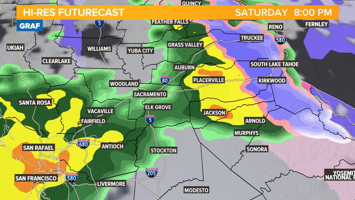
This is the period with the heaviest rain and snow, and the strongest winds.
A brief period with lighter and more scattered valley showers may develop during the early afternoon, but the break is only temporary.
Heavy rain – likely the heaviest at any time during the storm – moves into the valley during the late afternoon and early evening. The heavy rain may lead to some ponding on roads and somewhat reduced visibility. In other words, a good soaking rain is expected.
In the Sierra, there will be no such pause in the snow. In fact, snowfall rates may climb towards two inches per hour at pass level. Trans-Sierra travel will become very difficult. If you can avoid driving through the mountains Saturday, that is what's recommended. Due to snow on the roads, the heavy rate of snowfall and gusty winds, all manner of winter weather travel impacts are possible. This includes chain controls, commercial truck holds and even partial or full closures of major highways like I-80, US-50 and CA-4.
Somewhat counterintuitively, snow levels rise again during the afternoon hours Saturday, with the lowest snow now close to 5,500-6,000 feet.
The rising snow levels are due to the storm tapping into the warm atmospheric river. So even though the afternoon and evening will be the wettest period with the heaviest rain and snow, it will also be the warmest period of the storm. Upper foothill areas and even mid-elevation locations that initially saw snow will see precipitation transition to snow by the afternoon and evening.

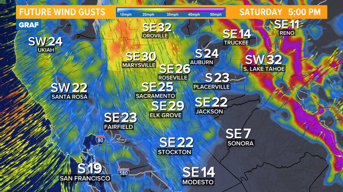
In addition to the rain and snow, winds will also peak during the late afternoon and early evening. A Wind Advisory goes into effect for the northern Sacramento Valley this afternoon.
Stiff valley winds will gust out of the south will increase to 25-35 mph, coinciding with the heavy rain which may reduce visibility for a time.
In the Sierra, wind gusts at pass level increase 45 to 55 mph, with ridgetop gusts in excess of 70 mph possible.

Rain and snow taper off through the late evening hours with the valley rain ending during the overnight.
SUNDAY
The storm really winds down during the morning hours. Most of Sunday will be dry and even have periods of sunshine during the afternoon.
Valley rain ends by sunrise and though clouds stick around through the morning, a mix of sun and clouds are expected in the afternoon.
Sierra snow showers may linger through the early afternoon, but the heaviest and most impactful snow will be done. Still, winter weather traffic control measures may be in place.

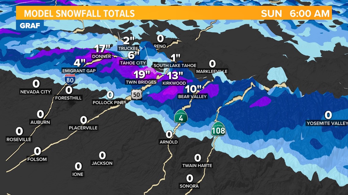
It's looking like another good storm for ski resorts. When it's all said and done, snowfall totals are expected to be similar to the previous few storms with about a foot around 5,000 feet and two feet at pass level.
In the valley, rainfall totals are likely to be between a quarter of an inch and a half of an inch. With that being said, there are some models suggesting closer to one inch of rain. Final totals will depend on if we see clearing Saturday afternoon and also how heavy the rain is during the Saturday afternoon-evening timeframe.

WATCH MORE ON ABC10 | California Avalanche: Kenneth Kidd remembered after deadly avalanche at Palisades Tahoe

