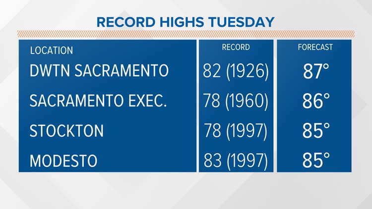
SACRAMENTO, Calif. — It's not often you forecast temperatures well above the record highs for multiple locations over multiple days, but that's happening this week.
On Monday, we set a new record in Sacramento at 81 degrees and tied a record high for Stockton at 80 degrees.
The ridge blocking rain and cooler temperatures from moving into the area will set up right on Northern California and reduce wind and raise temperatures even higher. Many locations will hit the mid to upper 80s, while the daily records are often in the upper 70s and low 80s.
The lack of stronger wind should reduce pollen level slightly, but allow mosquitoes to be more active close to sunrise and sunset. The heat will not quite reach dangerous levels, even though records will fall, but it could catch some people off guard.


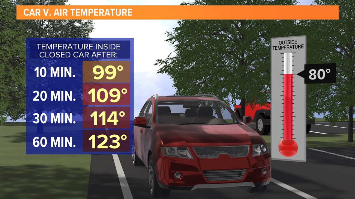
Heat inside vehicles can rise quickly when the car is off with no air conditioning. People hiking or biking need to be aware heat often seen in June will be happening months early and all the early summer tips need to be taken seriously this week.
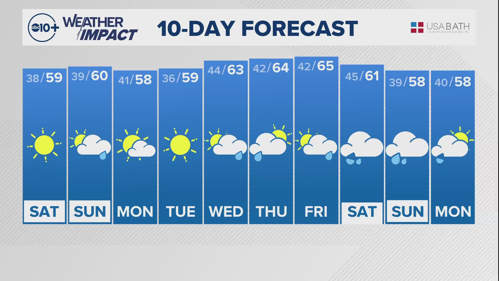
The warm wave will end next week with the possibility of a storm bringing back rain and snow. At this point, the focus of the storm is Central and Southern California with only some rain or snow chances locally, but this may change.
READ MORE FROM ABC10:
ABC10: Watch, Download, Read
Watch more from ABC10
California eviction protections end on April 1, 2022 | Thousands still waiting for rental assistance


