SACRAMENTO, Calif. — The California Office of Emergency Services has prepositioned crews in 19 counties as the Golden State braces for more rain, bringing flooding concerns.
Unstable weather conditions prompted warnings throughout Saturday, bringing hail, flooding, thunder and potential funnel clouds to Northern California.
National Weather Service Sacramento says "copious amounts of lightning" in parts of Tuolumne County may have caused powerline and structural damages, knocking out power to some.
President Biden and Gov. Newsom spoke Saturday following the emergency declaration the issued Friday.
"The state has the full support of the federal government as it responds to the impacts of severe winter weather, including flooding, landslides and mudslides," according to Newsom's office.
A Winter Storm Warning has been extended to Wednesday evening.
A tornado warning was issued in Sonora, Phoenix Lake and Jamestown but expired at 3:15 p.m. According to the National Weather Service, the California Highway Patrol spotted funnel clouds in the area of Jamestown. There are no current confirmed tornado or funnel cloud touch downs.
The severe weather prompted the National Weather Service to issue a severe thunderstorm warning for parts of Calaveras County including the cities of Copperopolis, Angels Camp, Murphy's, Arnold, Sonora and Mountain Ranch.
Parts of San Joaquin County were also under a severe thunderstorm warning Saturday including the cities of Stockton, Waterloo, Linden and Farmington.
The severe thunderstorm warnings have since expired.
Rain showers are forecasted to continue until Sunday morning with another atmospheric river setting up to hit the state late Monday into Tuesday.
The additional rainfall has put some residents living along local creeks and rivers on edge. Officials in Stanislaus County issued an evacuation order for a neighborhood in Modesto adjacent to the Tuolumne River near the 9th Street Bridge.
A separate evacuation order in Stanislaus County is impacting the community of Newman along the rising San Joaquin River.
Check out our latest coverage, maps and storm resources below:
Traffic
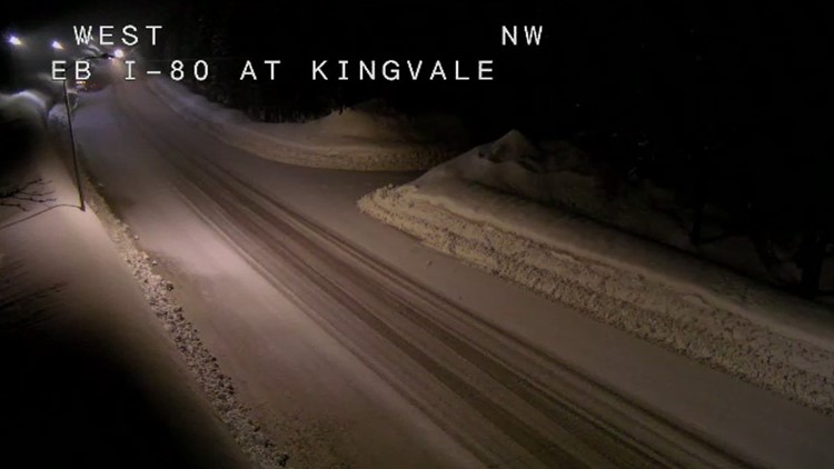
Interstate 80
- Chains are required for all cars (excluding four-wheel or all-wheel drive vehicles) westbound and eastbound from Eagle Lakes to Truckee.
Highway 50
- Chains are required on all vehicles (excluding four-wheel or all-wheel drive vehicles) eastbound and westbound from Twin Bridges to Meyers.
Maps
Radar map from ABC10.com. Adjust the layers with a filter on the bottom right corner to show rain, snow, wind and current temperatures:
STORM RESOURCES:
► FORECAST DETAILS | Check out our hourly forecast and radar pages
► GET WEATHER ALERTS TO YOUR PHONE | Download the ABC10 mobile app
► WEATHER IN YOUR EMAIL | Sign up for our daily newsletter
ACCOUNTS TO FOLLOW:
RELATED:
Watch more from ABC10: More Water Releases Continue Across California as Flooding Ramps Up


