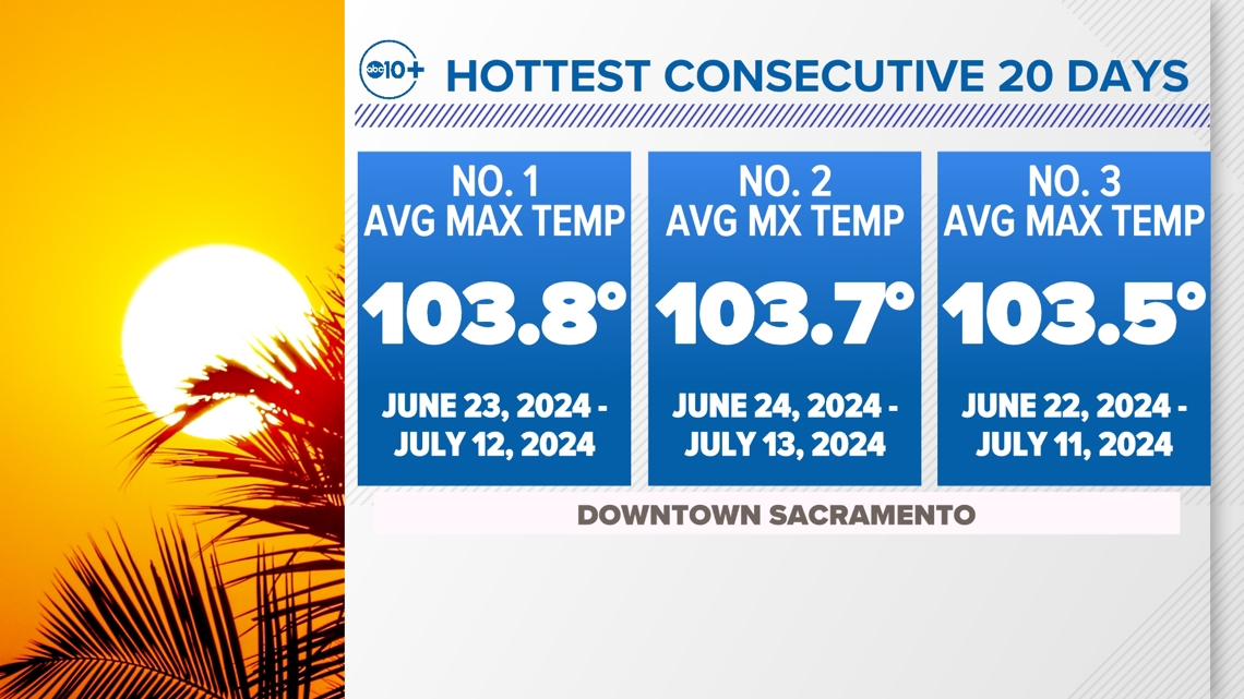
SACRAMENTO, Calif. — Downtown Sacramento has recorded its hottest consecutive max temperature over a period of 20 days with an average high of 103.8°.
Since the end of June, Northern California has been in the grips of a stubborn and strong high pressure ridge. This weather pattern brings sinking, warming air and typically intense heat in the summer.
The heat records are stacking up. Not only has the city hit the all-time record for hottest consecutive max temperature over a 20-day stretch, but also the second hottest, third hottest and even the fourth hottest consecutive stretch of days.

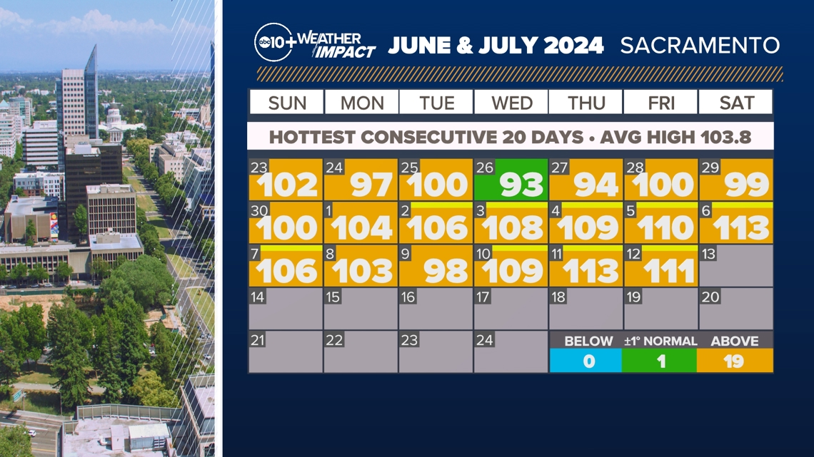
Below is the daily rundown of temperatures during this record max temperature stretch. There was only one day where the city monitoring station reached the average high. Every other day was above average and mostly well-above average. Included are also the hottest temperatures hit this year so far at 113°. Both of those days were also daily record highs.

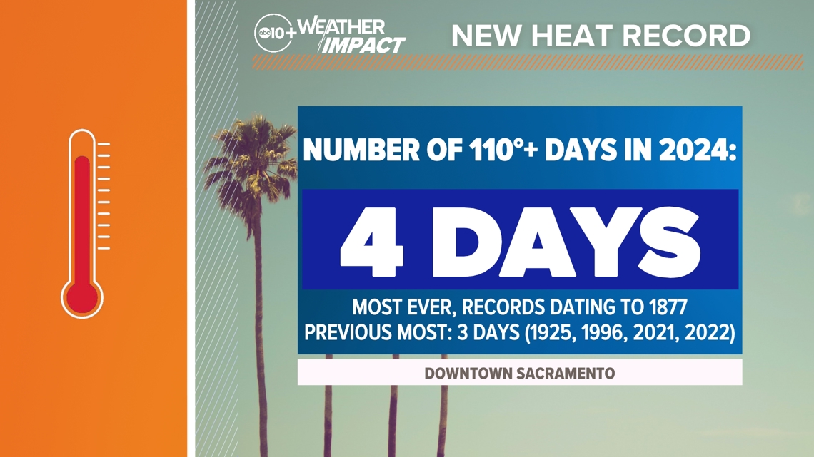
This stretch also carried with it a record for the most number of days at 110°+ for Downtown Sacramento. This year, the city has hit 110°+ four times. The previous record was three.

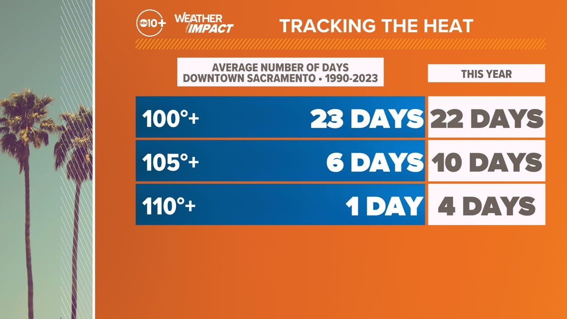
Along with that record number of 110°+ days, Sacramento has nearly hit the average number of 100° temperatures for the year and well exceeded the number of 105°+ days.

The daytime heat is only a part of the story. Overnight lows have also been well above average. This is contributing to the oppressive feel of this heat wave. So far, the average high in Downtown Sacramento for the month is 106.5° which is well above the normal average 94.5°. The average low in Downtown Sacramento for the month is 69.4° which is above the average of 61.6°.
July is only half over with another stretch of heat forecasted for the middle and end of the month. The ABC10 Weather Impact team will be tracking this historic stretch of heat.
WATCH ALSO:
For more ABC10 news and weather coverage on your time, stream ABC10+ on your TV for free:
► Roku - click here
► Amazon Fire - click here
► Apple TV - click here


