CALIFORNIA, USA — The main impacts of Tropical Storm Hilary move into Northern California on Monday, generally consisting of light rain, cloud cover, and high humidity.
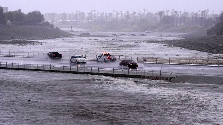
Tropical Storm Hilary deluged arid parts of Mexico and then drenched Southern California from the coast to the desert resort city of Palm Springs and inland mountains, forcing rescuers to pull several people from swollen rivers.
The first tropical storm to hit Southern California in 84 years, Hilary dropped more than half an average year’s worth of rain on some areas, including the desert resort city of Palm Springs.
On-and-off showers will continue across Northern California on Monday. As of 9 a.m., downtown Sacramento has picked up 0.03" of rain, which represents 150% of the city's average August rainfall. Tropical moisture ushered in by Hilary will produce very humid conditions across the region to go with high temperatures in the upper 80s to low 90s.
Unstable air and plentiful moisture will increase thunderstorms chances this afternoon across interior Northern California before the remnants of the storm vacate the state by Tuesday.
Live Radar: Track Hilary aftermath and the storm
ABC10 meteorologists set up the following graphics showing the impacts of Tropical Storm Hilary. View the livestream below.
STORM RESOURCES:
► FORECAST DETAILS | Check out our hourly forecast and radar pages
► GET WEATHER ALERTS TO YOUR PHONE | Download the ABC10 mobile app
► GO DEEPER | Stream in-depth weather forecasts on ABC+
► WEATHER IN YOUR EMAIL | Sign up for our daily newsletter
Live Radar
For only live radar images, view the map from the National Weather Service below.
WATCH ALSO:


