 SACRAMENTO - There is growing evidence that California could see an even stronger El Niño event this winter than the one in 1997 that caused massive flooding across Northern California.
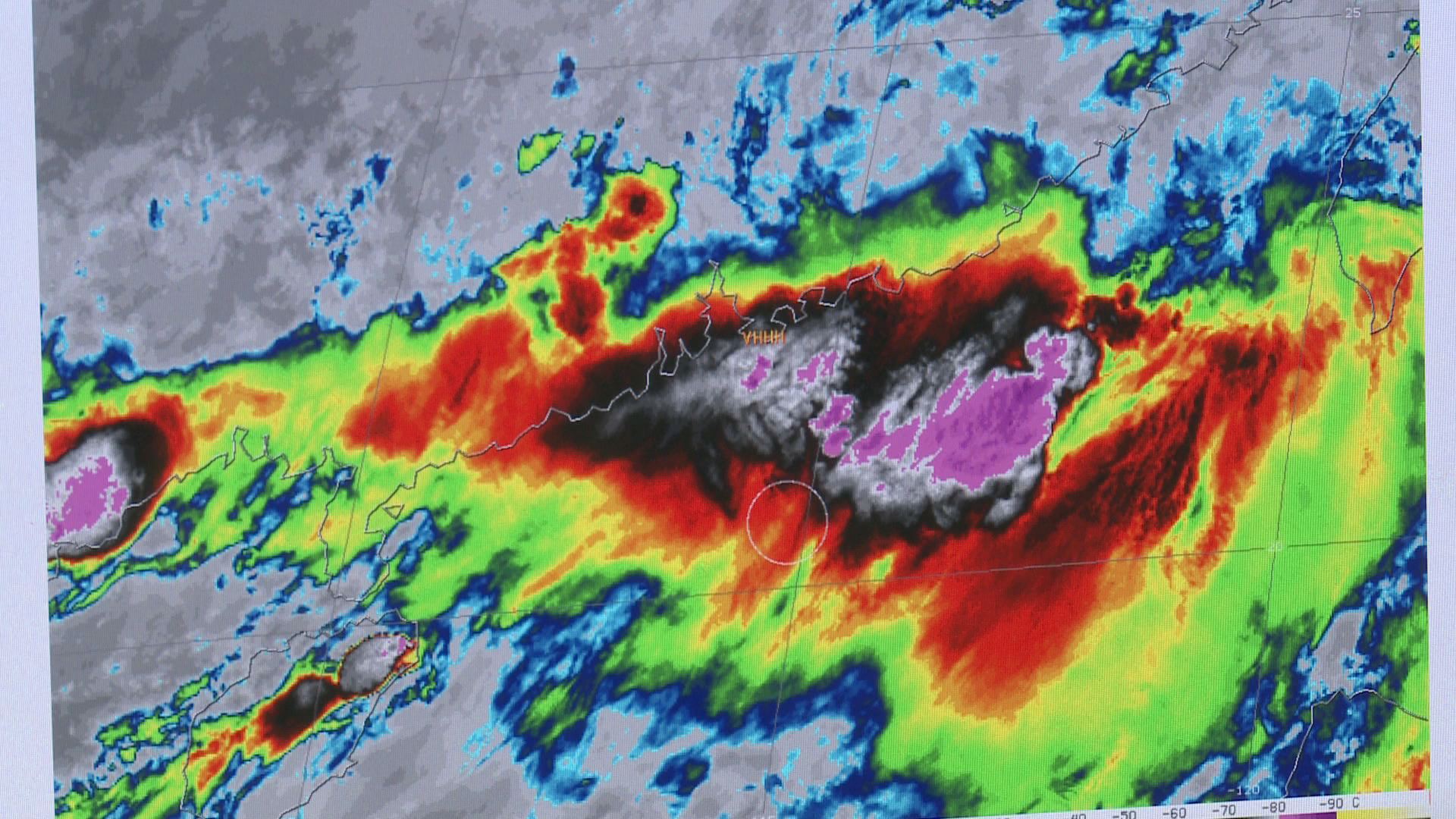
Stunning images from Japan's Himawari-8 Weather Satellite, just switched on on Tuesday, show what could become a historic El Niño in full bloom.
"Almost all models are showing consistency that we're seeing a stronger and stronger tendency for that to hold in place through the winter season. It could rival that of 1997," News10 Chief Meteorologist Monica Woods said.
In recent days, cyclones and typhoons, including one mammoth storm heading toward China with cloud cover the size of Texas, have helped shift the trade winds from west to east, pushing warm sub-surface water toward the coast of South America and making it all but certain an El Niño event will last at least through the fall.
"What we want is just enough water to come in slowly enough for the watersheds to hold that," Woods said. "The nice thing is that so many of them are dry that they have the capacity, but the flip side of that is, as anybody knows in a desert climate, is that terrain is just parched and so a lot of that can be runoff if those storms are too warm."
In this El Niño year, if the models hold up - and climatologists said they seem almost certain it will -- we could see the beginning of the end of California's historic drought, even if it may come at a price.
"Yes, El Niño's great, and it could provide us with relief and replenish some of these reservoirs," Woods said. "The flip side of that is it could mean catastrophic flooding, too."