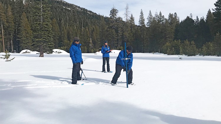
SACRAMENTO, Calif. — California’s first snow survey of the 2020-21 season is happening Dec. 30 at the Phillips snow course in the Sierra Nevada.
The Department of Water Resources will conduct five of these surveys through May by plunging a long steel tube into the snow. This will measure the snow's depth and give an estimate of its water content.
Winter and spring snow surveys provide valuable information to water managers. About 30% of California’s water comes from snowmelt runoff. As the water moves downstream, it fills reservoirs. These large water retention areas not only hold water for the dry, warm summer months but also provide valuable flood protection.
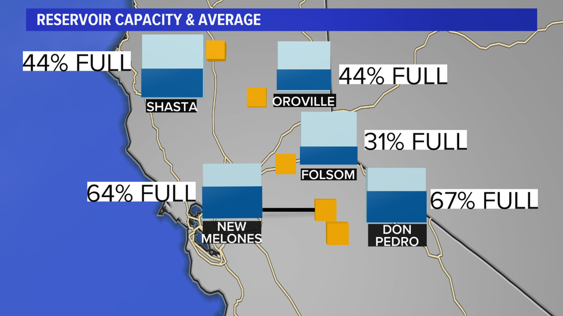
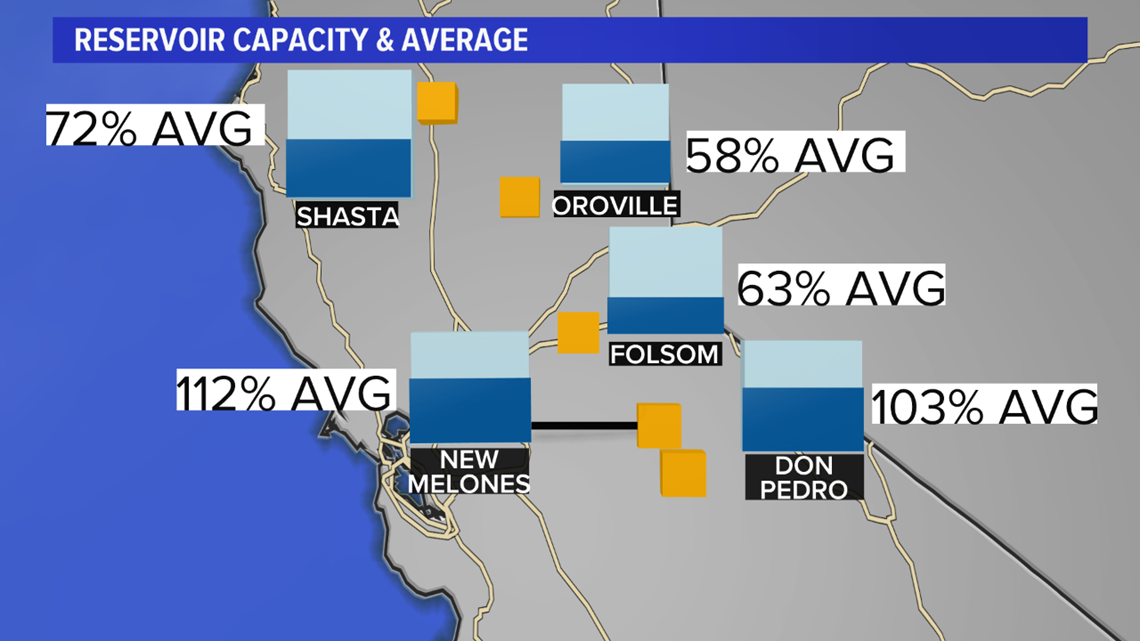
The images below show where our major reservoirs are for capacity and averages for this time of year.
Reservoir Capacity

Reservoir Average

Manual surveys and real-time estimates are critical when preparing for drier times of the year or big storms that could melt snow quickly sending large amounts of melted snow down the hill.
The snow survey data is also helpful for residents, hydroelectric power companies, farmers and the recreation industry. In years of low snow, there is less available water and restrictions must be put in place. Effects can be felt from increased prices for food and utilities.
The 2020-21 water year is off to a slow start. Electronic snow monitoring stations show below normal snowpack in the northern, central and southern Sierra. This leaves the statewide average at 48% with about 4.00” of water content. The manual survey will help to verify these numbers.

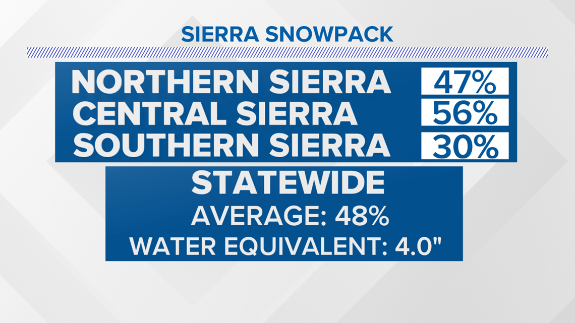
As seen in the three charts below, each basin for snow measurement is showing below average conditions. This means less runoff possible in the spring and less available surface water in the summer months.

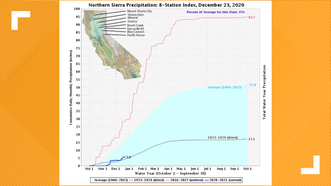

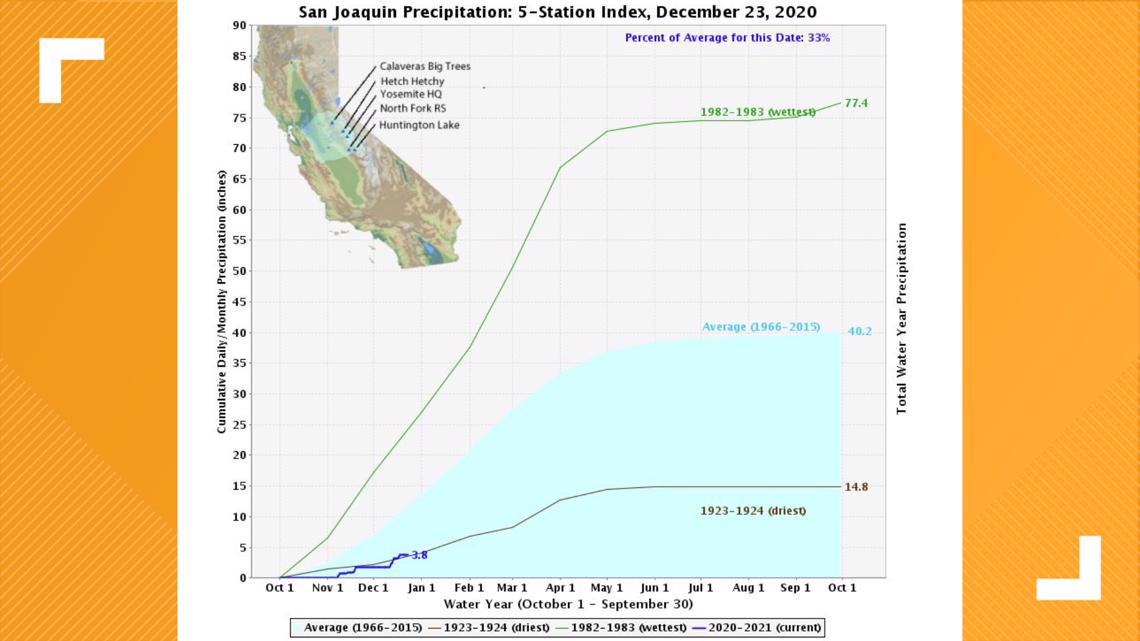

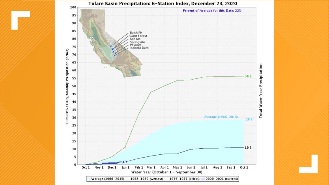
California depends on less than 10 large systems each year to deliver snow to the Sierra. The wettest months are typically December, January, February and March. Most storms after that are too warm to add considerable snowpack.
WATCH ALSO:


