SACRAMENTO, Calif —
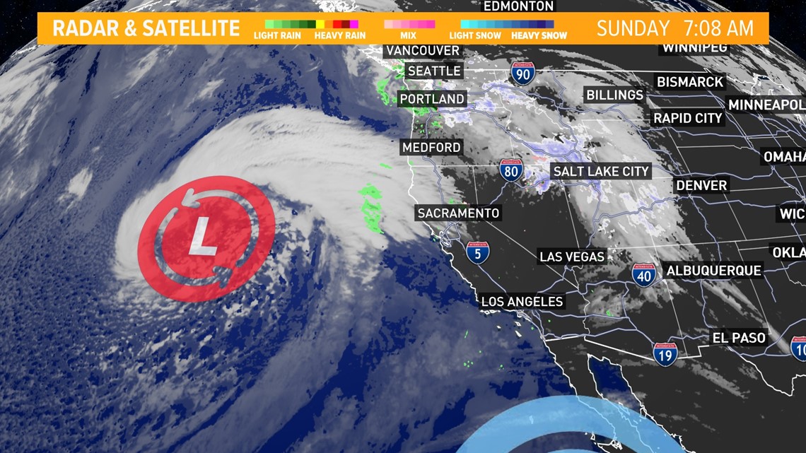
An active start to 2024 continues Sunday as a third storm in seven days strikes Northern California.
The second storm in the sequence pushed through Northern California on Saturday and generally dropped 0.3-0.5” in the Sacramento area, but a strong line of rain pushed through areas like Citrus Heights, Roseville, and Rocklin and totals were closer to an inch.
Further south in San Joaquin County, totals were much lighter with only 0.1-0.2” falling.
Sierra snow totals ranged from 4-10". The Central Sierra Snow Lab received 7.5” and the station is now at 85% average snowfall to date.
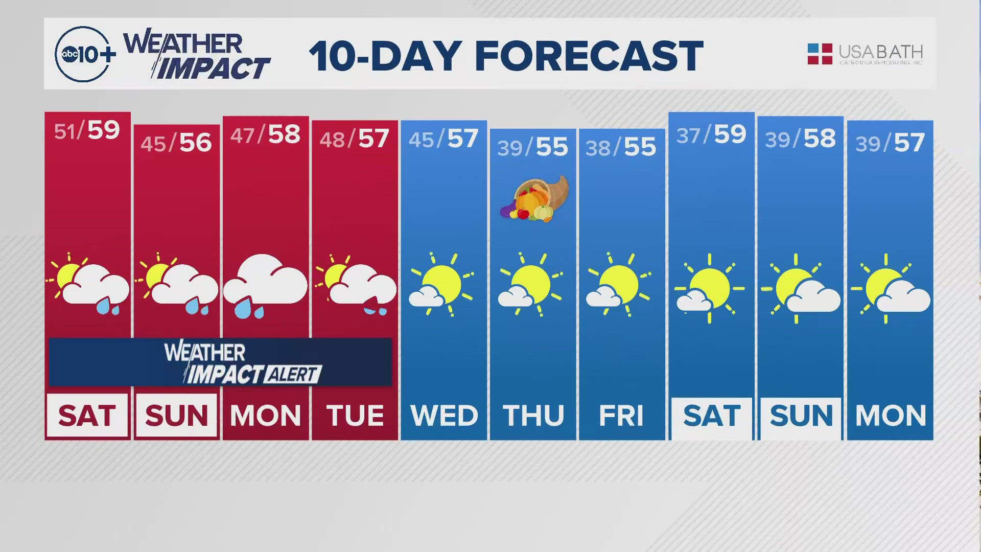
Sunday will be on the warmer side with highs in the mid to upper 60s in the valley and breezy winds as the storm spins closer to the coast.

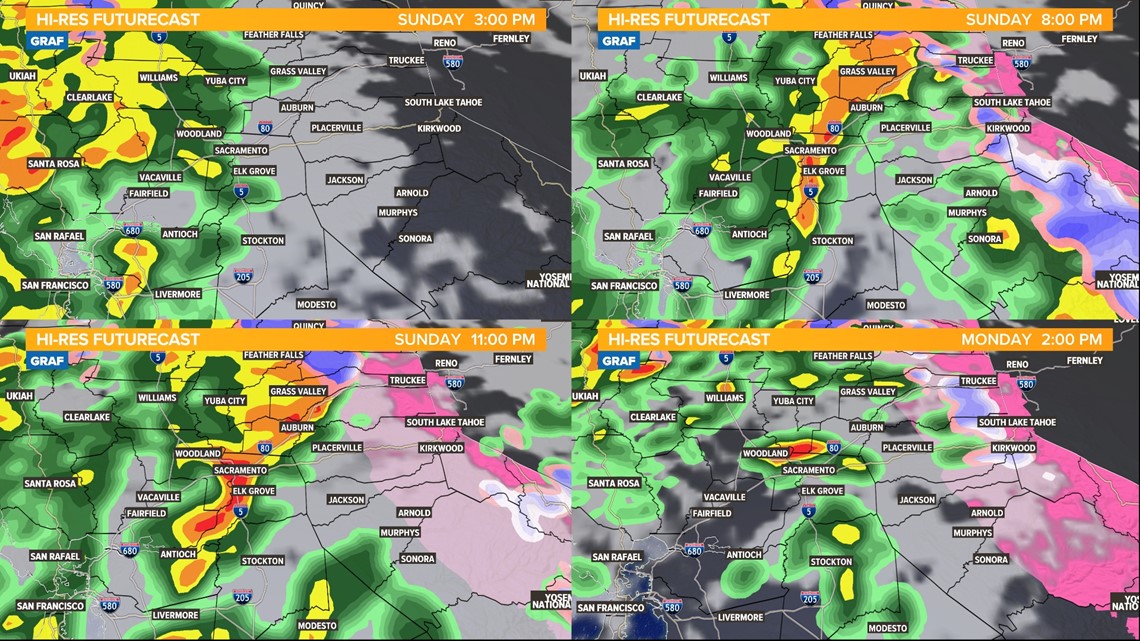
Sunday night through Monday morning will be marked by periods of heavy rain and snow. Rain is expected to begin in the Sacramento area around 4 p.m., continuing until around sunrise Monday.
The heaviest rain is expected around 3 a.m. in the valley but is expected to lighten up by the Monday morning commute.
A Flood Watch goes into effect across the valley on Sunday afternoon and continues until Wednesday morning. Creeks and streams will be running high, as will the major rivers.
Weather models are picking up on the possibility of some entrainment happening with the rainfall overnight.
A band of rain may develop and become somewhat stationary during the evening and overnight hours.
If this band sets up and does indeed become somewhat stationary, the flood risk on roadways and other urban areas increases. Rainfall totals under the band will also be inflated and could blow past the forecast.

In the Sierra, extreme impacts are expected due to snowfall rates of 2-3" per hour creating whiteout conditions when paired with the gusty winds. Chain controls and road closures are possible through Wednesday.
Following the main band of precipitation on Sunday night through Monday morning, scattered showers will continue through Wednesday thanks to the low pressure parked off the coast.
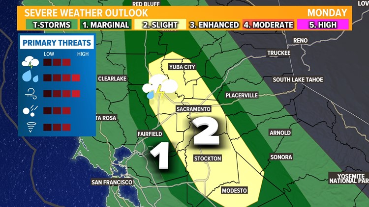
Monday has all the ingredients to be an impactful severe weather day. The Storm Prediction Center has issued a level 2 out of 5 “slight” risk for severe weather for Monday in the Southern Sacramento and northern San Joaquin Valley.

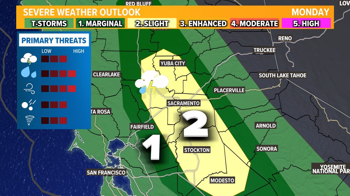
Thunderstorm development will be dependent on how much clearing there will be in the cloud field. Clearer skies early in the day will help to destabilize the atmosphere, aiding in the formation of thunderstorms in the afternoon.
The environment will also be favorable for tornado or funnel cloud development, with a 5% chance according to the Storm Prediction Center.
Since 1970, Sacramento County has had 15 confirmed tornadoes and San Joaquin County has had 17. Tuolumne County had its first confirmed tornado last March near Tuttletown.
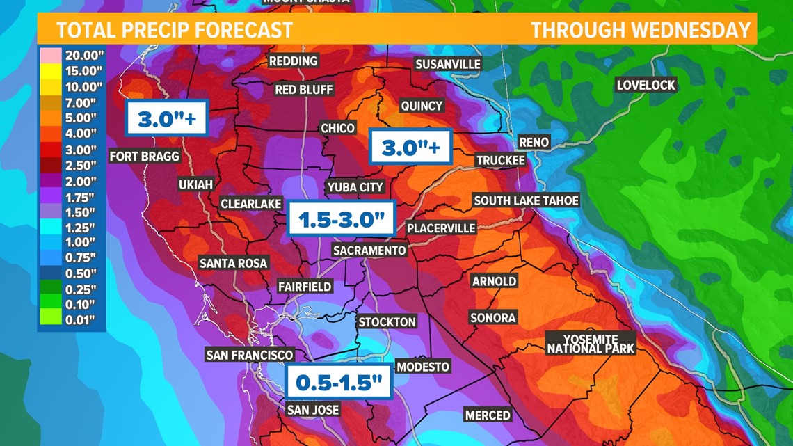
Rain and snow continue on Tuesday but do get lighter. Some non-severe thunderstorms are possible on Tuesday. When it's all said and done, rainfall totals are expected to be between 0.5" - 1.5" in the San Joaquin Valley and 1.5" - 3.0" in the Sacramento Valley.
Cape Mendocino and the Coastal Range could see up to 5" of rain while the Sierra foothills pick up more than 3".
1-2 feet of snow are expected in the Sierra above 5,500 feet and 3 to 4 feet at the highest peaks.

A return to dry weather is expected on Thursday but more wet weather is possible by next Sunday.
WATCH ALSO: