SACRAMENTO, Calif —
Much like last week, two cold storm systems dropping into California from the north will bring light rain and heavy snow to the region this week.
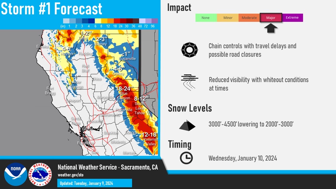
The first system will produce rain and snow Tuesday and Wednesday, but Wednesday will be the main event, particularly in the Sierra. A Winter Storm Warning is in effect for the Sierra from 4 a.m. Wednesday through 1 a.m. Thursday.
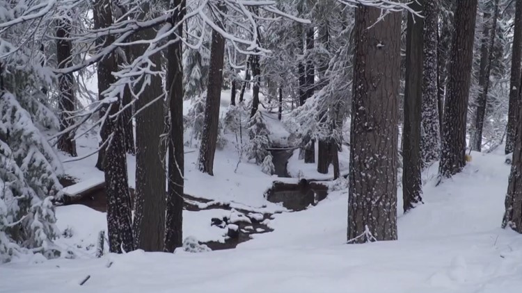
Snow will be the main story this week rather than rain. The first system is only expected to bring 0.10-0.25” of rain in the valley but the Sierra will be looking at snowfall totals of 1-2 feet.
Here is a timeline of what can be expected this week.
Tuesday evening
Rain showers are possible across the valley throughout the day but don’t expect more than a few hundredths in areas where showers do pop up. Some areas experienced light rain Tuesday around noon, mainly in the eastern Sacramento Valley and foothills. A few pop-up snow showers are expected in the Sierra prior to the main event Wednesday morning.
About 0.01-0.1" of rain is possible in the valley Tuesday along with a few inches of snow in the Sierra.
Wednesday morning
Following a break in precipitation overnight, the rain and snow will pickup during the morning hours. The heaviest snowfall will begin Wednesday morning, so expect travel delays throughout the day.
Winds will be gusty with gusts as high as 50 mph in the Sierra. Paired with the heavy snowfall rates, travel will be extremely difficult and is discouraged.
The best chances for rain in the valley will be after 10 a.m. with showers continuing throughout the day.
Wednesday evening
Periods of heavy snow will continue in the Sierra throughout the evening hours. Precipitation will begin to taper off Wednesday night as the storm heads east. Expect for the snow to wrap up by midnight.
Snow totals will be heavy from this event and snow levels will begin around 4,000 feet, lowering to 2,500-3,500 feet by Wednesday. About 1 to 2 feet is expected above 4,000 feet with 3 feet possible over the highest peaks.

Thursday
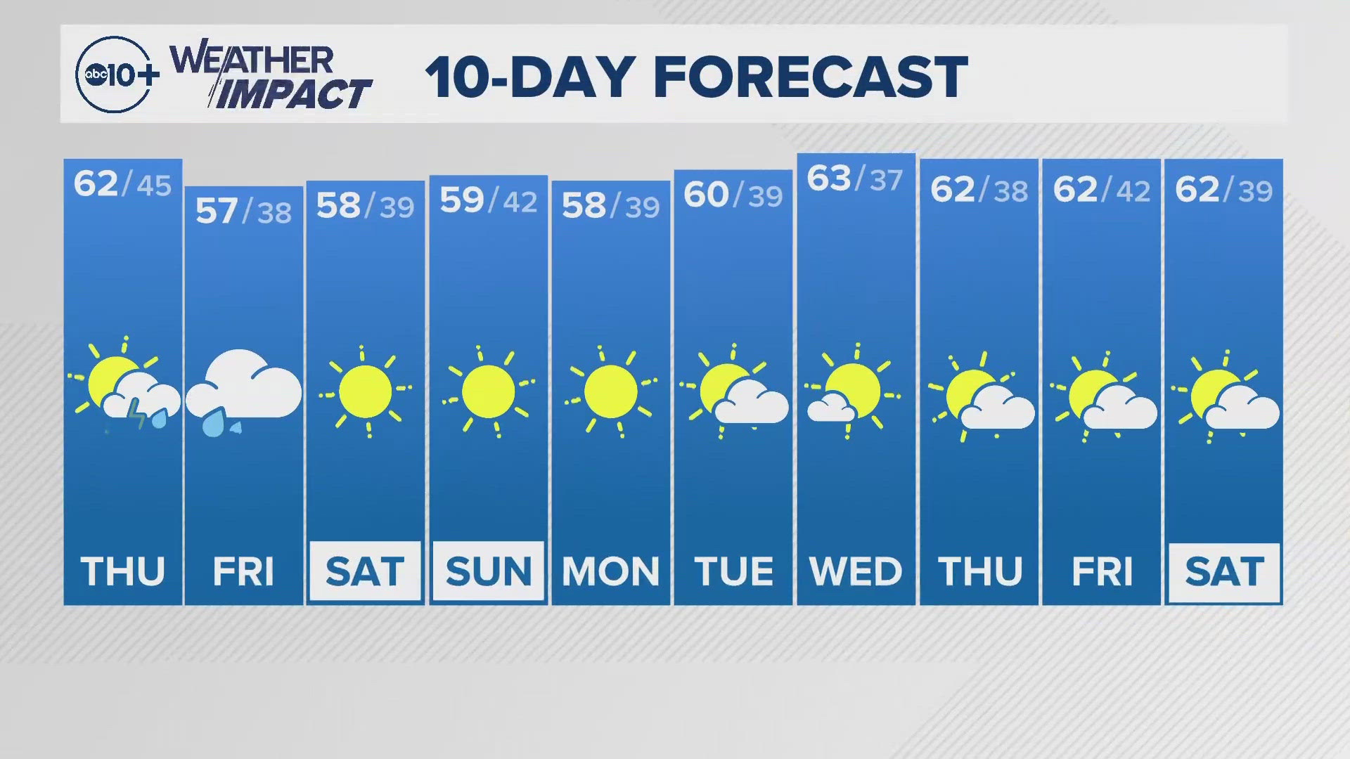
As the storm exits the regions and the skies clear up, temperatures are expected to drop below freezing across most of the valley. High temperatures will remain on the cool side with a high of 51 degrees forecast for Sacramento. High temperatures will stay below average before a warming trend begins on Sunday.

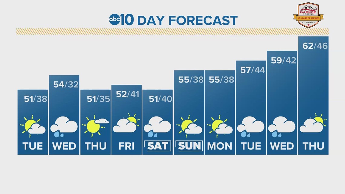
This weekend and beyond
There is still a large degree of uncertainty in the weekend storm. The European weather model shows the center of low pressure further south than the American model, so the European is favoring much more rain and snow than the American. The Climate Prediction Center continues to favor both warmer and wetter than normal conditions over the next 14 days.