SACRAMENTO, Calif. — A second atmospheric river aimed at California is expected to make its way onshore Monday night.
A strengthening low pressure system is advancing toward California. The rotation of the storm is collecting subtropical moisture which will act as the “Pineapple Express” that is expected to arrive late Monday night.
Even less than 24 hours out from the event, uncertainty remains in the placement of the low pressure system as it arrives onshore. The European model has the storm as slightly windier and wetter than the American model but widespread impacts are expected nonetheless.
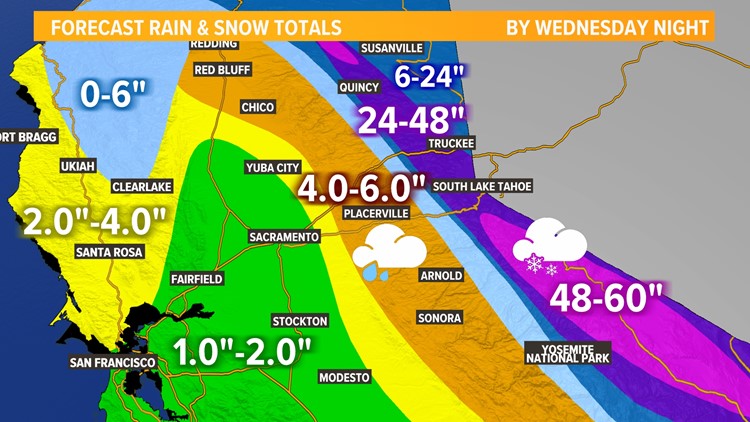
This will be another warm system, pushing the snow/rain line past 7,500 feet by Monday night. Areas above 8,000 feet will see extreme snowfall, upwards of 6 feet. Areas from 6,000 to 8,000 feet will see 1 to 3 feet of snow likely along with periods of heavy rain.
Monday afternoon
Isolated showers will precede the main event later tonight. Thunderstorms are also possible due to bountiful moisture and cold air aloft, resulting in unstable air.
The thunderstorm chances aren’t as high they were on Saturday and Sunday but strong storms are still possible. The main threats associated with any thunderstorms that form will be brief heavy rain, small hail, gusty winds, lightning and possibly a funnel cloud.
Monday Night
Winds will begin to pick up with the onset of the main band of precipitation.
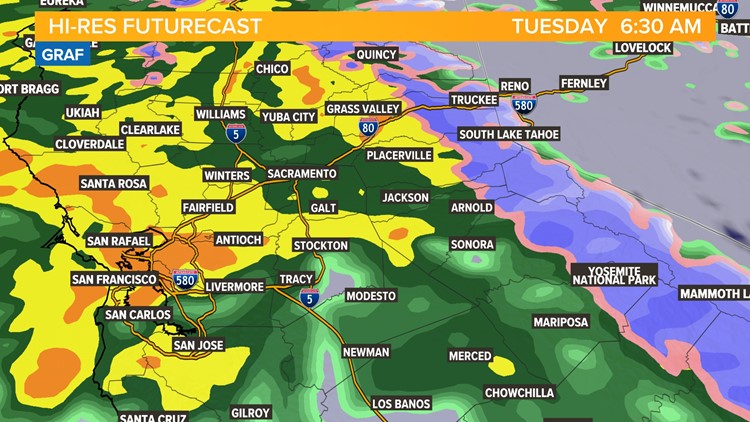
The main rain band is expected to reach the valley by 10 p.m. tonight and will pick up in intensity in the early morning hours of Tuesday.
Expect persistent rain in the overnight hours.
Tuesday Morning
Widespread rain will accompany the morning commute but the band of rain associated with the atmospheric river will begin to fracture, leading to scattered shower activity by noon.
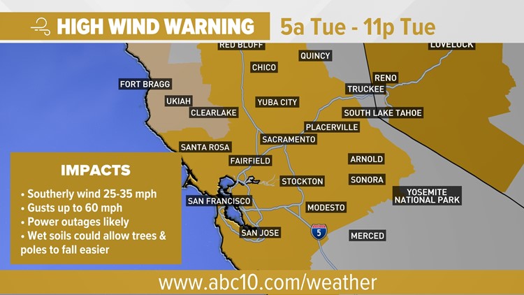
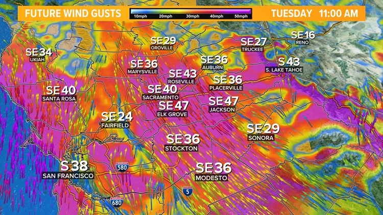
Scattered showers will continue for much of the day. The main concern on Tuesday, along with flooding, will be very strong winds as the center of the low pressure moves inland.
Gusts of 45-50 mph are expected in the valley and these winds could be even stronger depending on the behavior of the low pressure. Power outages and downed trees are likely.
By the time the system blows out of the region by Wednesday, the valley will likely receive 1-2" of rain while the foothills will see 3-5".
3/13-14 AR
WATCH ALSO:

