SACRAMENTO, Calif. — Flood concerns will once again rise as a warm atmospheric river barrels toward California.
The jet stream, transporting copious amounts of subtropical moisture from Hawaii, will take aim at California with the assistance of a low pressure system spinning off the Oregon Coast.
Heavy rain, high snow levels, gusty winds and possible flooding will be the main hazards associated with this system.
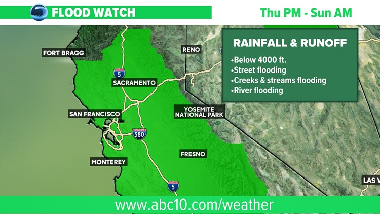
A Flood Watch is in effect for most of Northern California below 4,000 feet due to heavy rain and snow melt until Sunday.
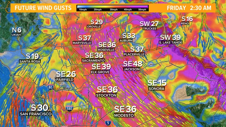
A Wind Advisory is in effect from 4 p.m. Thursday until 4 p.m. Friday for most of the same areas.
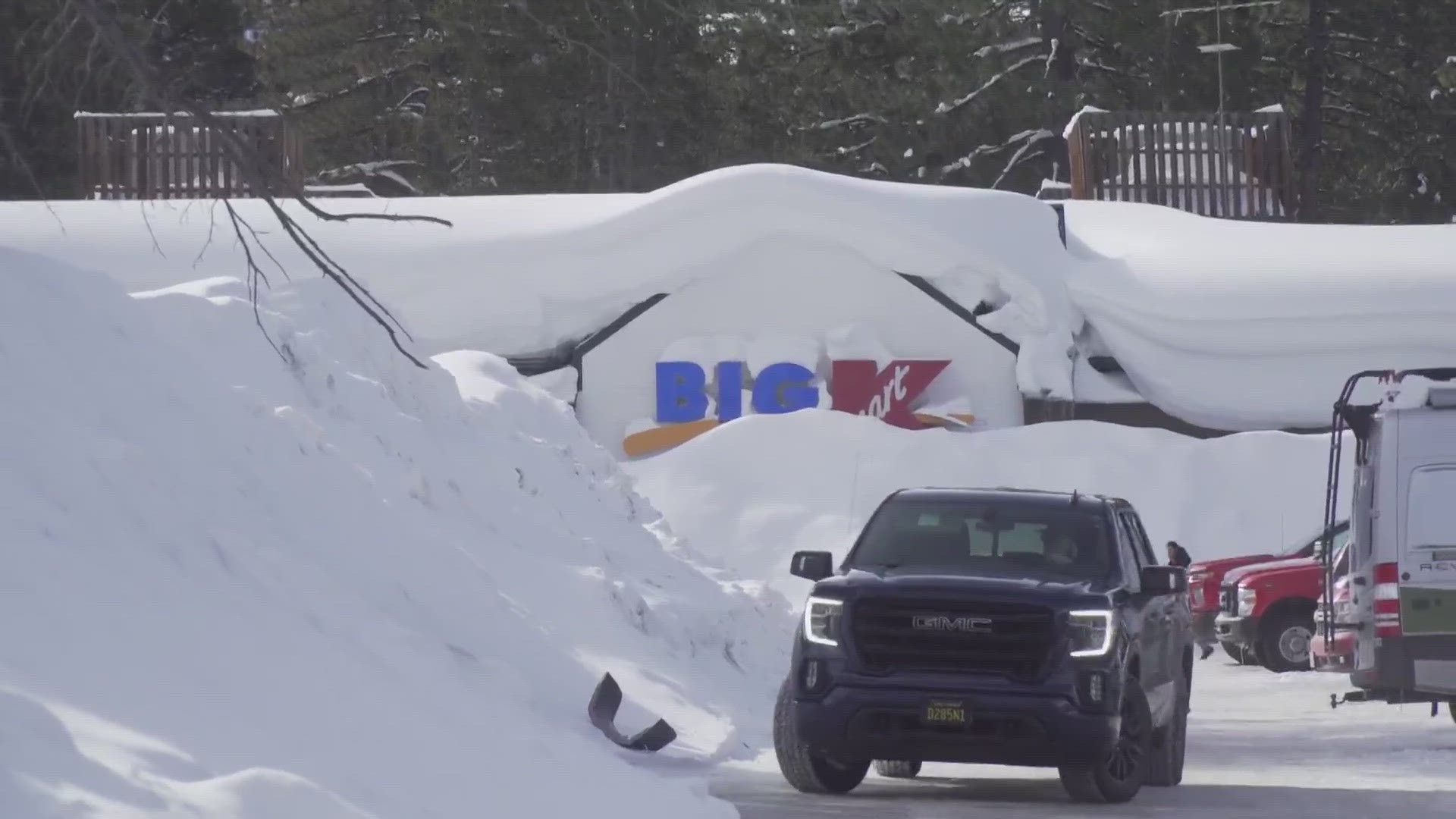
A Winter Storm Warning is in effect for the Sierra until Sunday. Areas above 8,000 feet could see upwards of 100" of snow by Sunday.
Thursday Afternoon
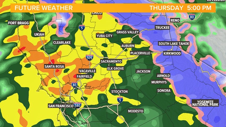
Rain has already moved onto California’s shores and is advancing inland. The rain will be widespread by Thursday afternoon and will likely cause a messy commute Thursday night.
Temperatures will be relatively cool this afternoon as the moisture continues to move in. High temperatures in the low to mid 50s are expected in the valley.
The snow line will continue to advance up the mountain as the storm moves in, bringing warmer air along with it.
Thursday Night
Rain will be steady into Thursday night apart from a few breaks.
Power outages and downed trees will be a concern as the strongest winds occur overnight Thursday and into Friday morning. Winds of 30-50 mph are expected in the valley and 50-70 mph in the Sierra.
The early morning hours Friday will see the highest snow levels. Snow levels will shoot up to 8,000 feet early Friday morning and areas below this elevation will see heavy rain during this period.
Friday Morning
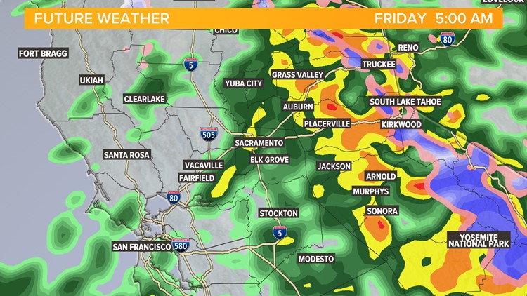
Rain showers will likely still be lingering for the Friday morning commute but will lighten up or even stop before lunchtime.
The snow levels will drop throughout the day behind the cold front but will still remain above pass level.
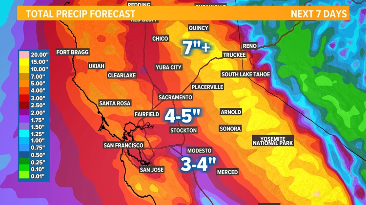
By Sunday, rainfall in the valley is likely be in the 2-3" range and 5-7.5” in the foothills.

