SACRAMENTO COUNTY, Calif. —
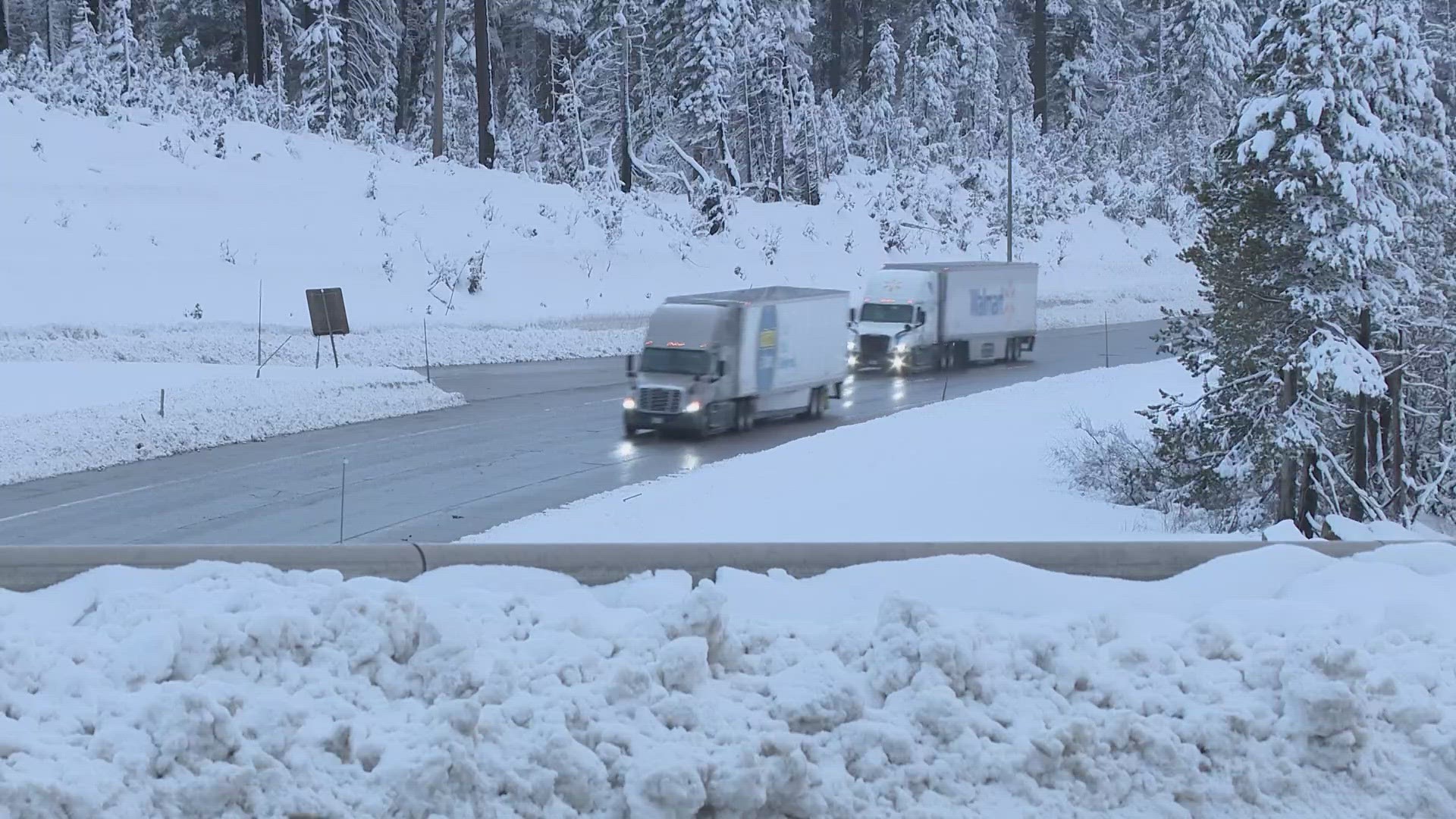
Although the bulk of the rain and snow has passed, scattered rain and snow showers are expected throughout the day on Thursday. The scattered nature of the showers means that some areas will see periods of moderate to heavy rain while others will be dry throughout the day.
Heavy rain fell on Wednesday night and most valley locations received 0.5-1.5". Sacramento Executive received 0.94,” Stockton 0.59,” Modesto 0.97,” Vacaville 1.58,” Orangevale 1.25,” Roseville 1.03,” and Placerville 0.85.”
Here’s a timeline of what can be expected as the most powerful storms so far this year arrive.
Thursday afternoon
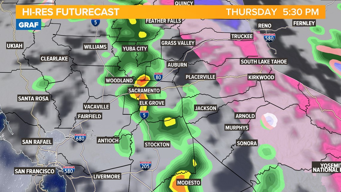
Thunderstorms are possible Thursday afternoon depending on how much sunshine can peak through the clouds after the cold front passes. As of 2 p.m., a few thunderstorms have formed in the San Joaquin Valley and southern Sacramento Valley.
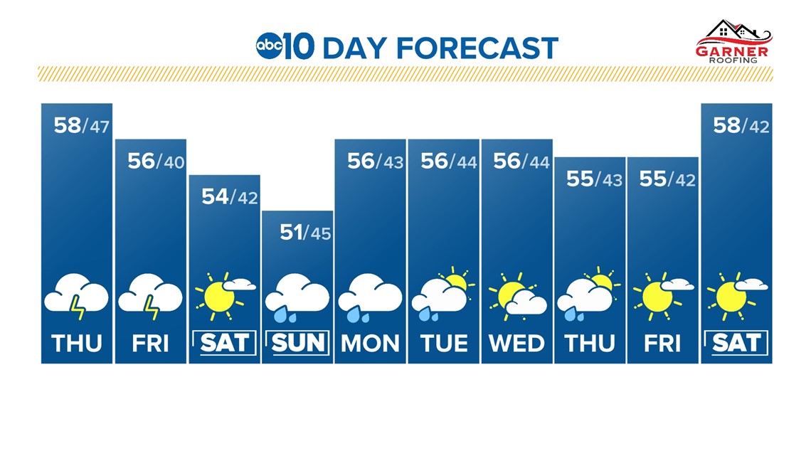
Otherwise, expect periods of rain and snow throughout the day. High temperatures will be in the upper 50s in the valley, 40s and 50s in the foothills, and 30s in the Sierra.

Friday
Isolated showers will continue in the valley on Friday along with more snow in the Sierra. Snow levels will be much lower and snow is possible as low as 3,000 feet on Friday. More thunderstorms are possible as well.
An additional 0.1-0.25" of rain is expected through Friday along with 6-24" of fresh snow above 5,000 feet.
Saturday
Saturday will act as a break between systems but light snow showers are still possible in the Sierra. High temperatures will still be on the cool side with highs expected to be in the low to mid 50s in the valley and 30s in the Sierra.

Sunday
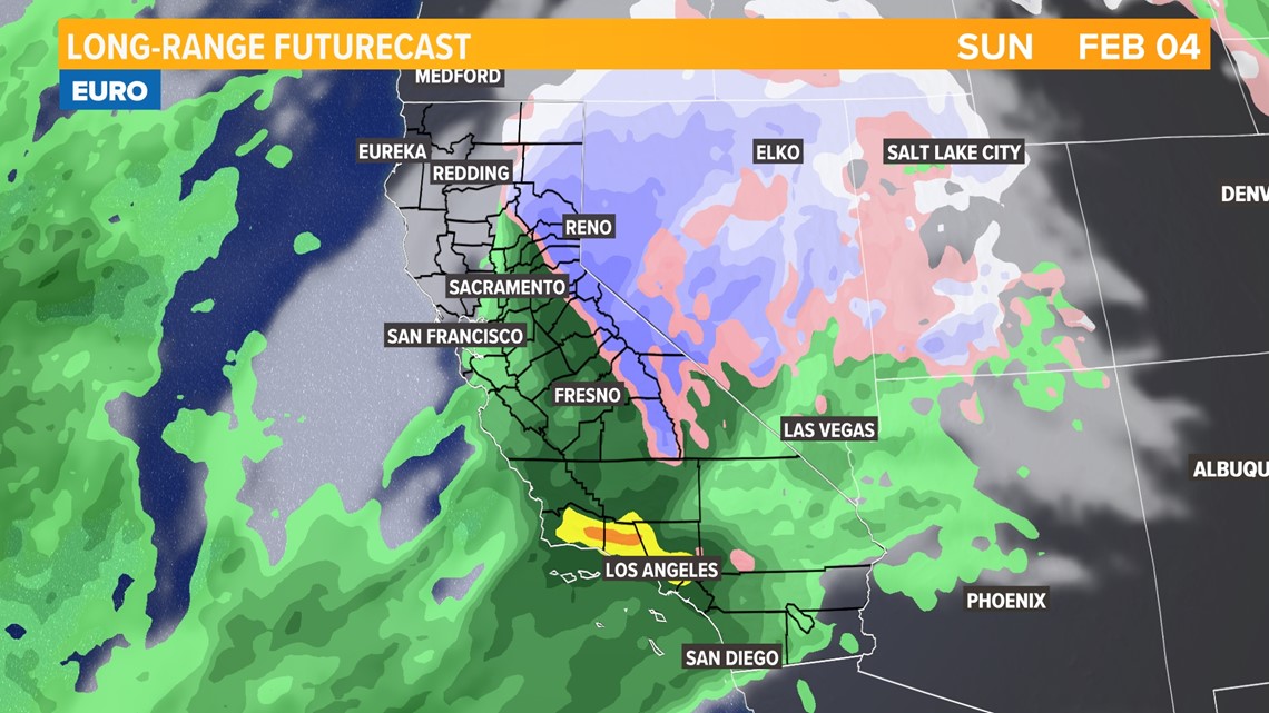
The second storm of the series will begin to impact Northern California by Sunday.
This will be the cooler of the two storms and more heavy rain and snow is expected but uncertainty remains in totals at this point. While periods of heavy rain and snow are expected in Northern California, the worst of the storm will impact Southern California.

WATCH ALSO:

