SACRAMENTO, Calif. —
The unseasonably cool weather this weekend will be replaced by extreme heat by next weekend.
Early signals are pointing towards this being an impactful, potentially dangerous heat event by the end of the week.
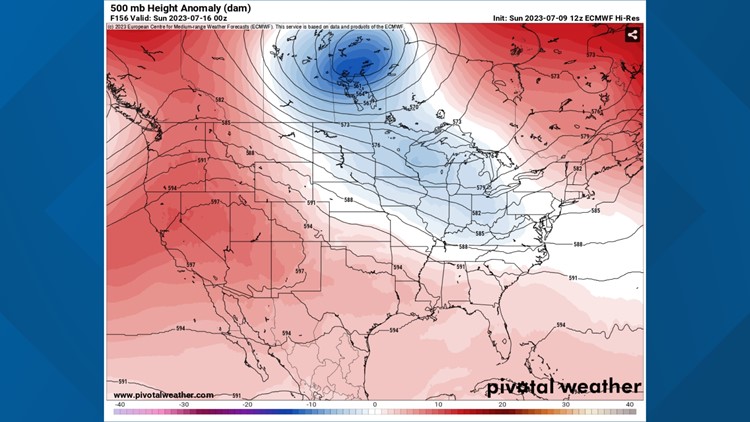
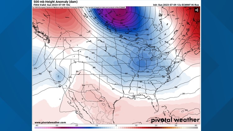
The workweek forecast will be dominated by a warming trend as the low-pressure system that kept things cool this weekend moves off to the northeast.
In its place, a very strong ridge of high pressure will shift west and California will fall under its influence.
While it will be centered over Las Vegas, the dome of heat created by the ridge will spread north and west, potentially pushing temperatures above 110 in the Central Valley by Saturday.
As the ridge continues to amplify and shift further over California, temperatures will rise daily. High temperatures are expected to rise throughout the week but the heat will not peak until the weekend.
Hot weather inbound
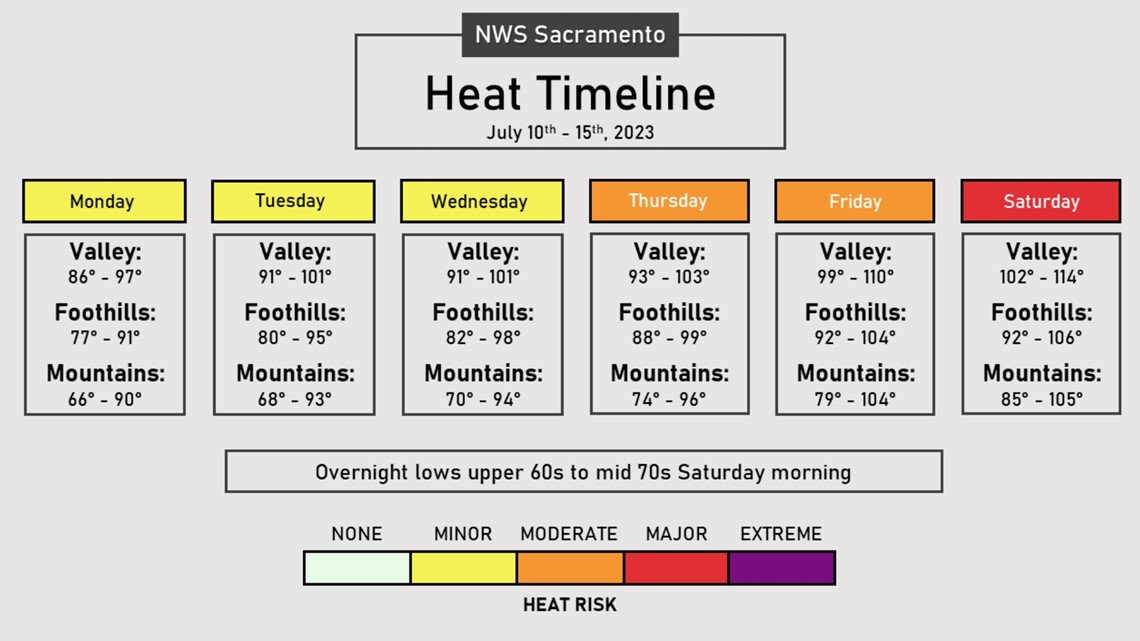
Monday in Sacramento looks to be the last below-average temperature day for the foreseeable future. A high of 90 is forecast for downtown Sacramento, lagging a few degrees below the mid-July climatological average of 94-95.
Temperatures will rise to the mid to upper 90s in Sacramento on Tuesday and will be similar, maybe even a degree or two cooler due to an upper-level disturbance, on Wednesday.
Thursday will see temperatures near 100 for most of the valley and even hotter by Friday, likely well past 100. Saturday and Sunday will be the peak of the heat event.


The decreasing influence of the delta breeze means that overnight lows will remain well above average, particularly on Friday and Saturday morning when lows will be in the upper 60s to mid-70s.
Sierra thunderstorms aren’t expected to be an issue this week due to a lack of moisture in the atmosphere.
Temperatures will be much above average in the Sierra this week and South Lake Tahoe has a chance to even hit 90 on Saturday.
Relative humidity values are expected to decrease throughout the week, potentially to the teens and single digits.
Winds are expected to be relatively calm due to the high-pressure building in, but anytime relative humidities are that low this time of year wildfire becomes a growing concern.
WATCH ALSO:


