
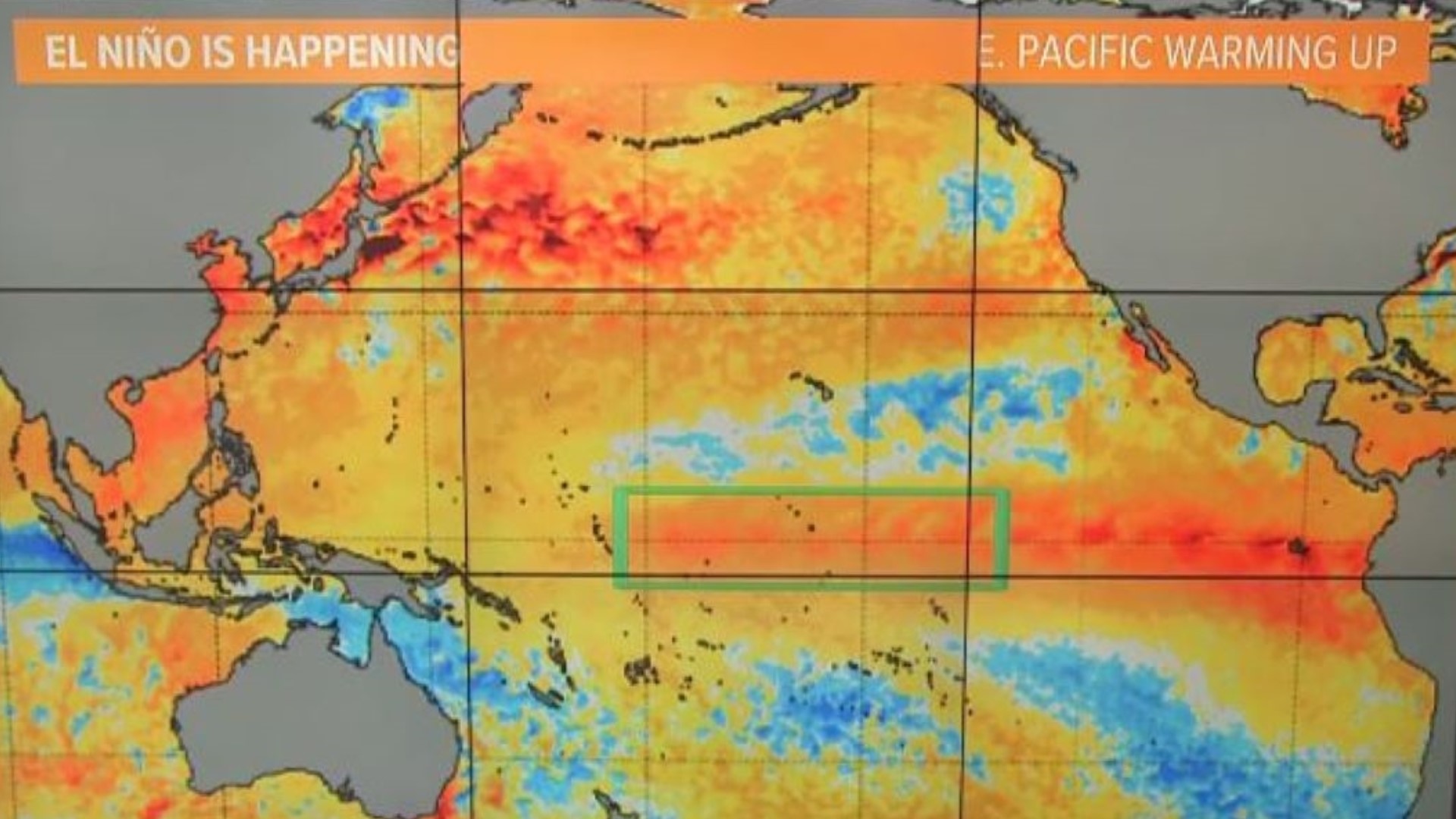
CALIFORNIA, USA — El Niño is continuing to intensify and has reached strong status according to the latest update from NOAA.
Sea surface temperatures (SST) in the central and east-central Pacific Ocean were 2.7°F above average from August to October, meeting the criteria for a strong El Niño event. Weak El Niño events began at 0.5°C.
Forecasters watch a global pattern like this closely for the possible impacts on daily and seasonal weather events. In California, strong El Niño events typically favor a wetter than average Southern California with Northern California having a normal chance of a dry or wet season.
But whenever El Niño is mentioned, the attention turns to flooding. It’s El Niño years like 1982-83 or 1997-98 that are hard to erase from memories when the sheer volume of water from either rainfall or Sierra snowmelt put so much pressure on levees that they simply couldn’t hold, eventually flooding valley towns.
Just like every storm, each El Niño delivers varying impacts. The rainy season of 2015-16 was occurring during a very strong El Niño pattern and the results were mixed with much of California experiencing normal to below-normal rainfall while the Pacific Northwest was very wet, when in past years it had been dry.
Currently, El Niño conditions and base conditions are increasing. Forecasters expect this pattern to continue for the next several months. There’s a 62% chance of it lasting into June 2024 with a peak in January.

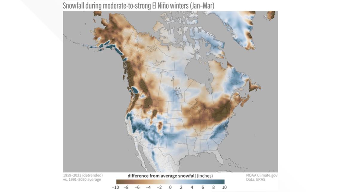
Snow is also a big story when it comes to El Niño since these weather patterns can favor a slightly warmer storm cycle and higher snow level. This shift in snow versus rain can have a couple of impacts including recreation and runoff. Many of the Sierra resorts rely on snow levels that start at about 6,000 feet for maximum use of the mountain. There have been years when the resorts simply couldn’t open lower runs due to lack of snow. The other impact that has more wide-reaching effects is runoff concerns when more rain than snow falls at higher elevations. Gravity will move that water quickly downhill. If this pattern lingers, water managers have to carefully orchestrate the release of water to make room for what is heading toward the valley.
Many dams and reservoirs are operating with well above average levels and management for flooding will be the top concern early in the season.
Watch more on ABC10


