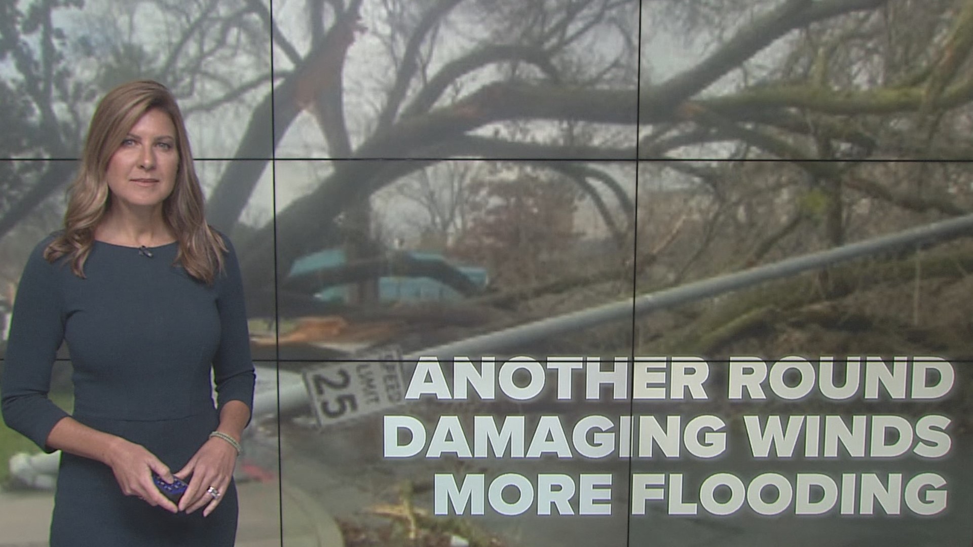
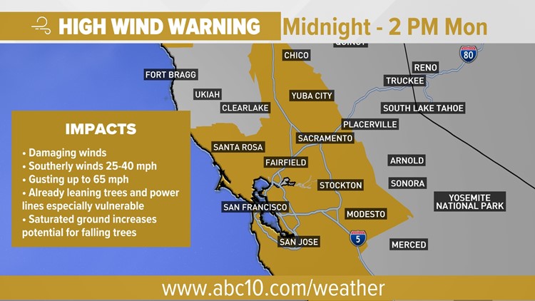
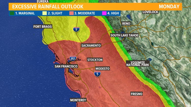
SACRAMENTO, Calif. — Another extreme impact wind event is hitting Northern California with wind gusts up to 65 mph. This is arriving on the heels of the damaging wind event overnight Saturday to early Sunday that knocked out power to over 300,000 people and flattened trees throughout the valley.
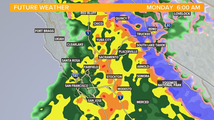
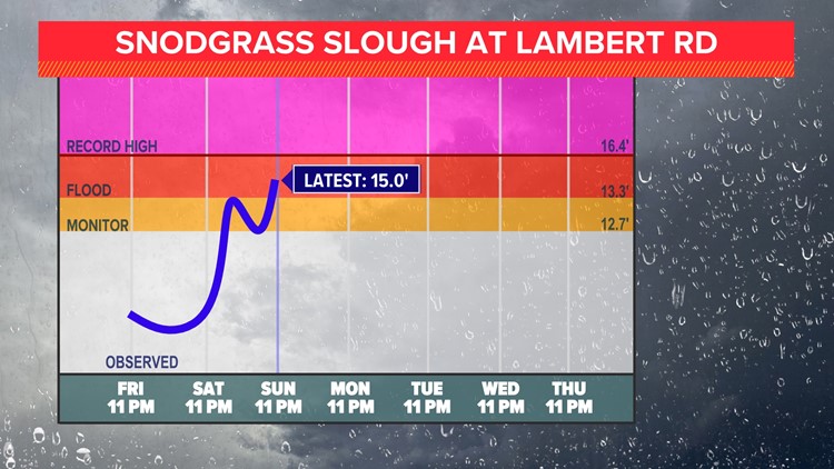
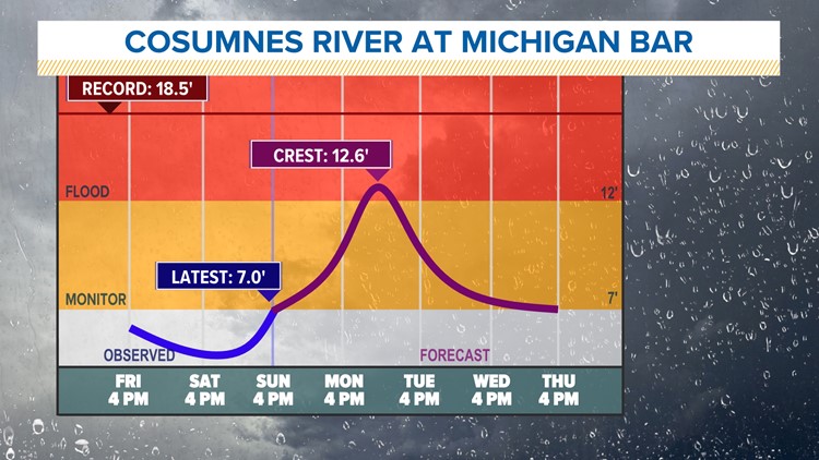
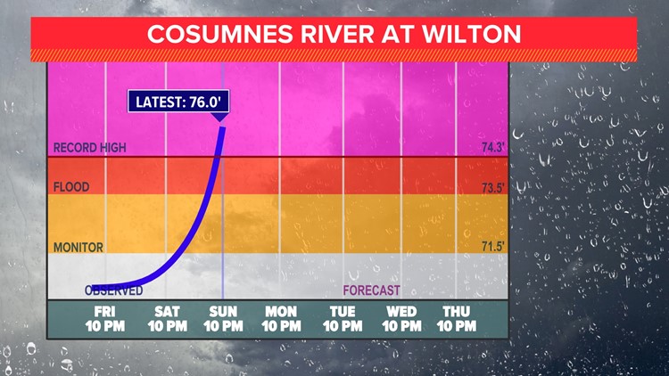
A FLOOD WARNING began late Sunday for the Cosumnes River at Michigan Bar. The incoming storm is bringing heavy rain and will produce a significant rise in the Cosumnes River. Flood Stage is expected to occur by this afternoon. Some roads will be impassable and evacuation will be difficult to impossible.

A WINTER STORM WARNING and AVALANCHE WATCH is in effect for the Sierra. Wind gusts could reach over 100 mph. Due to snow, rain, and wind, travel is not advised in Sierra with rapidly changing weather conditions.
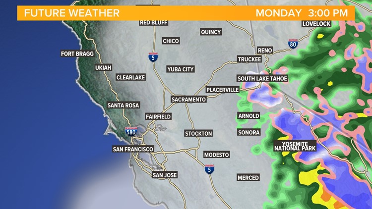
Snow levels will rise through the morning hours even above pass level, meaning much of the area will be seeing rain. This increases the flood threat for areas downstream in the foothills and valley.
MONDAY AFTERNOON
By the lunchtime and afternoon hours Monday, the rain will be winding down with some periods of dry weather. Be prepared for lingering standing water on roadways, especially in low-lying areas and near creeks. Due to plenty of storage in Oroville and Shasta and slightly lighter rainfall than expected, the Sacramento Weir will not be opened.
Winds will be dying down but there is likely to be a lot of debris on the road from trees that were blown around overnight. Travel will likely still be difficult, even for the evening commute.
Snow levels begin to drop Monday late afternoon to below the passes.
MONDAY NIGHT
Rain will begin after midnight on Monday and will continue throughout much of Tuesday. Snow levels will continue to drop behind the initial front of rain.
Flood risk will continue to be elevated but winds won't be as strong as previous nights.
TUESDAY
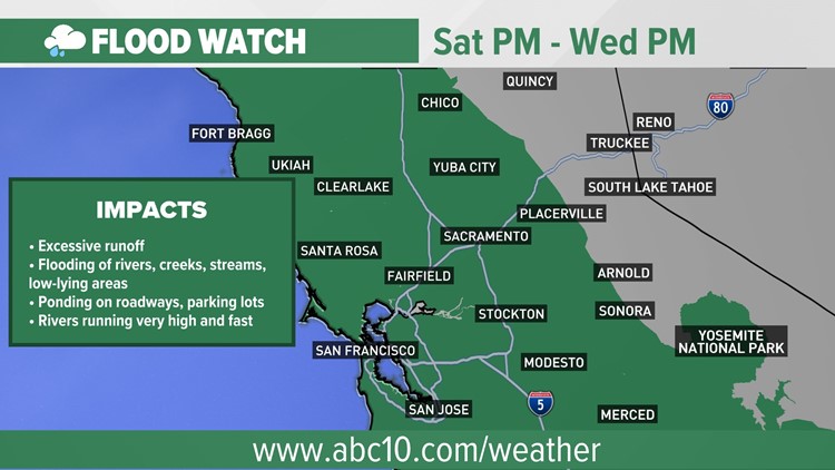
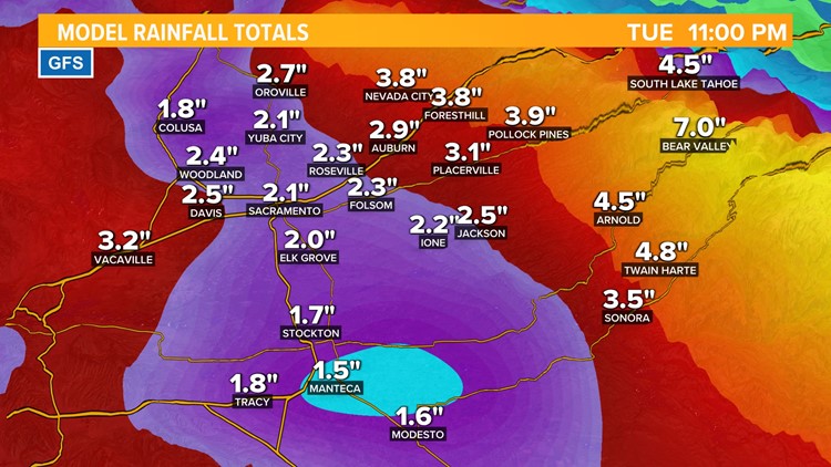
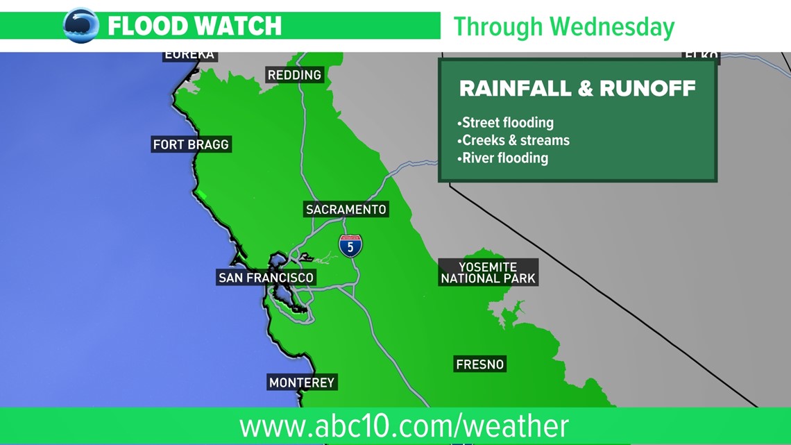
Rain and snow showers continue with the possibility of thunderstorms. Flooding concerns will continue to grow with continued rises in mainstem rivers. The FLOOD WATCH will continue until rivers, creeks and streams have receded. Another inch of rain is possible in the valley along with a few more feet of snow. Higher rainfall amounts are possible in areas affected by thunderstorms. Pea size hail, strong winds, and even a funnel cloud is possible with the thunderstorms tomorrow.
Snow levels continue to fall to nearly 4,500-5,500 feet reducing the downstream runoff.
Storm gallery 1/8
WATCH ALSO:

