
SACRAMENTO, Calif. — A cold front will bring a big change in the weather pattern midweek.
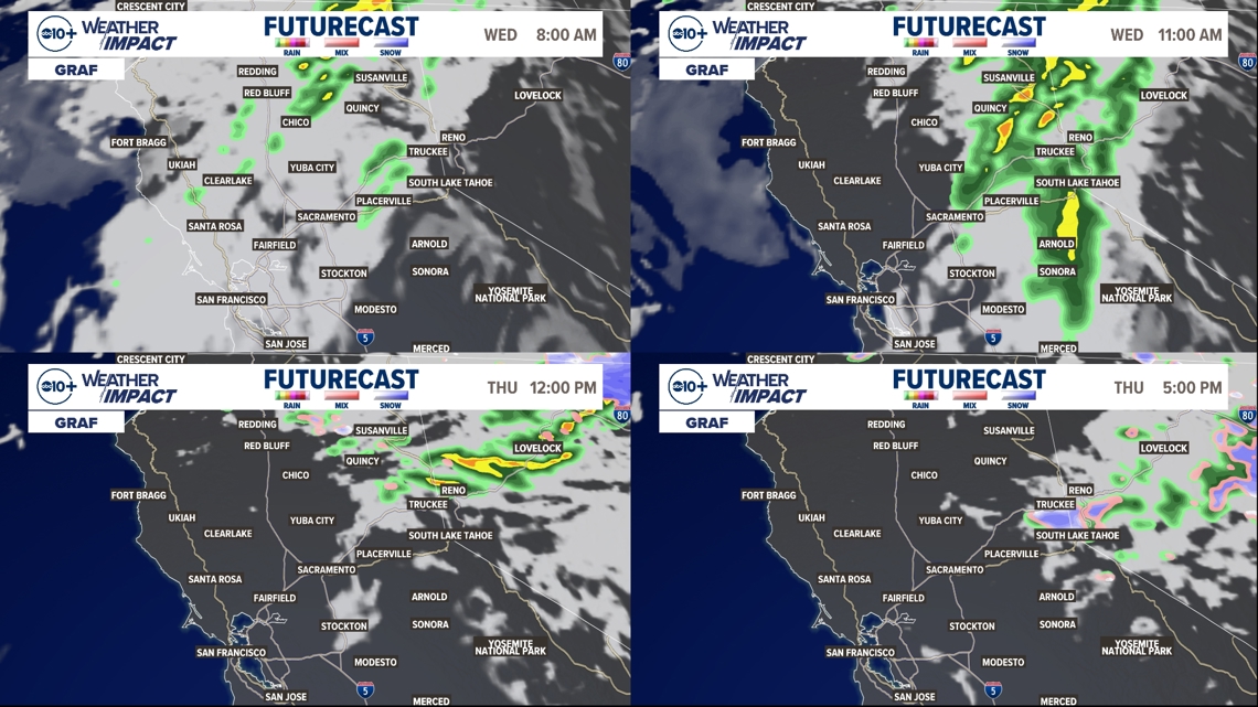
Wednesday starts with a slight chance of valley showers just after sunrise. The rain band picks up intensity as it moves east into the foothills and Sierra. Snow level will be over 9,000 feet which puts it well above the passes. There is a bit of instability with the system and a slight chance of thunderstorms for the higher elevations.
Rain mostly clear for the valley during the afternoon with little accumulation by the end of the day.
The best chances of accumulating rain will be in the foothills and Sierra, mainly north of I-80. Shower chances return for the Sierra on Thursday afternoon as the driving low pressure system brushes the east side of the state. With a colder air mass in place, snow level will drop closer to the passes. Total accumulation will be about 1-2 inches but enough to make slick driving conditions. Be prepared for rapidly changing conditions in the Sierra on Thursday.

As this system moves south and a high pressure ridge moves toward the coast, winds will pick up. This weather element is looking more concerning with dangerous wind conditions developing.
A RED FLAG WARNING is now posted from Thursday night through Saturday afternoon due to low relative humidity, gusty winds and elevated risk of rapid fire spread. Winds begin to pick up Thursday evening, strongest on Friday, and tapering off on Saturday. Valley wind gusts may be 35-45mph, Delta wind gusts 40-55mph, Foothill wind gusts 35-45mph. We may also see strong easterly gusts in parts of the Sierra, with some high country locations potentially looking at gusts in excess of 40 mph.

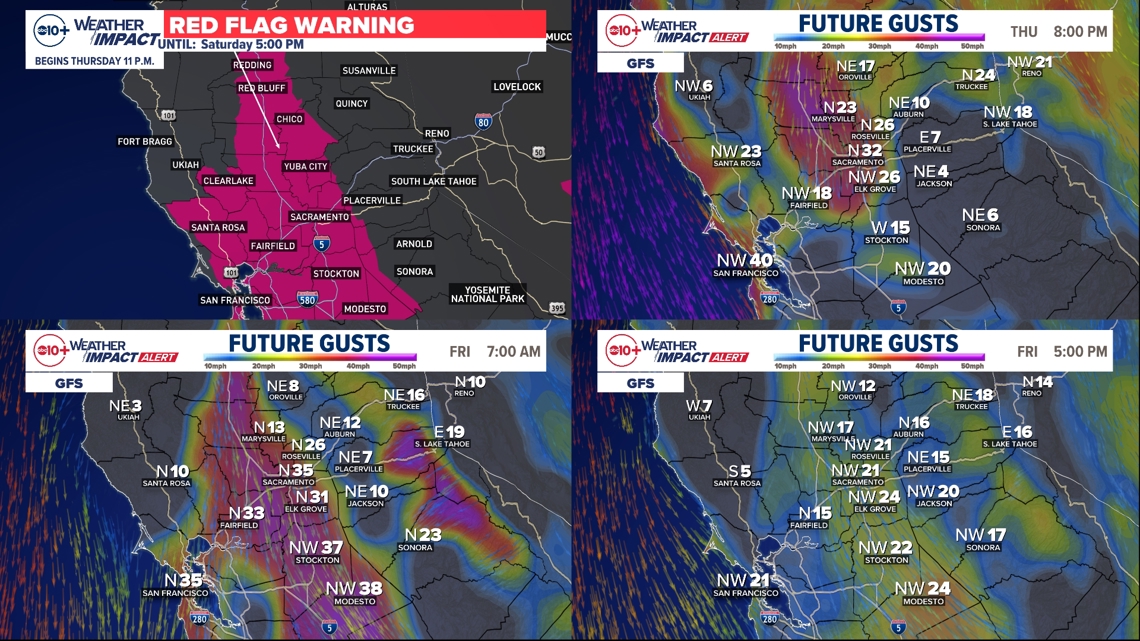
With the Red Flag Warning in the forecast, a Weather Impact Alert is posted for Thursday through Saturday.
Because any showers on Wednesday won't amount to much and fuels are so dry at this point of the year, these north wind events can really spike fire danger. In addition to the strong winds, relative humidity will take a tumble to end the workweek. We'll likely be looking at RH values in the 5-15% range during the time of the strongest north winds.
The most destructive and deadliest fires in California history have all occurred in October and November. This is the peak fire season with fuels primed for rapid spread, fueled by gusty winds.
WATCH MORE ON ABC10 | Milton Aftermath: Sacramento volunteers part of disaster relief


