SACRAMENTO, California —
Two weak cold fronts will squeeze out light rain and snow across Northern California over the next 48 hours before a warming trend begins on Wednesday.
The first of two fronts will begin to produce rain in the valley late Sunday night into early Monday morning. Ahead of the front, southerly winds will gust to 25-35 mph. Rain will only amount to around 0.10” or less in the Sacramento area with totals increasing toward the north and decreasing toward the south.
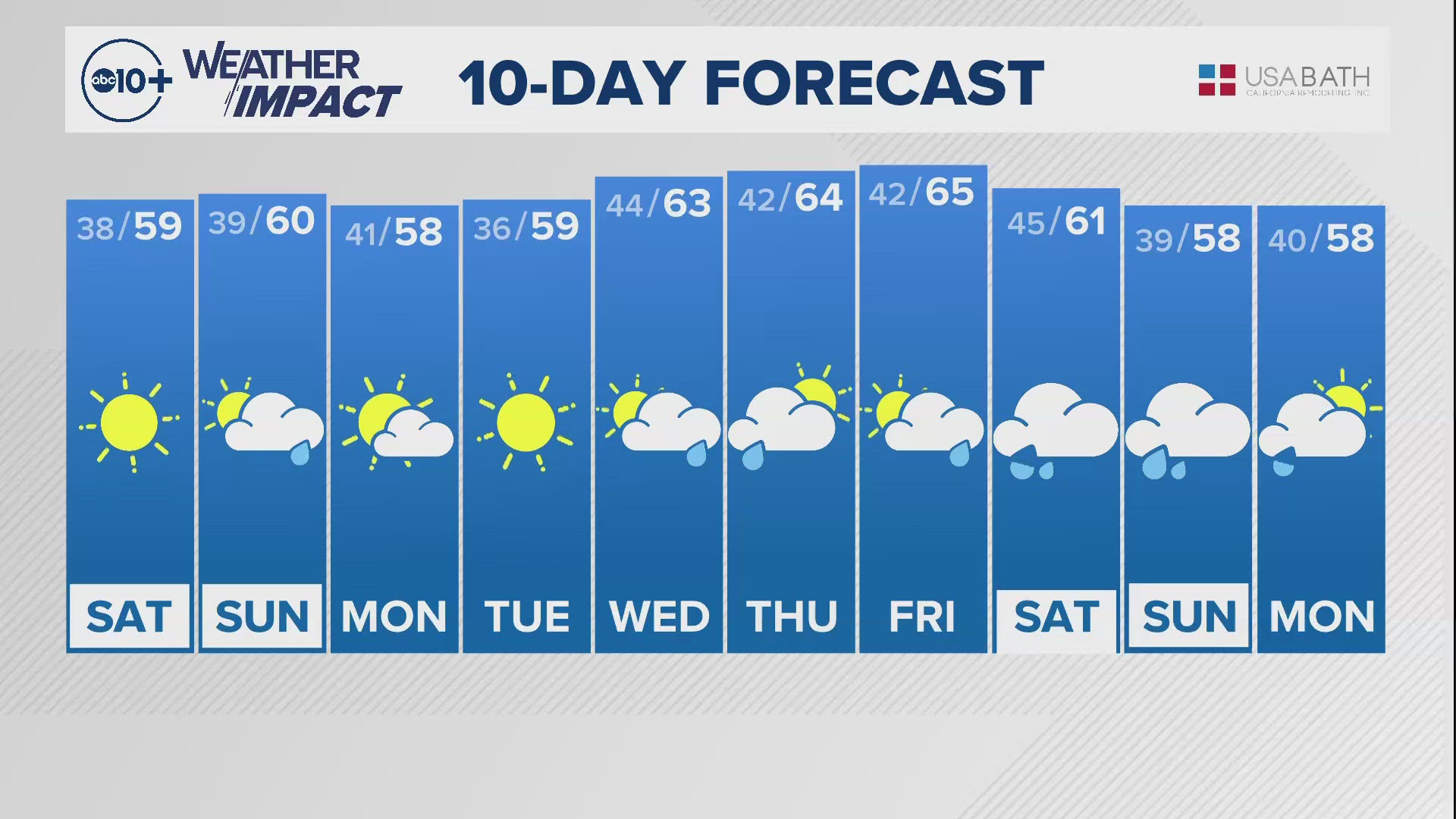
High temperatures will be in the low 60s in the valley on Monday and Tuesday which falls below the average high of 67 degrees for this time of year.
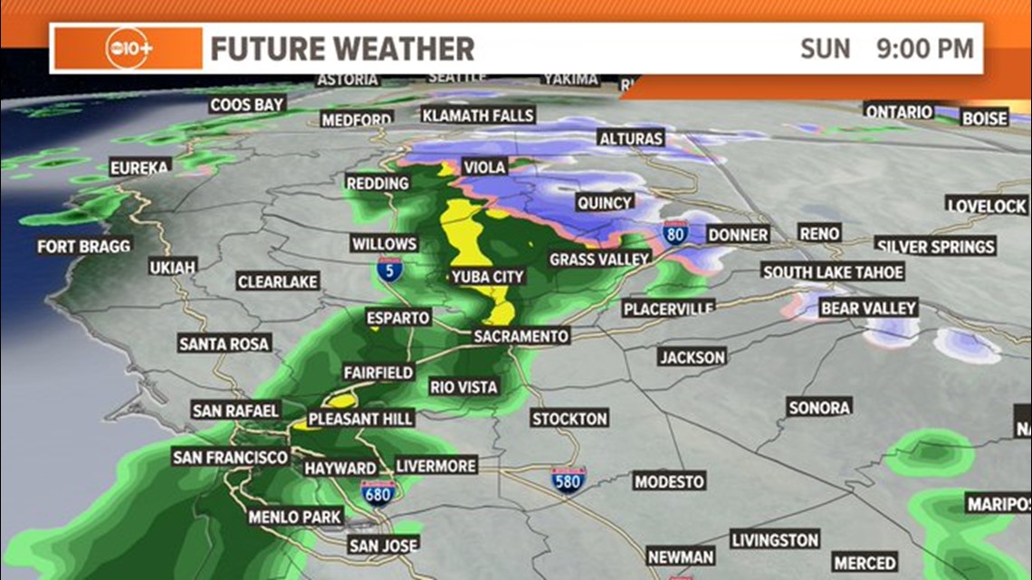
Here is what Futurecast thinks the radar will look like at 9 p.m. Sunday. Showers will slowly spread into the region throughout late Sunday night.

Monday will be dry before the next wave arrives late Monday night with showers continuing through Tuesday morning. Totals will be light with the second wave and less than a tenth for much of the region.
The two systems combined will produce less than 0.25” south of Interstate 80 so this will be a low impact event for the valley.
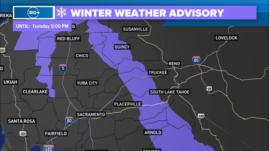
A Winter Weather Advisory is in effect for the Sierra due to snowfall totals of 4-10" above 5,000 feet with locally higher totals likely. The snow and wind will make travel more difficult across the Sierra but it won't be nearly as impactful as recent systems.

Temperatures will be well above average by Thursday as high-pressure moves in overhead. As the high-pressure system builds in, an inside slider system to the east will produce gusty winds from the north on Wednesday and Thursday before things calm down on Friday.
There won’t be any precipitation associated with these winds, instead, it will be warm and dry and the type of event that would raise fire risk if it were the late summer or fall instead of early spring.
Temperatures will be in the lower 70s by Thursday and mid-70s by Friday in the valley and 40s and 50s in the Sierra depending on elevation.
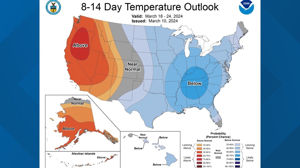
The early week precipitation will be the last for a while for Northern California. The Climate Prediction Center favors both warmer and drier conditions through the next two weeks across most of the Western United States.

WATCH ALSO: