
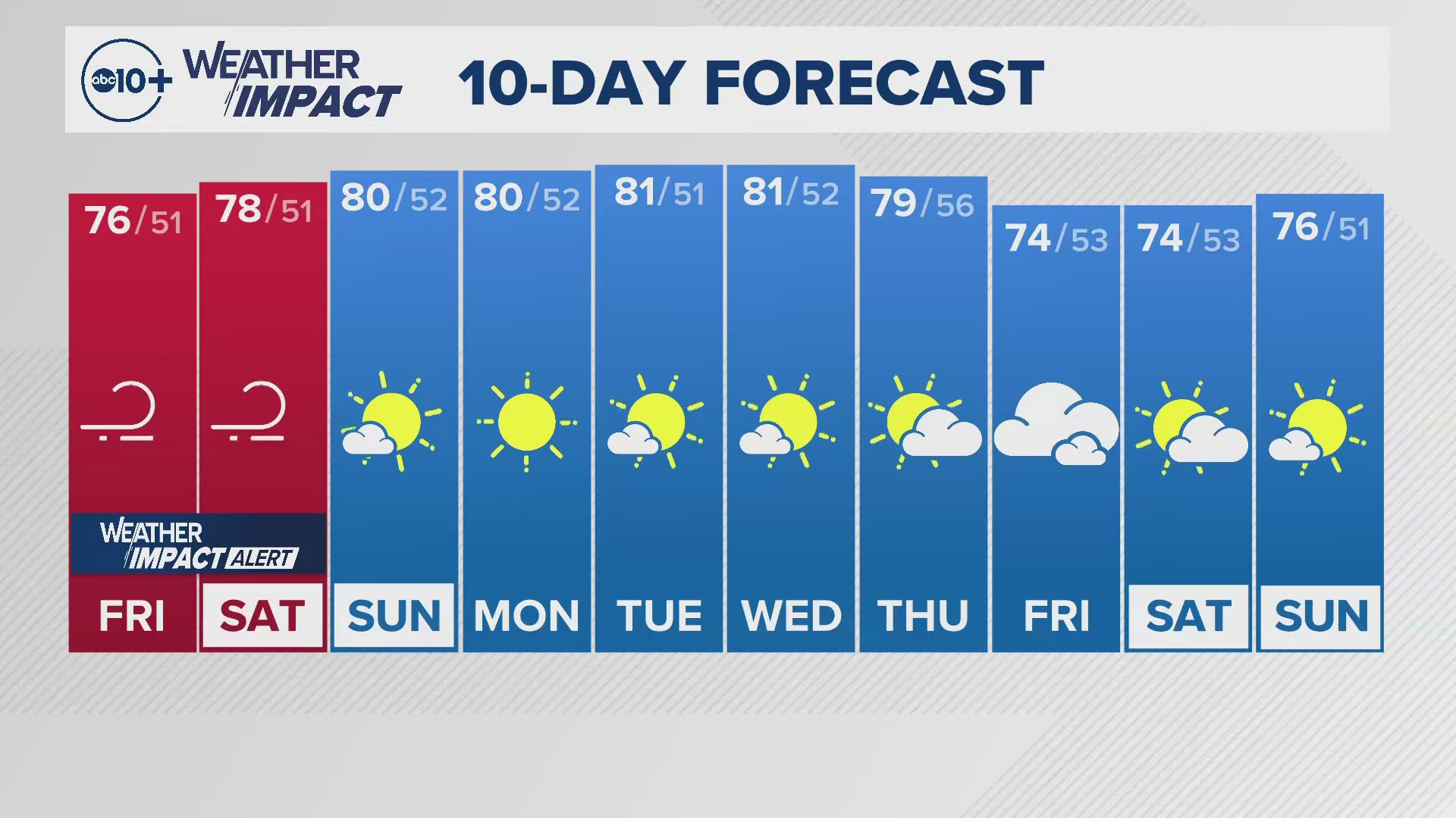
SACRAMENTO, Calif. — A cold area of low pressure is bringing heavy snow to the Rockies and mountains of Utah, while the western side will see strong winds and very low humidity.
This combination of wind and dry air creates fire weather conditions known as a Red Flag Warning. This warning is issued by the National Weather Service and began at 11 p.m. on Thursday and will last until 5 p.m. on Saturday.
When will it start?
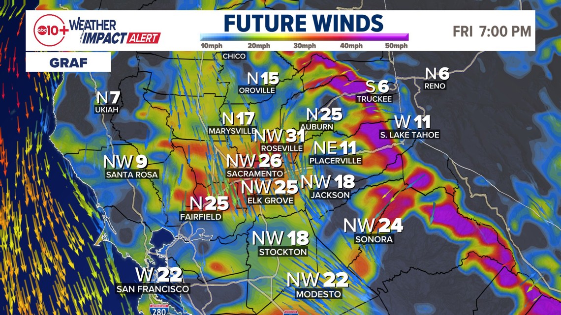
Wind is expected to remain strong all day and also affect the Sierra into Friday night and early Saturday morning. Gusts will range from 25-35 mph at times in the valley and 40+ mph for higher elevations.

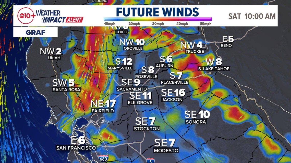
Saturday morning some strong winds remain but begin to taper in the lower elevations first.

► Stay up to date with the forecast and weather impact team with the ABC10+ streaming app. Here's how to download it for free.
What is the impact?


The highest risk is for the valley from Redding to areas south of Modesto for Red Flag fire conditions. The Delta and Bay Area as well as coastal zones will also have a high fire risk due to strong winds and low humidity. Friday morning the warning area was expanded to the Sierra foothills as well. At this point most locations in Northern California are covered by the Red Flag Warning Area.
The other major impact is both planned, and unplanned power outages. Strong winds could compromise power lines and create a fire risk and PG&E is planning outages to minimize the risk. Concerned customers can enter their address to see if they may be affected here.
Secondary impacts concern driving east or west with a crosswind. Dust and debris will also affect people because of the wind. Any outdoor activities or events need to monitor wind impacts on structures and lightweight aspects. Finally, it will be cold in the morning and evening and people spending time outdoors are advised to bundle up.
Weather Impact Resources
► FORECAST DETAILS | Check out our hourly forecast and radar pages
► GET WEATHER ALERTS TO YOUR PHONE | Download the free ABC10 mobile app
► GO DEEPER | Stream in-depth weather forecasts and investigative reports with the free ABC10+ streaming app
► WEATHER IN YOUR EMAIL | Sign up for our daily newsletter
► MEET THE WEATHER IMPACT TEAM | Chief Meteorologist Monica Woods, Carley Gomez, Brenden Mincheff, Rob Carlmark
What you need to know
People should have a plan or at least be aware that they could lose power. There will be some unplanned outages due to the wind. Often a tree limb or entire tree can fall on a power line and you will have localized outages. Also, falling limbs are a risk to people and property. Precautions should be taken to avoid areas that can have falling limbs, or parking cars far from trees.
ABC10: Watch, Download, Read


For more ABC10 news and weather coverage on your time, stream ABC10+ on your TV for free:
► Roku - click here
► Amazon Fire - click here
► Apple TV - click here
GO DEEPER: The state had a historic winter and the ABC10 Weather Impact Team is investigating where the water is going and if we're wasting it.