
SACRAMENTO, Calif. — A much cooler period of weather has arrived in Northern California. Weather Impact Alert continues for the Sierra today as spotty showers will be present during the afternoon. A dusting of snow is possible Monday night and Tuesday morning.
Showers arrive

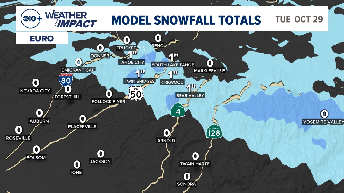
There's a chance for a dusting of snow Monday evening into Tuesday morning. Snow totals on the passes of I-80 and Highway 50 are very likely to be an inch or less, so travel shouldn't be extremely impacted but it may be slower going than usual.
Icy spots on the main highways are also unlikely, but patches of ice on side roads Tuesday morning aren't out of the question.
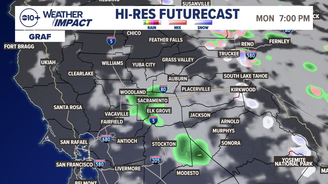
Some light valley showers Monday evening in the valley as the system exits the region. These showers would be very spotty and very light, with only a few hundredths of an inch of rain falling. Nonetheless, something to be mindful of Monday afternoon.
► Stay up to date with the forecast and weather impact team with the ABC10+ streaming app. Here's how to download it for free.
Impact
Monday night and Tuesday morning, there is potential for some flurries and light snow above 6,500 feet that could stick to the high passes. It's unlikely that truly disruptive winter weather will develop, but certainly an inch of snow or less is quite possible.
Chain controls are not anticipated. Frankly, if this storm was occurring in January or February, this would not be a Weather Impact Alert.
The main reason for this alert is because it is a significant pattern change from what we've had most of October.

In the valley, even fewer impacts. An umbrella Monday evening might come in handy as that looks to be the best chance for some light showers.
Regardless of whether or not the valley sees showers, much cooler temps will be present all week. Highs in the middle to upper 60s are expected through to the weekend!
Weather Impact Resources
► FORECAST DETAILS | Check out our hourly forecast and radar pages
► GET WEATHER ALERTS TO YOUR PHONE | Download the free ABC10 mobile app
► GO DEEPER | Stream in-depth weather forecasts and investigative reports with the free ABC10+ streaming app
► WEATHER IN YOUR EMAIL | Sign up for our daily newsletter
► MEET THE WEATHER IMPACT TEAM | Chief Meteorologist Monica Woods, Carley Gomez, Brenden Mincheff, Rob Carlmark
Bring a jacket
Be ready for a significant pattern change, especially if you're in the Sierra. A period of cooler weather with showers and flurries is expected to start the week. Have your warmer jacket ready and give yourself some extra time driving Tuesday morning.
Again, this is not a major storm by any means, but it is a major pattern change.
In the valley, not much needs to be done. Just remember cooler temperatures in the 60s are expected during the afternoon each day this week so you'll need to dress a little warmer.
ABC10: Watch, Download, Read


For more ABC10 news and weather coverage on your time, stream ABC10+ on your TV for free:
► Roku - click here
► Amazon Fire - click here
► Apple TV - click here
GO DEEPER : The state had a historic winter and the ABC10 Weather impact Team is investigating where the water is going and if we're wasting it.