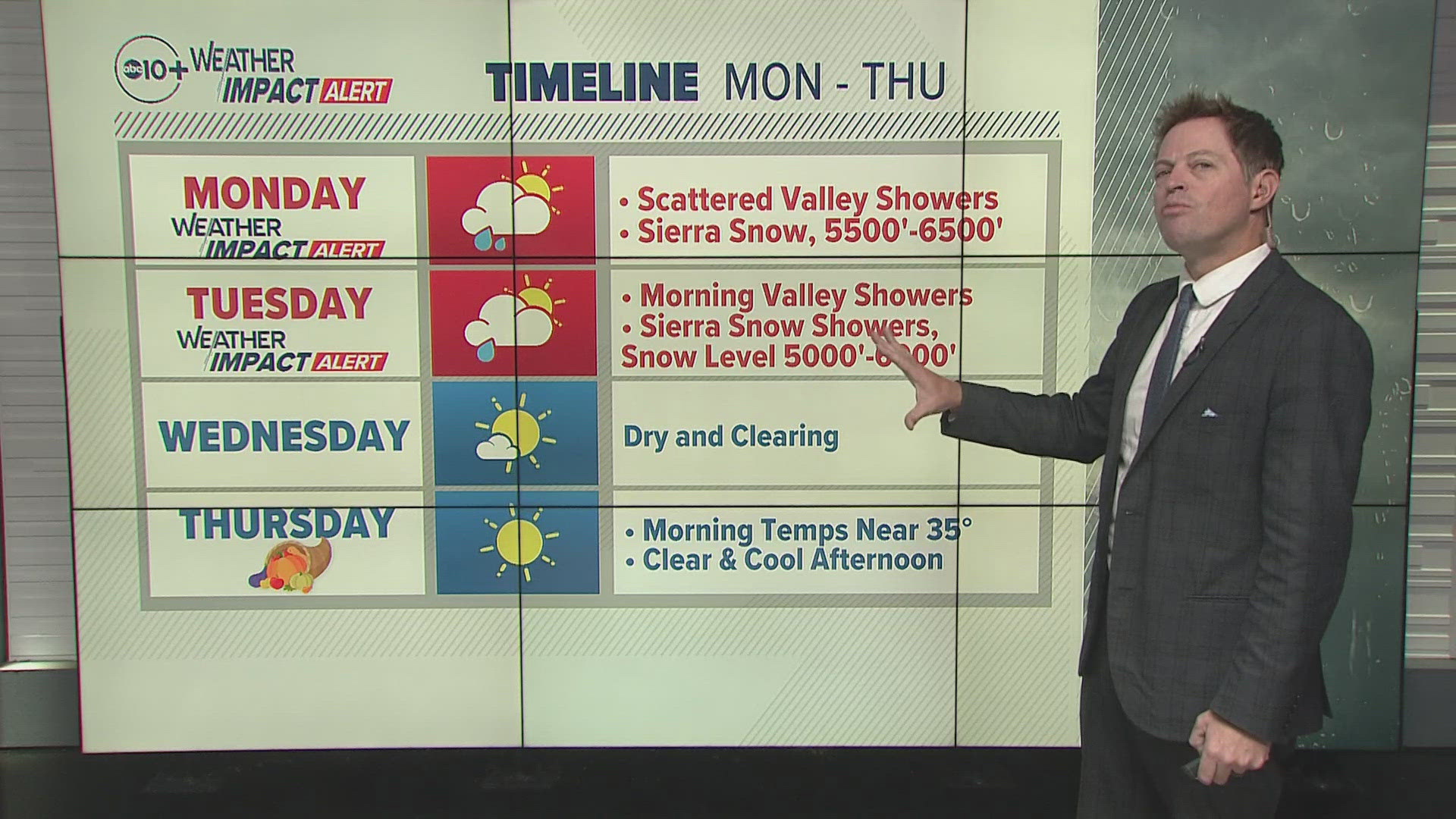
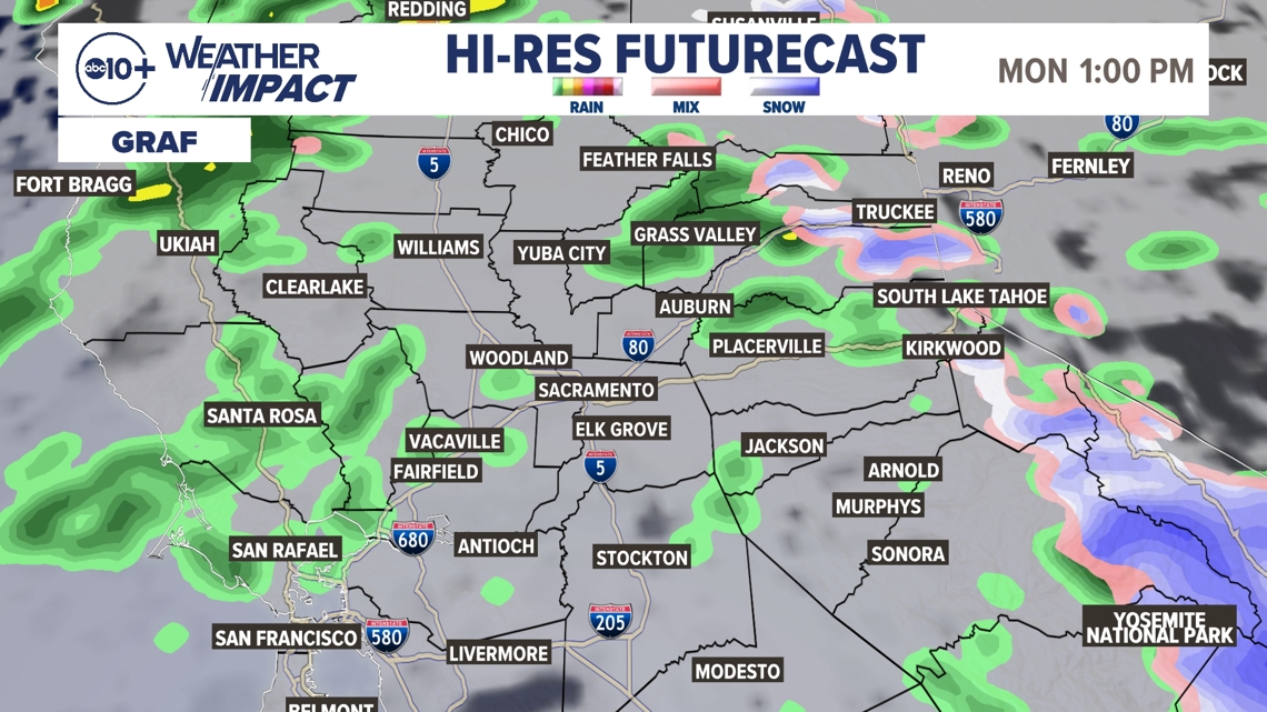
SACRAMENTO, Calif. — Weather conditions forecast for the Sacramento region are becoming more active with rain and snow moving in Monday. Rain is mostly focused in another narrow atmospheric river mostly in the Central Valley and coastal areas, but will drift to the north affecting more areas before the system becomes more scattered. Snow in the Sierra Nevada mountains will be heavy with a few feet possible through Wednesday.
When
Monday and Tuesday for the Sacramento and San Joaquin valleys with lingering snow into Wednesday for the Sierra.


► Stay up to date with the forecast and weather impact team with the ABC10+ streaming app. Here's how to download it for free.
Impact
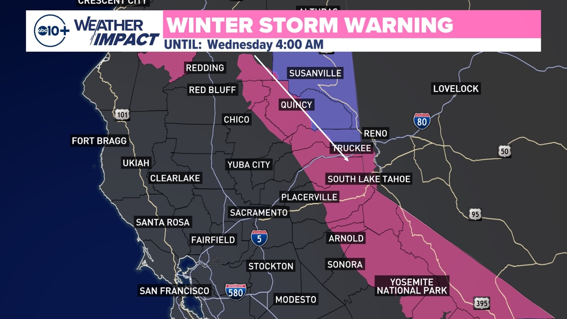
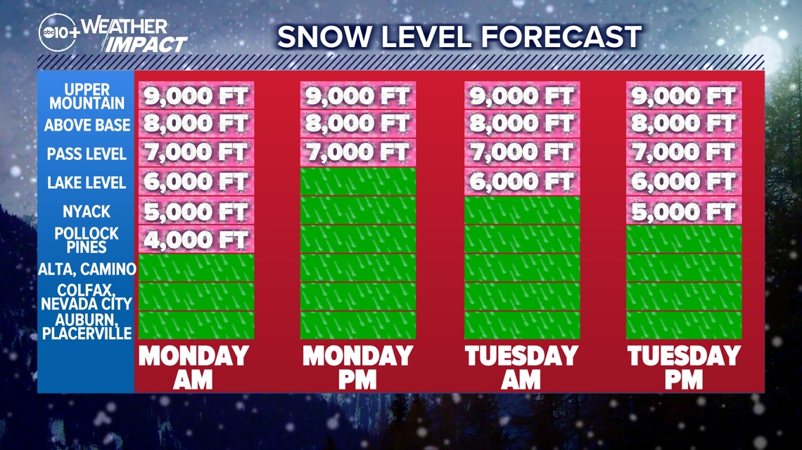
The biggest impact will be rain across the region and snow in the Sierra Nevada. Snow will start around 4,000 feet and then rise to about 6,000 feet. Snow will be at the pass level for the next three days.

Weather Impact Resources
► FORECAST DETAILS | Check out our hourly forecast and radar pages
► GET WEATHER ALERTS TO YOUR PHONE | Download the free ABC10 mobile app ► GO DEEPER | Stream in-depth weather forecasts and investigative reports with the free ABC10+ streaming app
► WEATHER IN YOUR EMAIL | Sign up for our daily newsletter
► MEET THE WEATHER IMPACT TEAM | Chief Meteorologist Monica Woods, Carley Gomez, Brenden Mincheff, Rob Carlmark
Need
Travel will be the main thing that is impacted by this storm with mountain travel to the Lake Tahoe area at the top of the list. The Sierra will encounter chain controls, slow drive times and road closures at times. Valley areas will get rain but not enough for major flooding issues and travel will be affected by spinouts and crashes.
Forecast Notes
This system is essentially the same as the one from last week but the Atmospheric River is mostly focused on the Central Valley and coastal areas. This is helpful since these areas missed out on much of the earlier rainfall and are below average for the season so far. This also brings increased snowpack for the Sierra which is good for recreation and water supply.
There is drifting with the focus of the main band of rain fluctuating and bringing heavy rain to various areas at times. All areas will at least experience some scattered showers Monday and early Tuesday.
The good news about timing is this system is on the move and will exit the area making way for dry conditions Wednesday which is a very busy travel day ahead of Thanksgiving.
Thanksgiving Day, Black Friday and the weekend after should be dry but cold temperatures in the 50s.
ABC10: Watch, Download, Read
Storm Recap
Two people died in the Pacific Northwest after a rapidly intensifying “bomb cyclone" hit the West Coast last Tuesday, bringing fierce winds that toppled trees and power lines and damaged homes and cars. Hundreds of thousands lost electricity in Washington state before powerful gusts and record rains moved into Northern California.
Forecasters said the risk of flooding and mudslides remained as the region will get more rain starting Sunday, but the latest storm won’t be as intense as last week’s atmospheric river, a long plume of moisture forming over an ocean and flowing over land.
“However, there’s still threats, smaller threats, and not as significant in terms of magnitude, that are still going to exist across the West Coast for the next two or three days,” weather service forecaster Rich Otto said.
As the rain moves east throughout the week, Otto said, there’s a potential for heavy snowfall at higher elevations of the Sierra Nevada, as well as portions of Utah and Colorado.
California’s Mammoth Mountain, which received 2 feet of fresh snow in the recent storm, could get another 4 feet before the newest system clears out Wednesday, the resort said.
-Associated Press
For more ABC10 news and weather coverage on your time, stream ABC10+ on your TV for free:
► Roku - click here
► Amazon Fire - click here
► Apple TV - click here
GO DEEPER: The ABC10 Weather Impact Team investigates algae and bacterial threats to some of California’s largest natural lakes.

