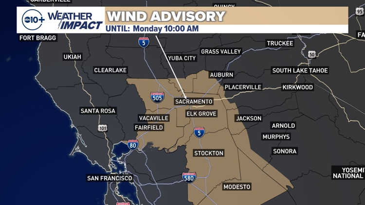
SACRAMENTO, Calif. — North winds are blowing down the valley on Sunday, with the strongest gusts in excess of 35 mph.
Winds lighten up somewhat Sunday evening before tapering off on Monday morning. However, another round of strong valley winds begins Tuesday.
A wind advisory is in effect until 10 a.m. Monday.

When
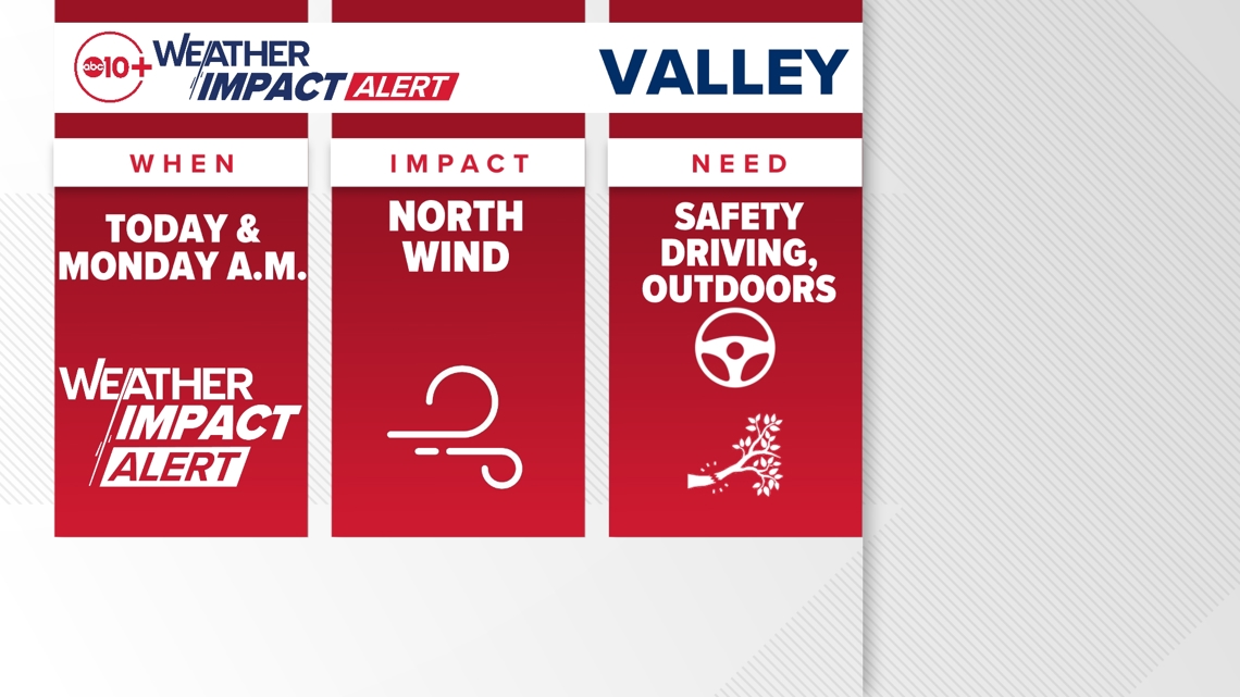
Sunday morning started off quiet, but winds quickly picked up across the valley after sunrise. The strongest winds will be during the afternoon hours on Sunday.
Widespread 30 mph wind gusts are expected for areas up and down the valley, including Sacramento, Stockton and Modesto, as well as for Delta areas like Fairfield and Vacaville. Some areas — especially in the Delta — could see gusts of 40 mph.

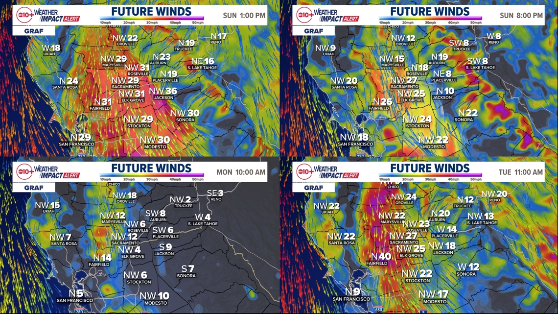
Wind gusts lighten up a bit once we get into the evening, but widespread gusts of 25-30 mph will still be present all the way through the overnight hours and even during the Monday morning commute.
By lunchtime Monday, winds largely die down, but we'll still have a northerly breeze for most of the daytime. Winds remain breezy out of the north through early Tuesday morning.
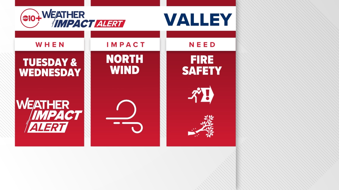
After sunrise on Tuesday, we'll again see wind speeds picking up. By lunchtime Tuesday, valley areas along and west of I-5 are likely to see gusts as strong as 45 mph. Winds will continue to gust out of the north at 30-40 mph for most of the day Tuesday and into Wednesday morning.
While the Sunday and Monday wind event will take place across the entire valley, the Tuesday and Wednesday event will be mostly on the west side of the valley, although it will be breezy everywhere.
► Stay up to date with the forecast and weather impact team with the ABC10+ streaming app. Here's how to download it for free.
Impact
Impacts vary between wind events.
For the Sunday and Monday wind, this is a little bit more of a nuisance than a real problem. Since Northern California just had some rain and snow, fire danger is only mildly higher. Of course, fires are always possible, so it's good to stay vigilant.
Some things to be mindful of are weak tree limbs that could snap and to watch for crosswinds, especially when driving east-west in the Sacramento Valley and Delta.
For the Tuesday and Wednesday wind, this will have a little bit more risk associated with it. We'll be further removed from the Friday night rain and snow, and we'll have dried out from the first round of northerly winds. This means fire danger will be higher midweek.
Tuesday is Election Day, so a lot of people are likely going to be out and about during the evening when winds will still be strong.

Weather Impact Resources
► FORECAST DETAILS | Check out our hourly forecast and radar pages
► GET WEATHER ALERTS TO YOUR PHONE | Download the free ABC10 mobile app
► GO DEEPER | Stream in-depth weather forecasts and investigative reports with the free ABC10+ streaming app
► WEATHER IN YOUR EMAIL | Sign up for our daily newsletter
► MEET THE WEATHER IMPACT TEAM | Chief Meteorologist Monica Woods, Carley Gomez, Brenden Mincheff, Rob Carlmark
Be aware
Be aware of your surroundings if you're outside, and be mindful of trees with lots of little or weak branches. If you're driving, use two hands. Strong crosswinds will be possible on east-west highways.
For the Tuesday and Wednesday wind event, it's important to be aware of fire risk. While fire danger won't be exceptionally high, grass dries quickly so fires could grow quickly.
ABC10: Watch, Download, Read
For more ABC10 news and weather coverage on your time, stream ABC10+ on your TV for free:
► Roku - click here
► Amazon Fire - click here
► Apple TV - click here
GO DEEPER: The ABC10 Weather Impact Team investigates algae and bacterial threats to some of California’s largest natural lakes.


