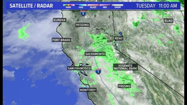
SACRAMENTO, Calif. — A fast-moving storm packing winds gusting up to 70 mph dumped more than a half-foot of snow on parts of the Sierra and more than an inch of rain at Lake Tahoe before starting to move out of the region early Tuesday.
Rain and wind moved into the Sacramento region Monday night and through Tuesday morning. Rain showers, which were heavy at times, brought beneficial rainfall to drought-ridden areas in the Sacramento Valley.
Also, snow levels were well above 8,000 feet in elevation, leaving most locations in the Sierra with rainfall instead of snow. The National Weather Service reported 9 inches of snow overnight at the top of the Mammoth Mountain ski resort south of Yosemite National Park. Seven inches fell on Tahoe’s northwest shore at the Palisades Tahoe resort and 4 inches at Mt. Rose near Reno.
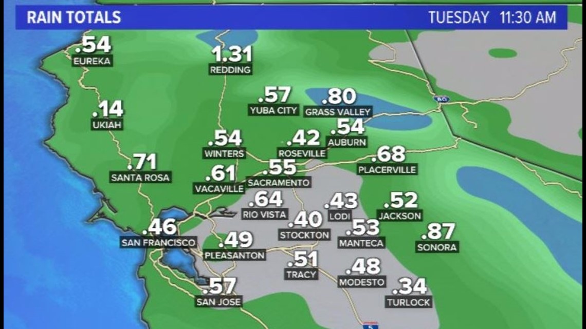
Here's a look at some of the storm totals for the past 24 hours:
- Redding: 1.31"
- Grass Valley: .80"
- Placerville: .68"
- Sacramento: .55"
- Auburn: .54"
- Modesto: .48"
- Stockton: .40"

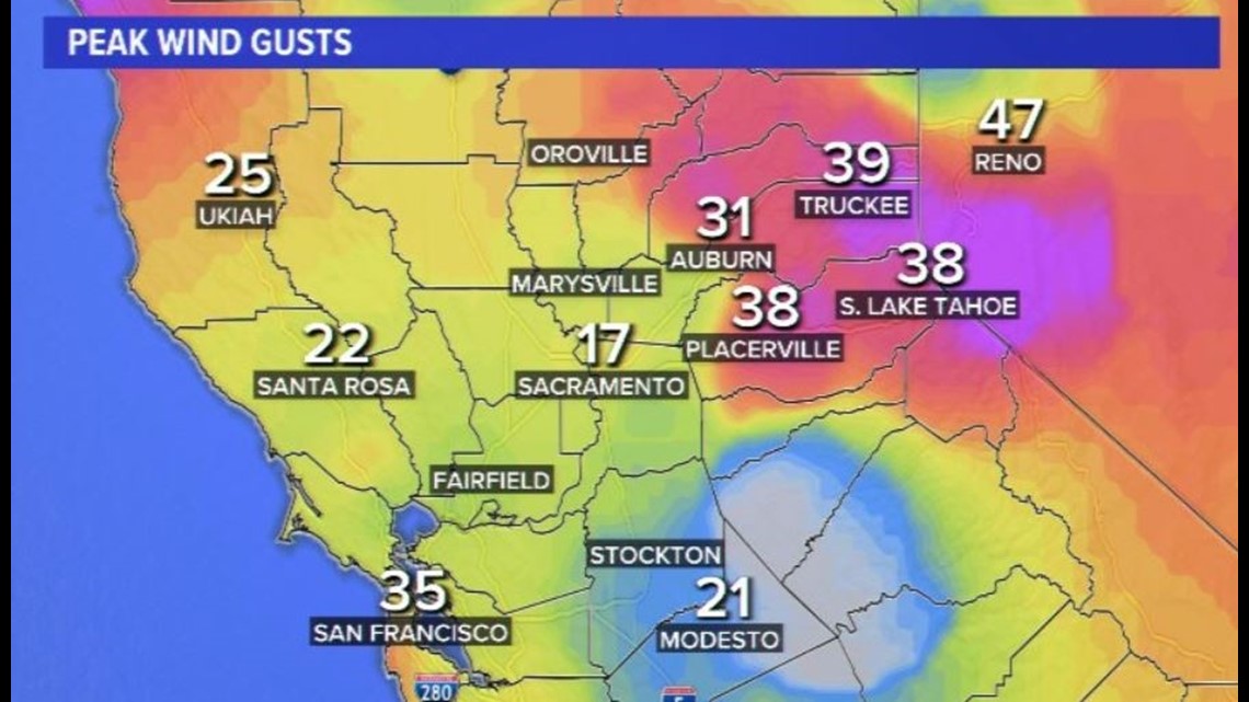
In addition to the rain, gusty winds arrived along with the passage of a cold front. Here are some of the peak wind gusts in Northern California since midnight:
- Truckee: 39 mph
- Placerville: 38 mph
- Auburn: 31 mph
- Modesto: 21 mph
- Sacramento: 17 mph

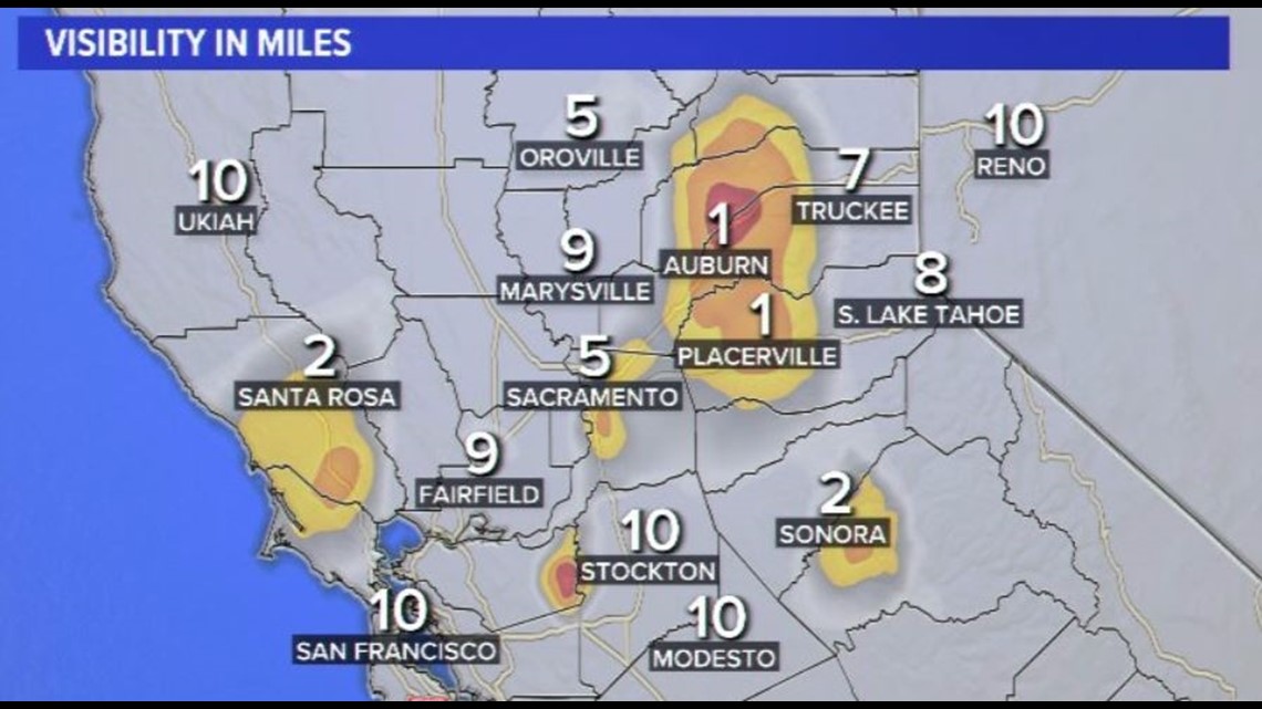
As the rainfall continued to clear the area, ample moisture has led to low-level clouds. These clouds are hampering visibilities across the area around mid-morning.

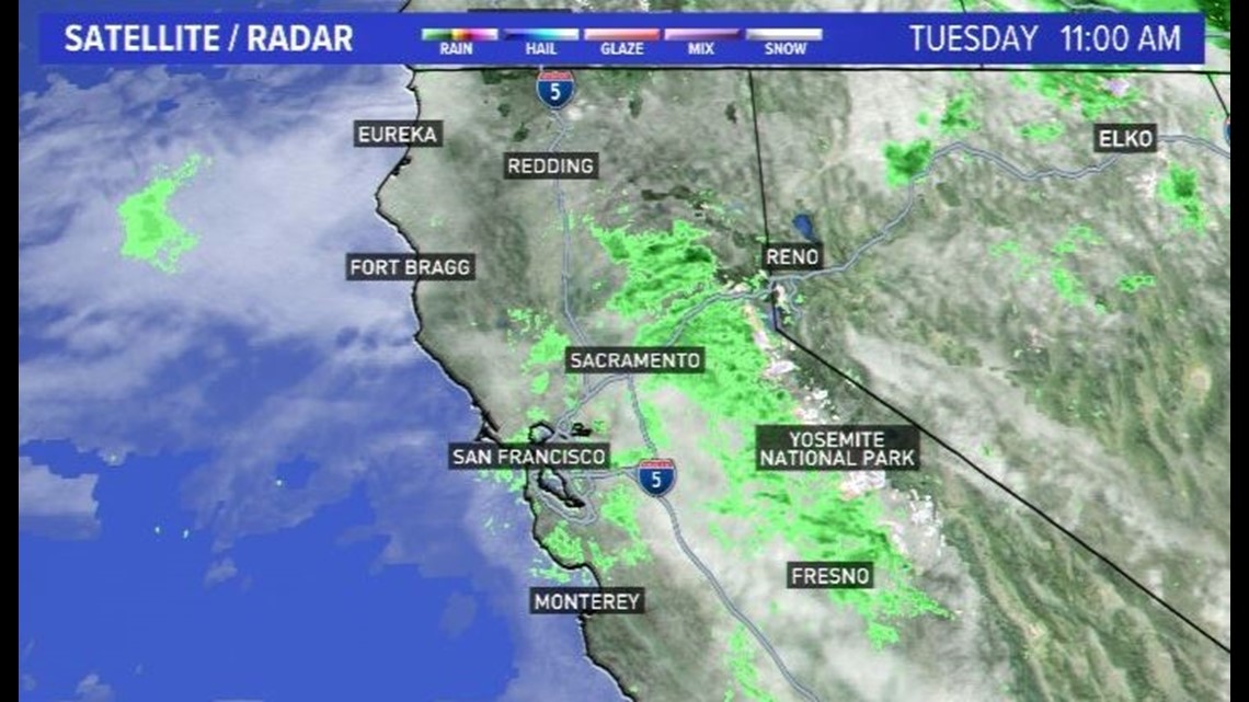
ABC10's satellite radar at 11 a.m. showed rain showers in the Foothills moving into the Sierra. These showers will continue to clear the area throughout the day, improving conditions. Winds will diminish as we head into the early evening hours.

Watch more ABC10:


