
SACRAMENTO, California —
Northern Californians have been waking up to freezing temperatures the last few days, a trend that will continue Tuesday morning before a pattern change ushers in milder morning temperatures and increased precipitation chances.
Sacramento Executive Airport reached the freezing mark on both Sunday and Monday, dropping to 32 and 30 respectively. Sunday’s freeze was the first of the season, putting the location ahead of scheduled compared to the first average freeze date of December 3.
Another cold, much below average morning in on tap for Tuesday. NWS Sacramento extended the freeze warning through Tuesday morning with widespread temperatures near or below 32 degrees expected. By Wednesday, an approaching system will keep low temperatures above the freezing mark thanks to increased cloud cover.

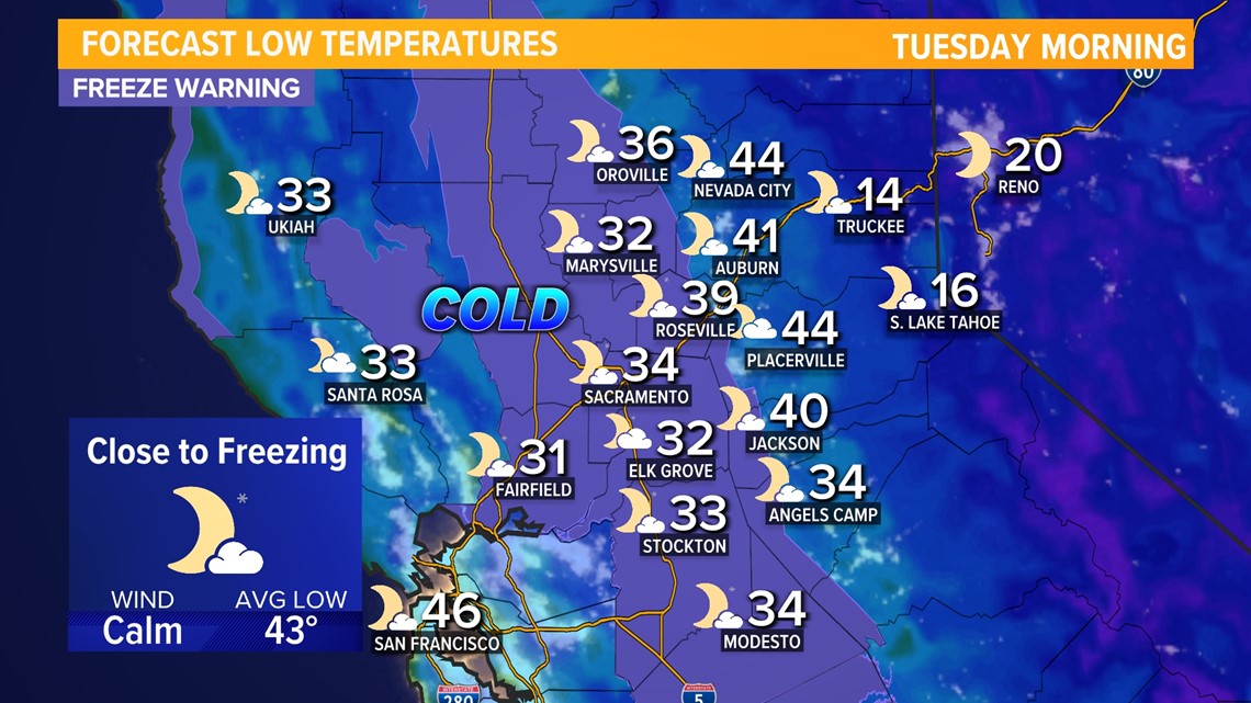
High temperatures on Monday and Tuesday will be right around average for this time of year in the valley with highs in the low 60s to around 60. Foothill highs will be in the 50s while 40s are expected in the Sierra.
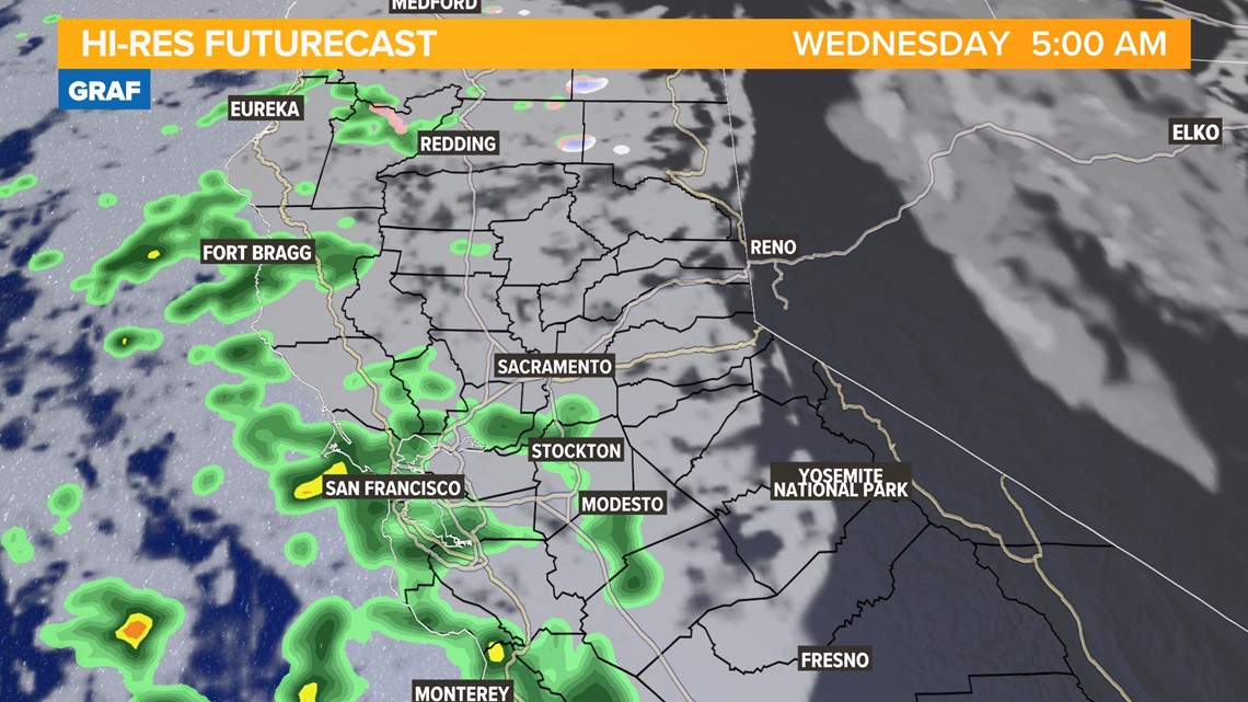
Wednesday will be cooler and cloudier thanks to a low pressure system that is expected to bring precipitation mainly to the coast. Temperatures in the valley will only be in the mid to upper 50s and highs are expected to stay below 60 through the work week.
Shower chances in the Sacramento area on Wednesday morning are relatively slim, with measurable rain much more of a certainty along the coast. A stray shower or two could push into the valley on Wednesday morning, but the foothills and Sierra will be dry before another storm brings rain and snow.

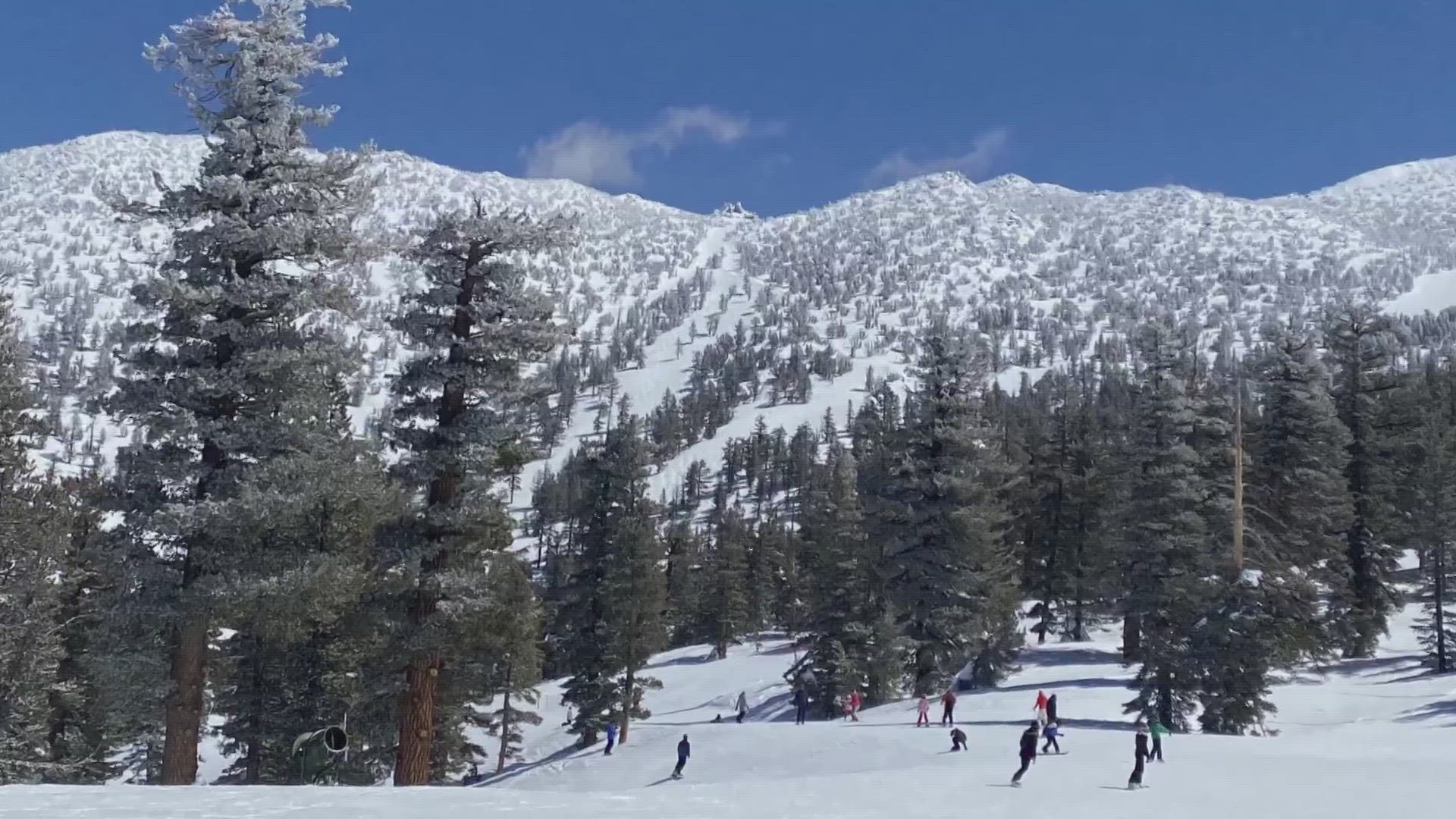
The next chance at showers in the valley will be on Thursday night and into this weekend as a cold storm system drops into the region from the north. Valley rain totals will be on the lighter side (generally 0-0.25" expected) and Sierra snow totals will range from 6-12" above 4,000-5,000 feet.
Although these storms will bring decent snowfall totals, Northern California has yet to see an atmospheric river system akin to those last year that dropped multiple feet of snow in the Sierra.
By Sunday, high pressure is set to become the dominant feature over California, which means dry conditions, and although this week will bring wet weather to much of the region, it will be a while longer before a major atmospheric river slams into the state this far south. It looks the earliest possible chance of this occurring is in mid-December based on model guidance.
WATCH ALSO:


