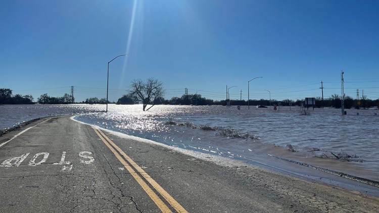
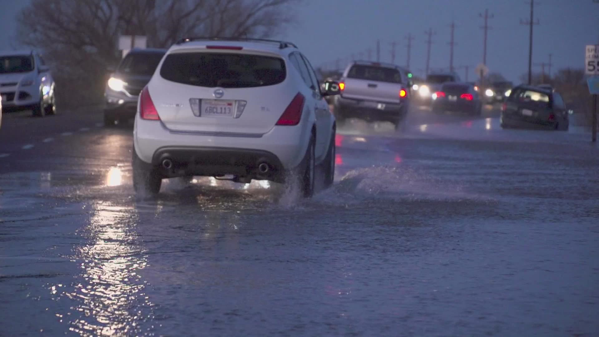
SACRAMENTO, Calif. — Problems still remain Monday as the Sacramento region is drying out and cleaning up after a New Year's Eve storm resulted in levee breaches Sunday near Elk Grove.
Highway 99 reopened south of Elk Grove in traffic in both directions shortly after midnight, Caltrans announced. It was closed Sunday due to flooding. One person was found dead in a car.
The Point Pleasant area is under an evacuation order due to flooding concerns in the area. Flood waters were expected to become "incredibly dangerous" after sunset Sunday evening.
An evacuation warning was issued Sunday evening to people living in the areas of Glanville Tract and Franklin Pond.
An evacuation center is open at the Wackford community center at 9014 Bruceville Road in Elk Grove.
The Rio Cosumnes Correctional Center on Bruceville Road in Elk Grove was evacuated Sunday afternoon due to flooding concerns. The Sacramento County Sheriff's office said 1,075 inmates were taken to different nearby correctional facilities.
County spokesperson Matt Robinson said Sunday that there were three levee breaches in the Cosumnes River area, which are believed to have been weakened when they were hit by debris during the 2017 floods.
The National Weather Service continued a Flash Flood Warning for Wilton until 11 a.m. on Jan. 2. People were urged to move to higher ground and avoid walking or driving through flood waters. The potential exposure in the area is about 8,230 people.
► WATCH: Residents evacuate Point Pleasant:
STORM RESOURCES
► FORECAST DETAILS | Check out our hourly forecast and radar pages.
► GET WEATHER ALERTS TO YOUR PHONE | Download the ABC10 mobile app
► WEATHER IN YOUR EMAIL | Sign up for the ABC10 Today newsletter
MAPS
Radar map from ABC10.com. Adjust the layers with a filter on the bottom right corner to show rain, snow, wind and current temperatures:
TRAFFIC
Sacramento region traffic:
POWER OUTAGES
PG&E outages can be found HERE.
SMUD outages can be found HERE.
Click HERE for more ABC10 weather maps.
GO DEEPER: When you think of California's climate, drought probably comes to mind first, but California has a long history of floods. Some floods were so punishing and relentless they crippled the state. New research indicates these "megafloods" are twice as likely in the future with a changing climate. It's a future we can't avoid, but we can learn from the past and prepare. ABC10's team of meteorologists investigated the topic, answering questions like: What exactly is a megaflood? Can our infrastructure withstand it?