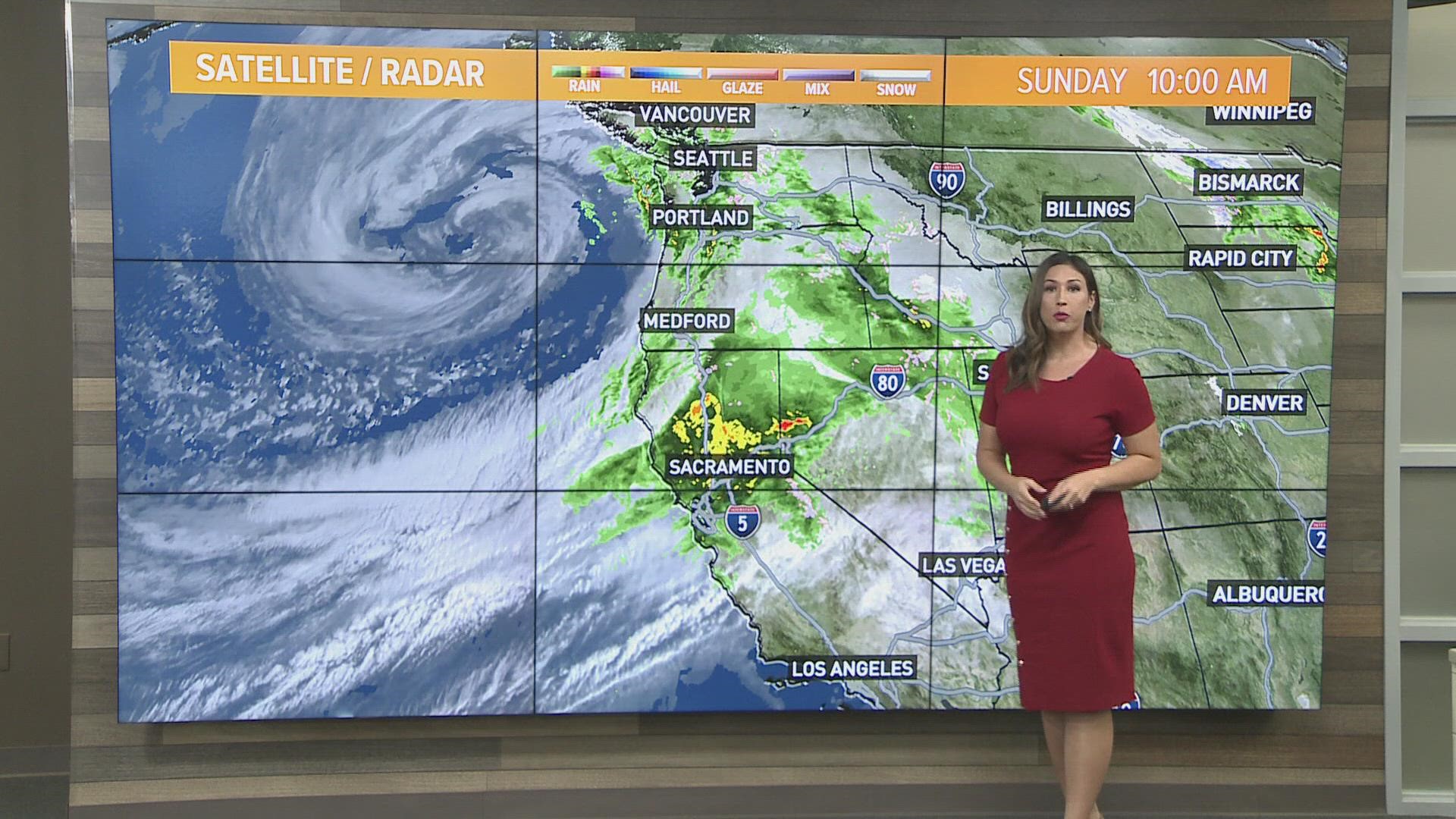
SACRAMENTO, Calif. — The Bomb Cyclone and atmospheric river off the Pacific have finally joined forces to cause an extraordinary amount of rain, as flash flooding is causing debris flows and landslides near burn scars.

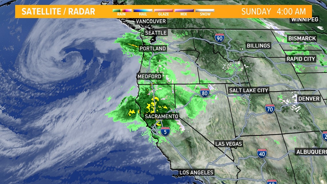
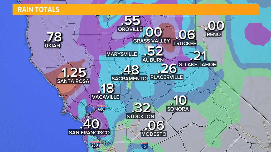
As of 4:30 a.m. rain totals in Sacramento approached .50 inches in just a few hours starting around midnight.

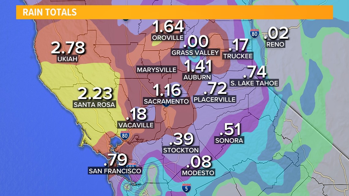
By 9 a.m. rain gauges showed Sacramento with over an inch of rain at 1.16 inches recorded.

The heaviest of the rain is expected to move through the lunchtime hours through the evening.

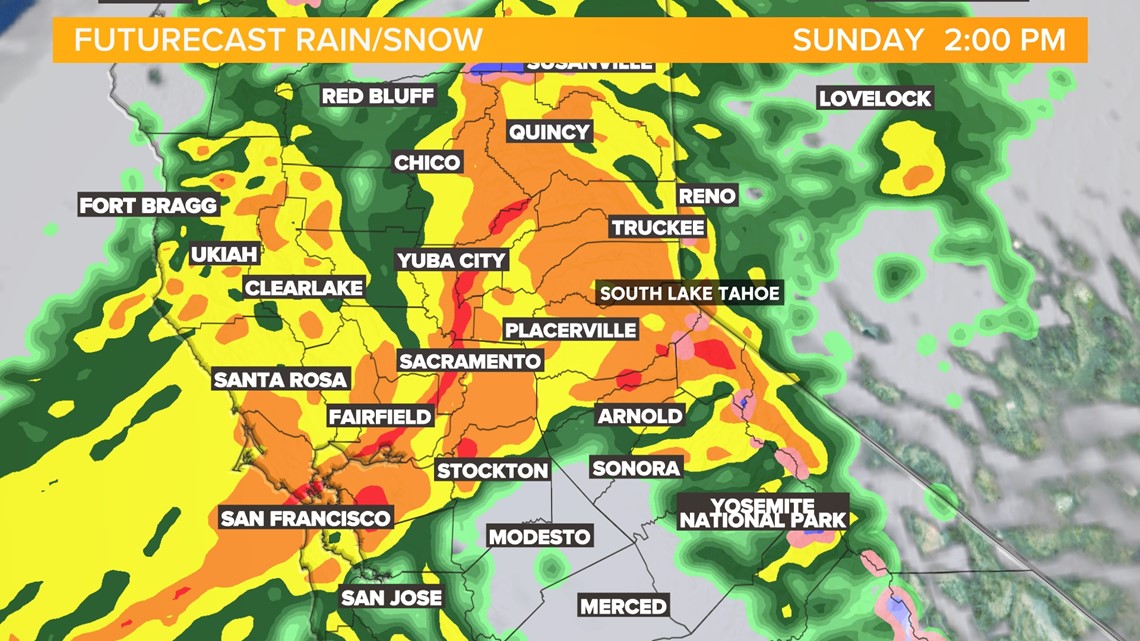
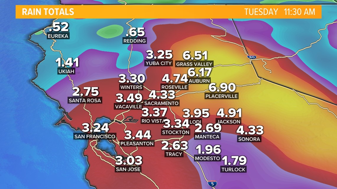
Computer models are varying on three to six inches now in Sacramento by Tuesday. Two to six inches of rain is expected through Tuesday for the valley. The foothills could see four to 12 inches of rain.

One of the first burn scars to block roadways was the Dixie Fire. Portions of Highway 70 were photographed with roadways washed out. CHP Quincy issued a warning that stretches of 89, 36, and 70 were seeing flash flood issues.
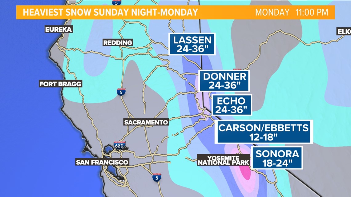
The Sierra will be under a Winter Storm Warning to take effect 11 p.m. Sunday to 11 p.m. Monday. One to two feet of snow is expected above 6,000 feet with some totals at peaks closer to three feet.

Monday will bring in scattered shower chances into the afternoon with possible thunderstorms.

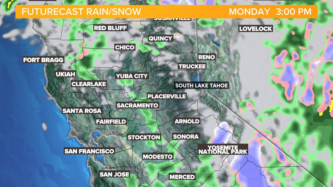
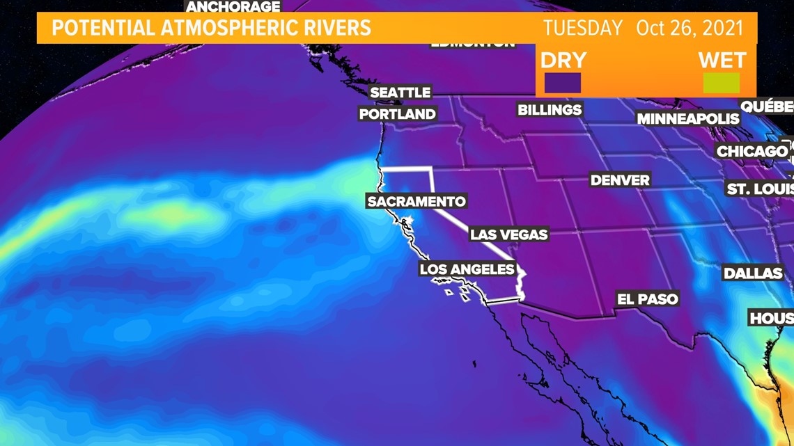
Another atmospheric river will cause rain to the northern California coast, spreading some showers by Tuesday afternoon across the Sacramento valley.

Storm Resources
► FORECAST DETAILS | Check out our hourly forecast and radar pages.
► GET WEATHER ALERTS TO YOUR PHONE | Download the ABC10 mobile app
► WEATHER IN YOUR EMAIL | Sign up for the Daily Blend Newsletter
ABC10: Watch, Download, Read
Watch more:

