SACRAMENTO, California — Northern California will be treated to a tranquil weekend of weather before the most impactful storm of the season so far hits California.
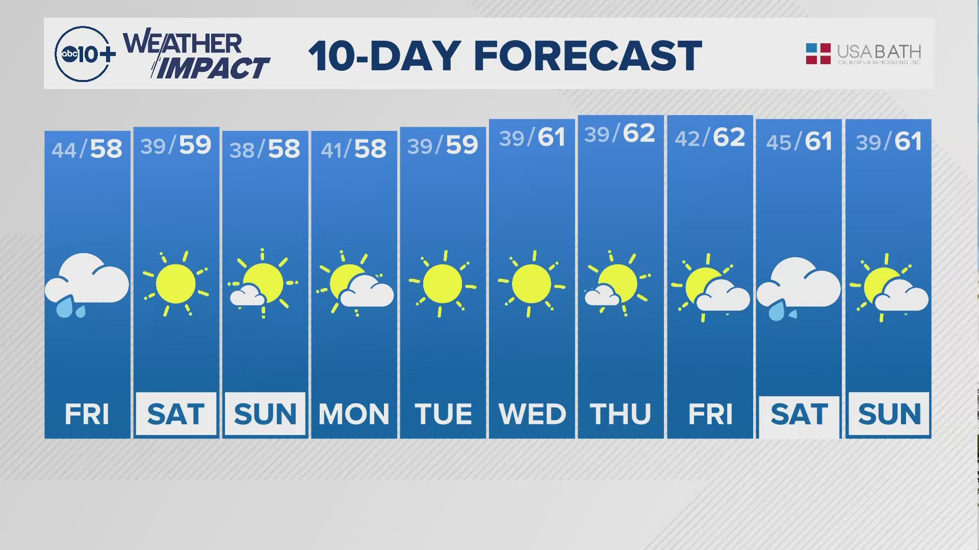
The region will be under a ridge of high pressure this weekend and temperatures will be right around climatological average (the average Nov. 10 high in Sacramento is 68 degrees).
Thursday will be the coolest day for the rest of the week with a high temperature of 64. Highs in the valley are forecast to be in the upper 60s to around 70 through Sunday before the pattern shift next week cools things down.
Thursday morning was the coldest morning of the autumn so far with valley observations reading in the mid to upper 30s. Cold mornings will continue through the weekend, but temperatures aren’t expected to dip as low as they did Thursday morning.

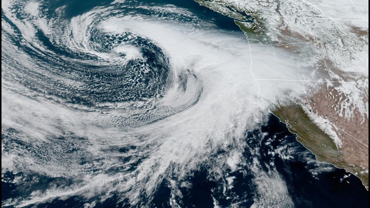
Looking toward next week, all eyes are on what is expected to be the most impactful storm of the season so far.
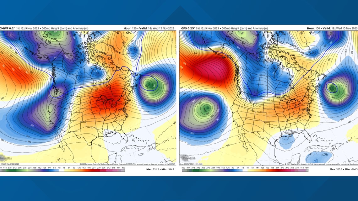
Much uncertainty exists in the forecast next week. The two main global weather models – the GFS and the European (Euro) – are showing tremendous differences in their forecast solutions.
The GFS shows the low pressure system sitting too far west of the California coast to deliver as much rain as previously forecast. However, the Euro, which is generally considered the most accurate, has the low crashing into the California coast, bringing widespread rain, heavy mountain snow and cooler temperatures.

Given the data available, an impactful storm remains likely next week. Confidence in precipitation amounts, temperatures, wind gusts and snow levels will increase in the coming days as the models come into better agreement.
The storm is expected to begin Tuesday, continuing to deliver rain and snow through the rest of week. The low pressure system will tap into moisture from a category 1 atmospheric river, and the counterclockwise rotation associated with the system will push that moisture onshore.
Temperatures in the 50s and 60s are expected in the valley next week but specific precipitation amounts are yet to be seen due to the given uncertainty.
Between Monday and Thursday, there is a 55-75% probability of greater than 1 inch of rain, with a 30-50% probability of greater than 2 inches in the Valley, and 50-70% for the foothills, according to NWS Sacramento.
In the mountains, snow levels will generally be around 5,500 to 6,500 feet, and there is a 40-70% chance of greater than 12 inches of snow accumulation, as well as a 20-40% probability of greater than 24 inches at pass level in the Sierra and southern Cascades.