SACRAMENTO, California —
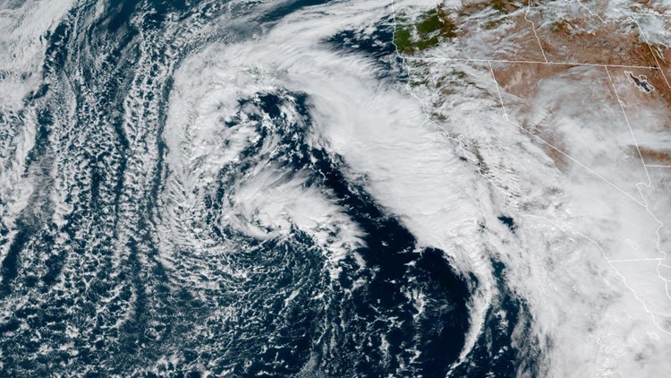
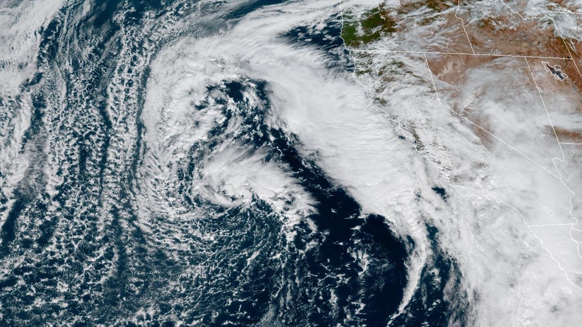
The low pressure system spinning off the California coast will spin up more rain across Northern California Wednesday.
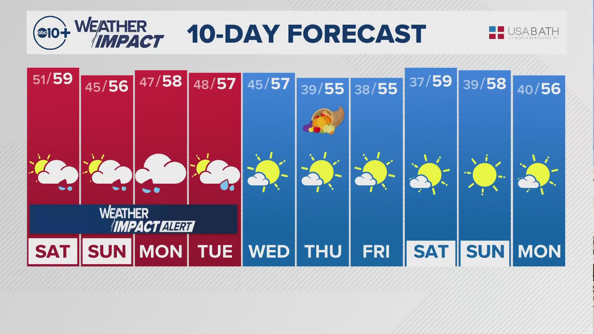
The spiraling rain bands attached to the system pushed through portions of California Wednesday morning, bringing spotty showers and cloudy skies to most of the state. Temperatures are forecast to only be in the mid 60s across the valley, and 40s and 50s in the Sierra.
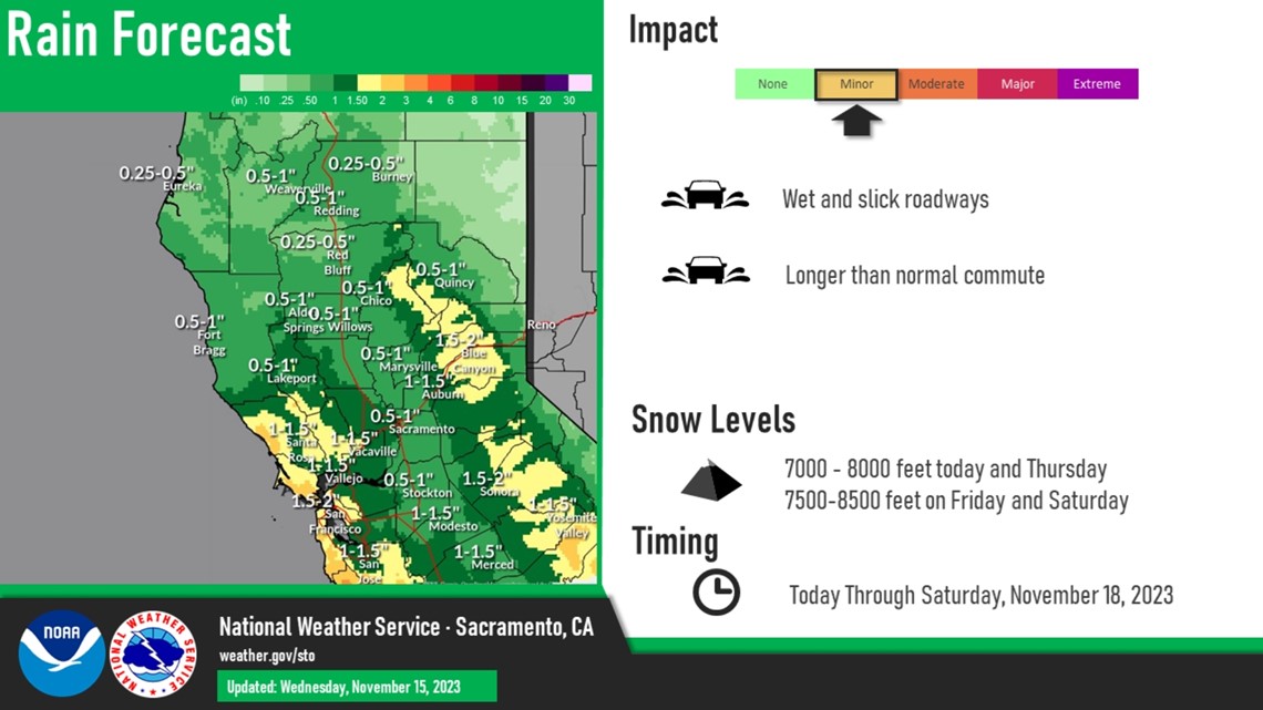
The bulk of the rain Wednesday will push into the region by late afternoon. The path of the showers will move from the south to the north thanks to the counterclockwise rotation of the low parked off the coast. Totals in the valley are expected to range between 0.10-0.25" in the valley, and up to half an inch in the foothills and Sierra.

Snow levels remain very high due to the warmer nature of this system. Only a few inches of snow are expected above 7,000-8,000 feet, a far cry from the predictions last week.
The next shot at precipitation will come Friday and into Saturday as the center of the low finally moves onshore. The bulk of the rain is expected to fall Friday evening through Saturday morning.
Thunderstorms are also a possibility as the low pressure ushers in some unstable air. The National Weather Service places the odds of thunderstorm development at 15-20% from Thursday to Saturday in the valley and the foothills, mainly south of Interstate 80.
In total through Saturday, valley locations north of Stockton can expect 0.5-1" of rain and to the south those totals will be slightly higher. Foothill and Sierra locations could see up to 2" of rain.

November has started very warm in California, a trend likely to continue the rest of the month once the storm clears. High pressure is favored to dominate the weather pattern over California through Thanksgiving week, which would mean mild temperatures and dry conditions.