SACRAMENTO, Calif. — A mid-March storm comes on the heels of President Donald Trump declaring a national emergency to combat coronavirus (COVID-19).


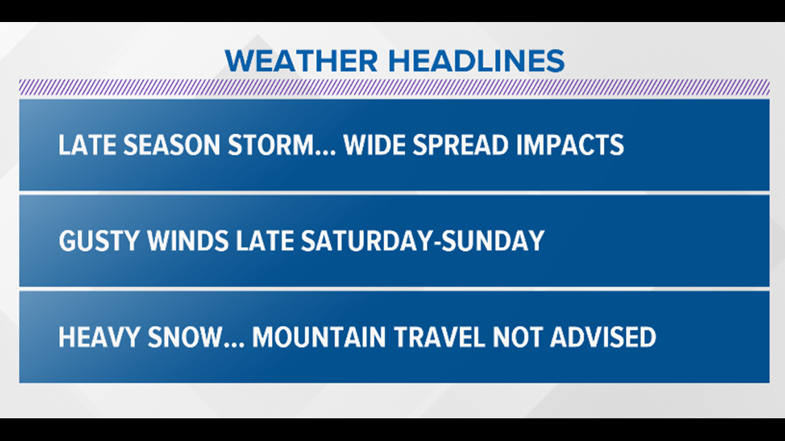
Widespread impacts are expected with this weekend's storm. From heavy rainfall in the valley and foothills to whiteout conditions in the Sierra. Heavy snowfall is expected tonight and during the day Sunday. Mountain travel is highly discouraged during this timeframe.
Something else to consider, this storm will bring high winds and heavy snow. This will cause CONSIDERABLE avalanche danger which is expected to rise to HIGH tomorrow as this storm continues.
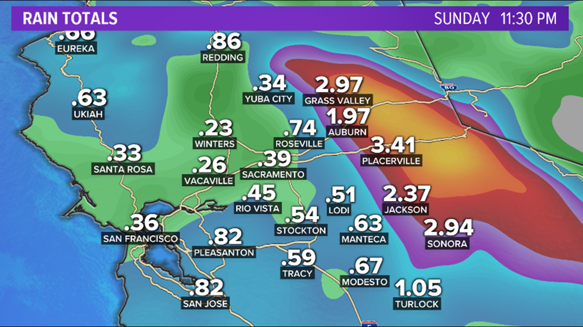
As multiple rounds of rain and snow pummel Northern California, if you’re planning to do any shopping, expect to be caught in the rain. Flooding is a concern as rain totals are expected to be around an inch for many spots with higher totals close to 3 inches for the foothills. Thunderstorm chances Sunday and Monday could add additional inches to rain totals.


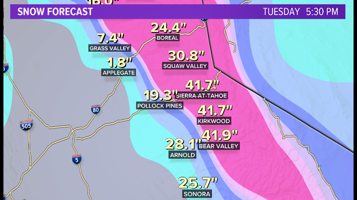
Snow levels will drop from 3,500 to 2,500 feet into Sunday night with many passes seeing 2 to 6 feet of snowfall. Carson Pass could receive as much as 6.6 feet (80 inches). Chains will be required through the weekend.


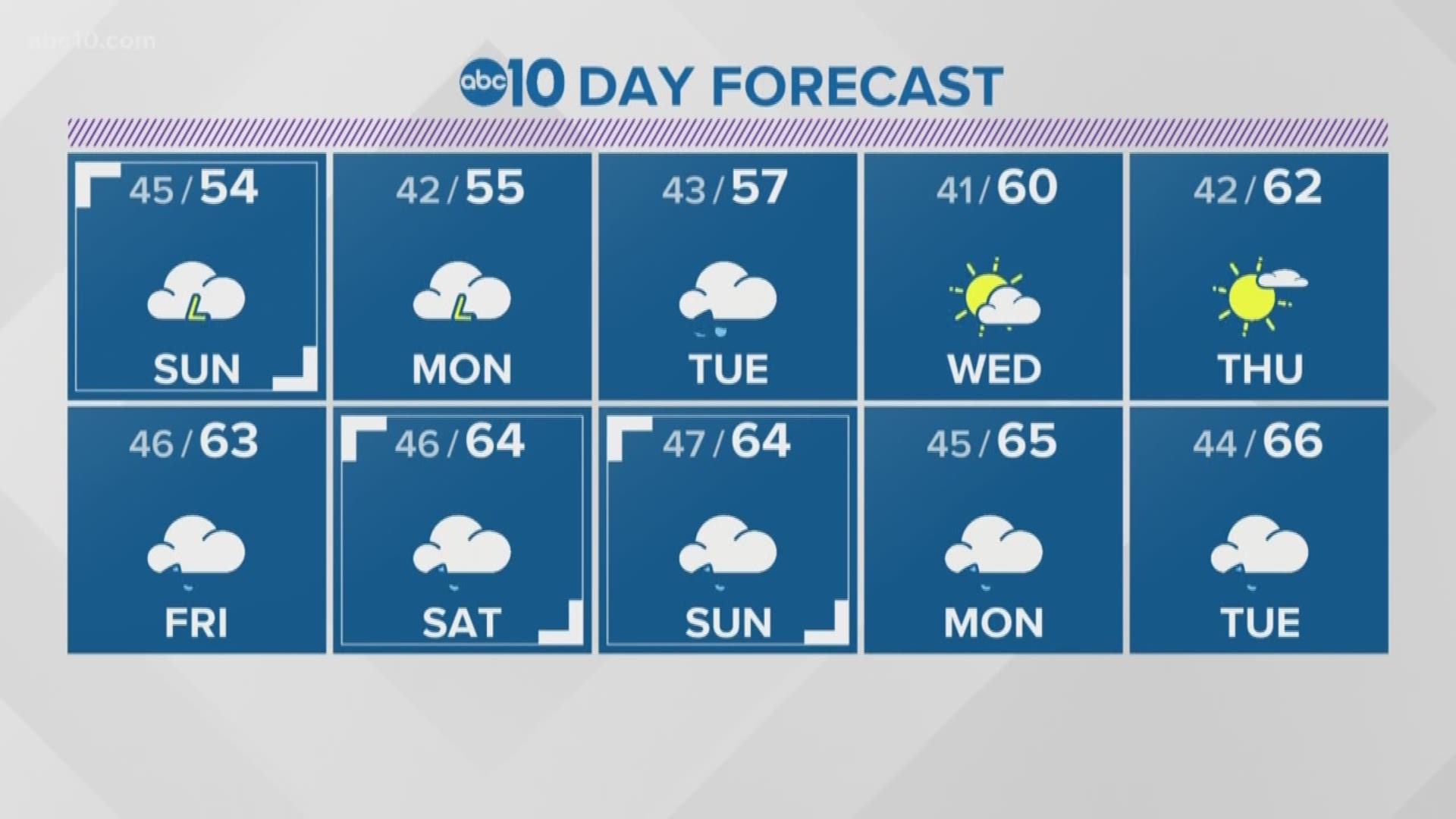
Temperatures are expected to drop about 10 to 15 degrees from Friday.
Wind will add to the chill factor as speeds pick up to about 15 mph in the valley and 30 to 40 mph in the Sierra.
RELATED:
FOR NEWS IN YOUR COMMUNITY, DOWNLOAD THE ABC10 APP:
►Stay In the Know! Sign up now for ABC10's Daily Blend Newsletter
The 2020 U.S. Census count is officially underway. And now there's a resource center open in Sacramento to assist residents in filling it out.


