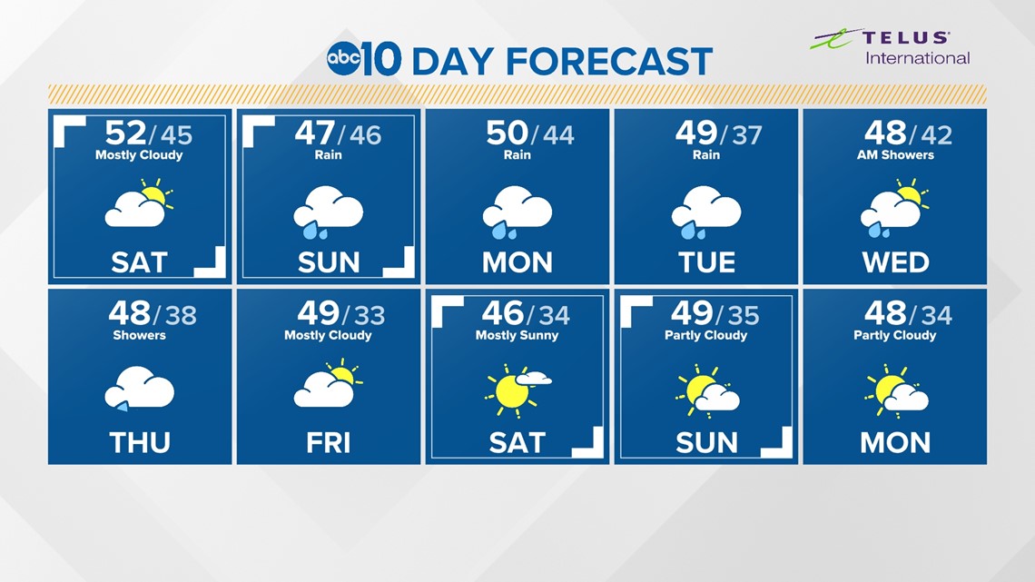
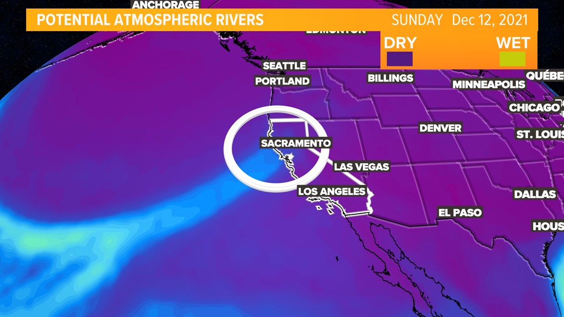
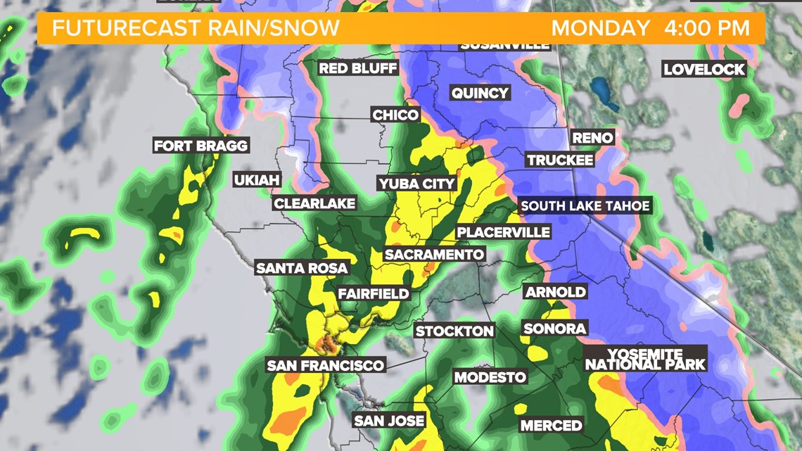
CALIFORNIA, USA — A low pressure system will tap into an atmospheric river off the coast of California Sunday morning. The combination, will lead to high precipitation totals. Forecast models show the system may stall out briefly Sunday into Monday, causing rain and snow totals to increase.

The cold Gulf of Alaska air is moving in before the cold front and will allow for much lower snow levels.

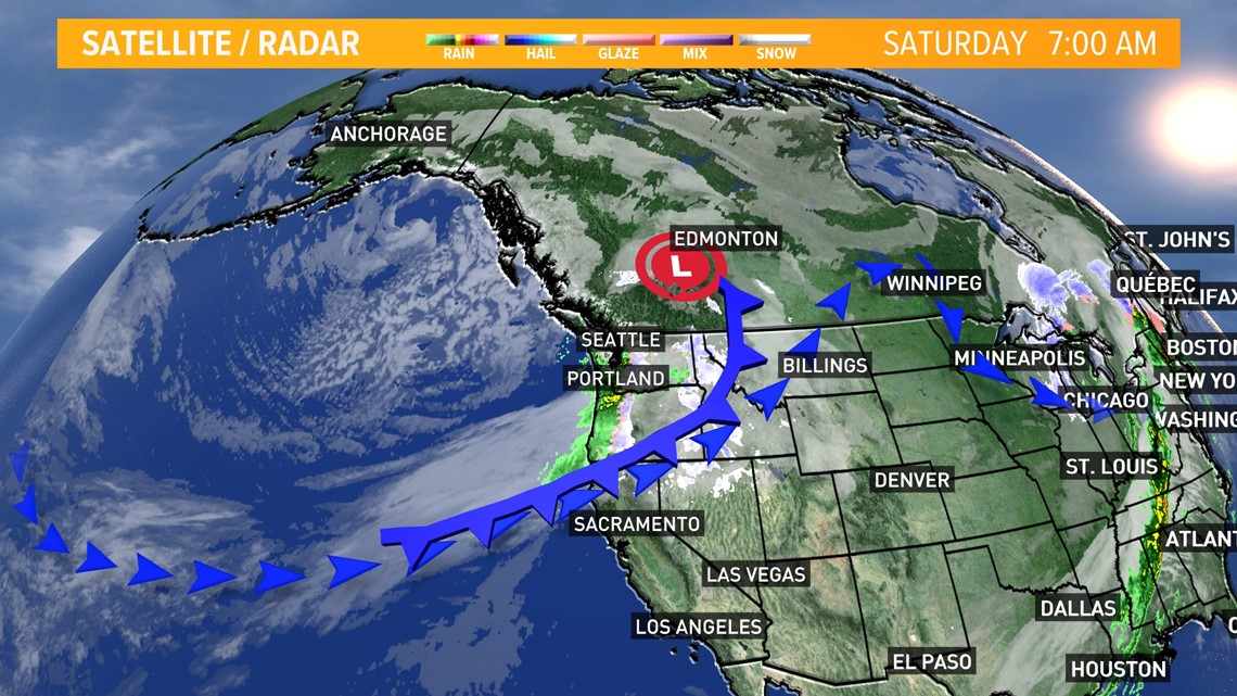
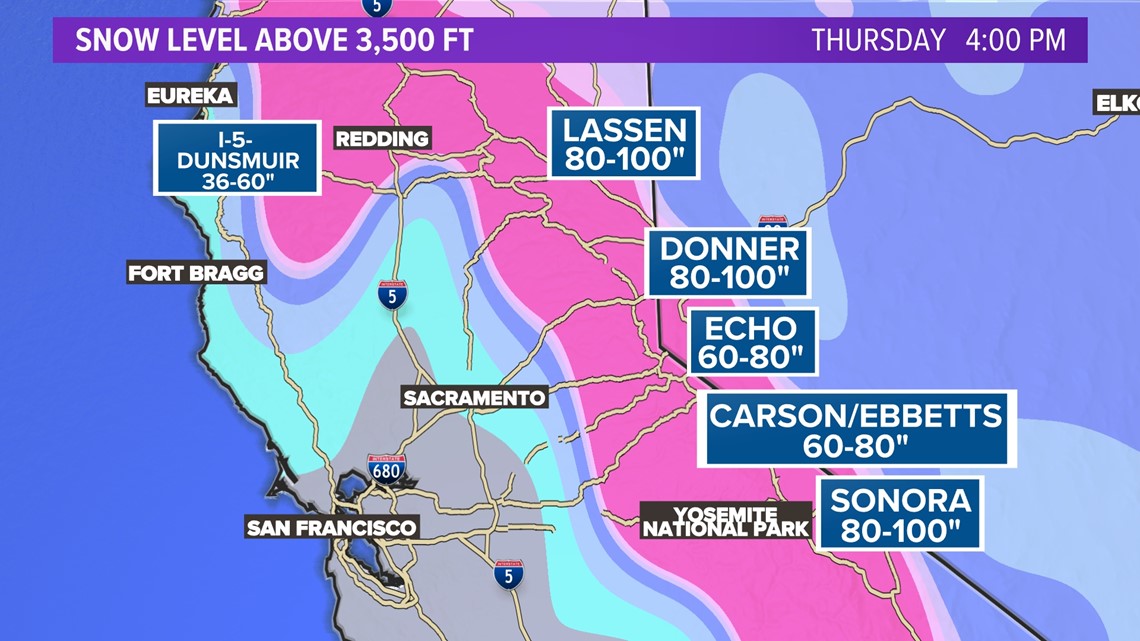
Levels could be as low as 2500 feet but are likely to accumulate snow above 3500 feet.

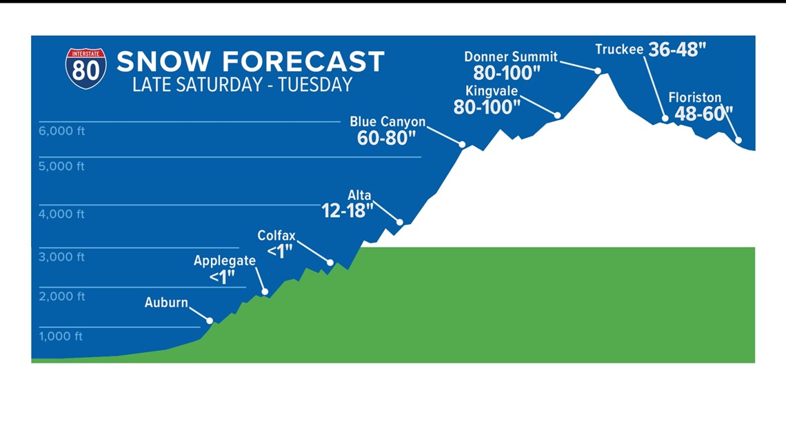

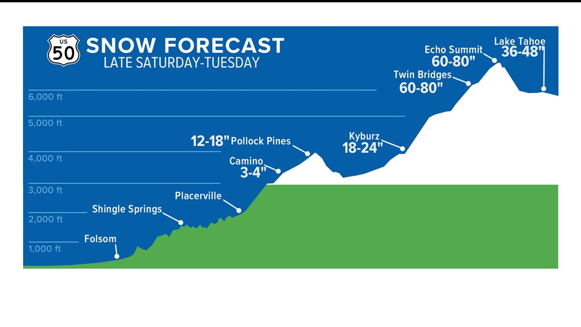
The continuous snow fall is expected to lead to as much as 80-100” of snow over areas like Lassen, Donner, and Sonora Pass.

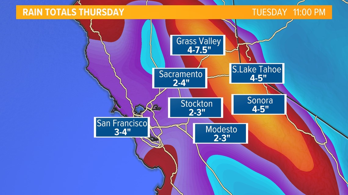
Rain will be the big issue for the foothills and valley, Sunday-Tuesday. As much as 2-4 inches of rain is possible with totals as high as 4-7.5 inches for areas like Grass Valley.

The National Weather Service consensus is that local burn scars like the Caldor Fire, won’t be of big concern due to lower snow levels limiting debris flows.

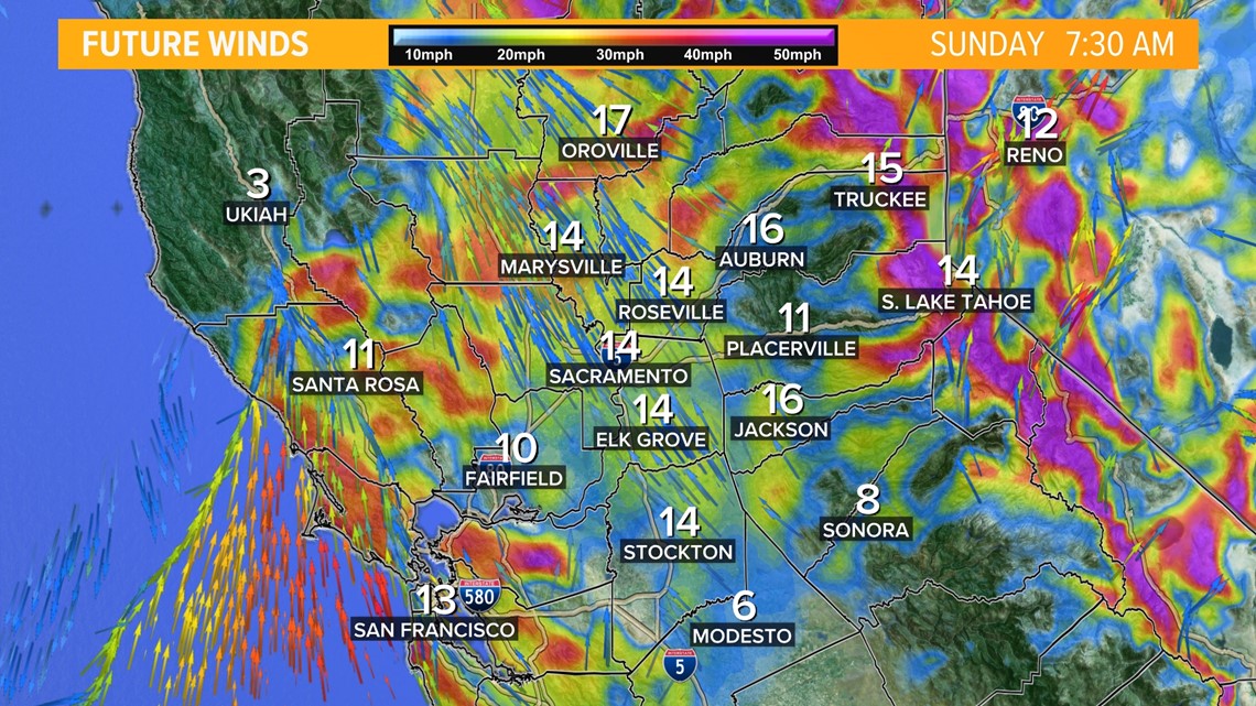
Winds will be the final blow in the series of weather events. Winds pick up Sunday 15-20 mph with gusts as high as 35 mph.

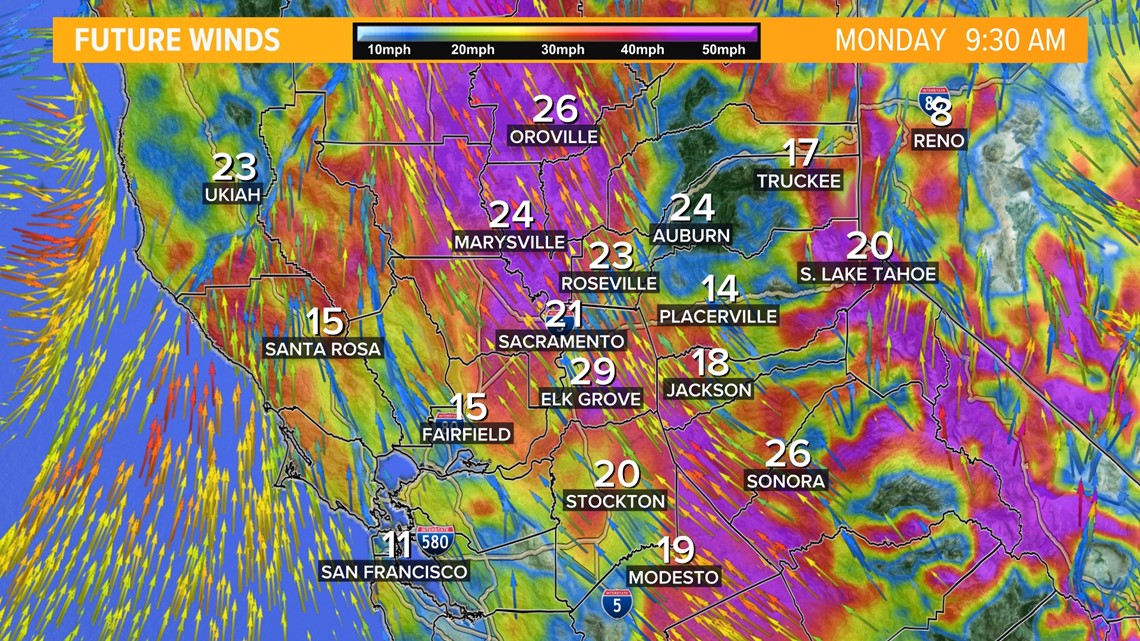
By Monday, mid-morning, some of the strongest winds will come into the valley out of the south. Gusts could be as high as 50 mph in the valley with gusts as high as 70+ mph for the Sierra.

A small break will come between storms Tuesday into Wednesday before more rain and snow with a weaker system arrives Wednesday into Thursday.

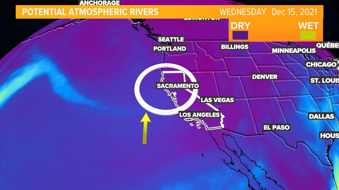
More mild weather returns for the weekend.

